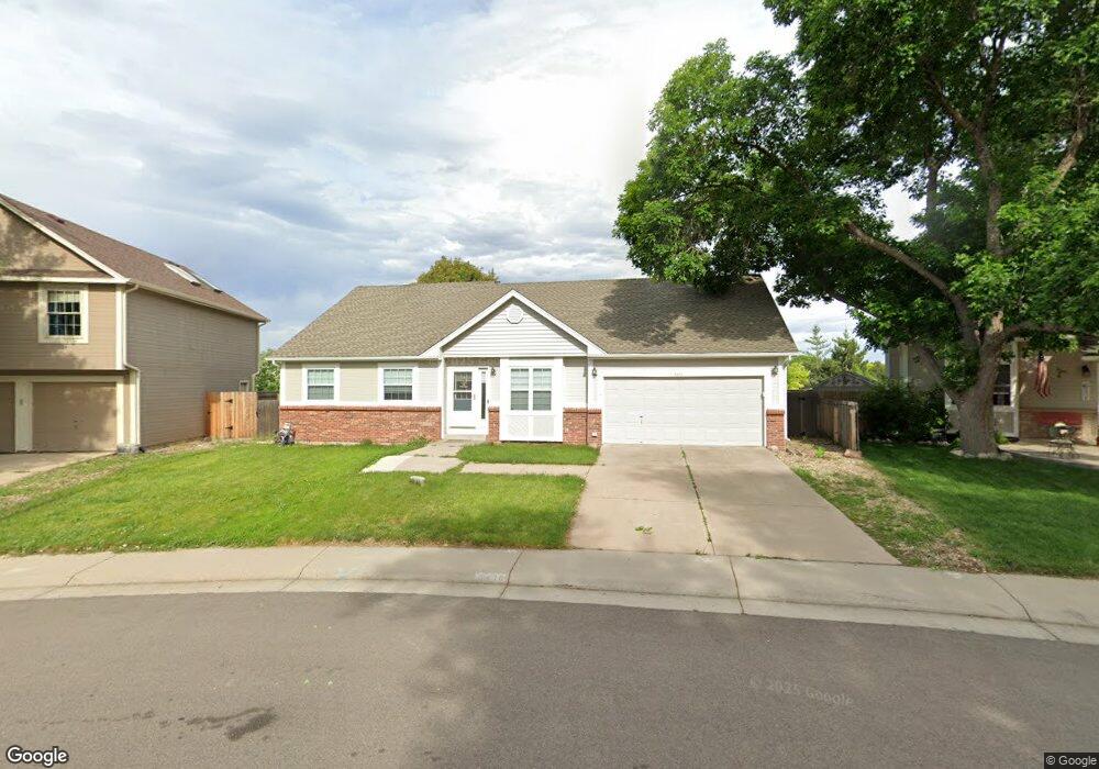
5476 S Simms Way Littleton, CO 80127
Westgold Meadows NeighborhoodEstimated Value: $646,000 - $675,054
4
Beds
3
Baths
2,836
Sq Ft
$234/Sq Ft
Est. Value
About This Home
This home is located at 5476 S Simms Way, Littleton, CO 80127 and is currently estimated at $663,514, approximately $233 per square foot. 5476 S Simms Way is a home located in Jefferson County with nearby schools including Mount Carbon Elementary School, Summit Ridge Middle School, and Dakota Ridge Senior High School.
Ownership History
Date
Name
Owned For
Owner Type
Purchase Details
Closed on
Jun 9, 2021
Sold by
Lynn Summer S
Bought by
Lynn Joseph B
Current Estimated Value
Purchase Details
Closed on
Jun 16, 2020
Sold by
Michela Kimberly R and Michela Michael A
Bought by
Lyon Joseph Brandon and Lyon Summer S
Home Financials for this Owner
Home Financials are based on the most recent Mortgage that was taken out on this home.
Original Mortgage
$490,943
Outstanding Balance
$434,364
Interest Rate
3.1%
Mortgage Type
FHA
Estimated Equity
$229,150
Purchase Details
Closed on
Apr 15, 2013
Sold by
Folvag Margaret
Bought by
Michela Kimberly R and Michela Michael A
Home Financials for this Owner
Home Financials are based on the most recent Mortgage that was taken out on this home.
Original Mortgage
$270,200
Interest Rate
3.25%
Mortgage Type
FHA
Purchase Details
Closed on
Oct 19, 2011
Sold by
Dueck Wayne R and Dueck Lena B
Bought by
Folvag Margaret
Home Financials for this Owner
Home Financials are based on the most recent Mortgage that was taken out on this home.
Original Mortgage
$126,500
Interest Rate
4.17%
Mortgage Type
New Conventional
Purchase Details
Closed on
Jul 22, 2008
Sold by
Thomalla Helen
Bought by
Dueck Wayne R and Dueck Lena B
Home Financials for this Owner
Home Financials are based on the most recent Mortgage that was taken out on this home.
Original Mortgage
$129,888
Interest Rate
6.36%
Mortgage Type
Unknown
Purchase Details
Closed on
May 15, 2002
Sold by
Mahaffey Nancy R
Bought by
Thomalla Helen
Home Financials for this Owner
Home Financials are based on the most recent Mortgage that was taken out on this home.
Original Mortgage
$61,500
Interest Rate
7.1%
Purchase Details
Closed on
Dec 27, 1995
Sold by
Culhane Patricia M
Bought by
Mahaffey Bruce A and Mahaffey Nancy R
Home Financials for this Owner
Home Financials are based on the most recent Mortgage that was taken out on this home.
Original Mortgage
$120,000
Interest Rate
7.31%
Create a Home Valuation Report for This Property
The Home Valuation Report is an in-depth analysis detailing your home's value as well as a comparison with similar homes in the area
Home Values in the Area
Average Home Value in this Area
Purchase History
| Date | Buyer | Sale Price | Title Company |
|---|---|---|---|
| Lynn Joseph B | -- | None Available | |
| Lyon Joseph Brandon | $500,000 | Land Title Guarantee | |
| Michela Kimberly R | $280,000 | Land Title Guarantee Company | |
| Folvag Margaret | $232,000 | None Available | |
| Dueck Wayne R | $259,777 | Land Title Guarantee Company | |
| Thomalla Helen | $239,000 | First American Heritage Titl | |
| Mahaffey Bruce A | $135,000 | -- |
Source: Public Records
Mortgage History
| Date | Status | Borrower | Loan Amount |
|---|---|---|---|
| Open | Lyon Joseph Brandon | $490,943 | |
| Previous Owner | Michela Kimberly R | $270,200 | |
| Previous Owner | Folvag Margaret | $126,500 | |
| Previous Owner | Dueck Wayne R | $129,888 | |
| Previous Owner | Thomalla Helen | $61,500 | |
| Previous Owner | Mahaffey Bruce A | $120,000 |
Source: Public Records
Tax History Compared to Growth
Tax History
| Year | Tax Paid | Tax Assessment Tax Assessment Total Assessment is a certain percentage of the fair market value that is determined by local assessors to be the total taxable value of land and additions on the property. | Land | Improvement |
|---|---|---|---|---|
| 2024 | $3,769 | $38,480 | $9,669 | $28,811 |
| 2023 | $3,769 | $38,480 | $9,669 | $28,811 |
| 2022 | $3,094 | $30,405 | $7,624 | $22,781 |
| 2021 | $3,130 | $31,280 | $7,844 | $23,436 |
| 2020 | $3,062 | $30,676 | $6,112 | $24,564 |
| 2019 | $3,030 | $30,676 | $6,112 | $24,564 |
| 2018 | $2,694 | $26,369 | $6,130 | $20,239 |
| 2017 | $2,460 | $26,369 | $6,130 | $20,239 |
| 2016 | $2,351 | $24,291 | $7,074 | $17,217 |
| 2015 | $2,061 | $24,291 | $7,074 | $17,217 |
| 2014 | $2,061 | $19,962 | $5,570 | $14,392 |
Source: Public Records
Map
Nearby Homes
- 11962 W Long Cir Unit 103
- 11152 W Crestline Dr
- 12254 W Arlington Ave
- 11963 W Long Cir Unit 101
- 5667 S Urban St Unit 304
- 11278 W Progress Ave
- 12233 W Cross Dr Unit 307
- 12208 W Dorado Place Unit 306
- 12304 W Cross Dr Unit 304
- 5813 S Taft Way
- 12288 W Dorado Place Unit 301
- 11424 W Belleview Dr
- 5657 S Oak St
- 5026 S Robb St
- 11487 W Grand Way
- 5790 S Parfet St
- 10815 W Alamo Place
- 5013 S Queen Ct
- 5321 S Nelson St
- 11166 W Bowles Place
- 5466 S Simms Way
- 5486 S Simms Way
- 5456 S Simms Way
- 11617 W Aqueduct Dr
- 11618 W Aqueduct Dr
- 5465 S Simms Way
- 5446 S Simms Way
- 5455 S Simms Way
- 11628 W Aqueduct Dr
- 11647 W Aqueduct Dr
- 5411 S Routt Way
- 5407 S Routt Way
- 11659 W Berry Ave
- 5417 S Routt Way
- 5436 S Simms Way
- 5445 S Simms Way
- 5506 S Simms Way
- 5401 S Routt Way
- 11648 W Aqueduct Dr
- 11667 W Aqueduct Dr