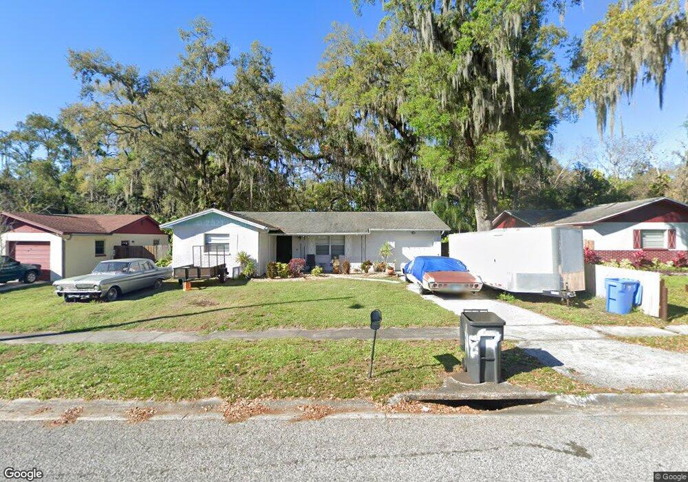
548 Robin Hill Cir Brandon, FL 33510
Estimated Value: $304,969 - $333,000
3
Beds
2
Baths
1,386
Sq Ft
$229/Sq Ft
Est. Value
About This Home
This home is located at 548 Robin Hill Cir, Brandon, FL 33510 and is currently estimated at $317,492, approximately $229 per square foot. 548 Robin Hill Cir is a home located in Hillsborough County with nearby schools including Limona Elementary School, Mclane Middle School, and Brandon High School.
Ownership History
Date
Name
Owned For
Owner Type
Purchase Details
Closed on
Sep 10, 1997
Sold by
Day Robert E and Day I
Bought by
Bryant Darian L and Bryant Felicia D
Current Estimated Value
Purchase Details
Closed on
Jun 9, 1995
Sold by
Dedering Kenneth C
Bought by
Day Robert E and Day Ruth I
Home Financials for this Owner
Home Financials are based on the most recent Mortgage that was taken out on this home.
Original Mortgage
$8,700
Interest Rate
8.23%
Purchase Details
Closed on
Apr 5, 1995
Sold by
Suchan Curtis Lee and Suchan Barbara Jeanne
Bought by
Dedering Kenneth C
Create a Home Valuation Report for This Property
The Home Valuation Report is an in-depth analysis detailing your home's value as well as a comparison with similar homes in the area
Home Values in the Area
Average Home Value in this Area
Purchase History
| Date | Buyer | Sale Price | Title Company |
|---|---|---|---|
| Bryant Darian L | $75,400 | -- | |
| Day Robert E | $64,500 | -- | |
| Dedering Kenneth C | -- | -- | |
| Dedering Kenneth C | $47,400 | -- |
Source: Public Records
Mortgage History
| Date | Status | Borrower | Loan Amount |
|---|---|---|---|
| Open | Bryant Darian L | $72,750 | |
| Previous Owner | Day Robert E | $8,700 | |
| Closed | Bryant Darian L | $0 | |
| Closed | Bryant Darian L | $7,540 |
Source: Public Records
Tax History Compared to Growth
Tax History
| Year | Tax Paid | Tax Assessment Tax Assessment Total Assessment is a certain percentage of the fair market value that is determined by local assessors to be the total taxable value of land and additions on the property. | Land | Improvement |
|---|---|---|---|---|
| 2024 | $2,500 | $132,476 | -- | -- |
| 2023 | $2,331 | $128,968 | $0 | $0 |
| 2022 | $2,189 | $137,627 | $0 | $0 |
| 2021 | $1,926 | $105,003 | $0 | $0 |
| 2020 | $1,838 | $103,037 | $0 | $0 |
| 2019 | $1,713 | $98,466 | $0 | $0 |
| 2018 | $901 | $65,999 | $0 | $0 |
| 2017 | $894 | $106,330 | $0 | $0 |
| 2016 | $877 | $63,312 | $0 | $0 |
| 2015 | $888 | $62,872 | $0 | $0 |
| 2014 | $871 | $62,373 | $0 | $0 |
| 2013 | -- | $61,451 | $0 | $0 |
Source: Public Records
Map
Nearby Homes
- 320 Pheasant Cir
- 102 Inwood Cir
- 310 Oak Ave
- 653 Timber Pond Dr
- 912 N Parsons Ave Unit A
- 306 N Moon Ave
- 239 Red Maple Place
- 408 Brenda Dr
- 122 Emily Ln
- 230 Thorn Tree Place Unit 230
- 209 Berry Tree Place
- 226 Thorn Tree Place Unit 226
- 224 Red Maple Place
- 237 Thorn Tree Place
- 222 Berry Tree Place Unit 222
- 534 Golden Raintree Place Unit 8
- 209 Red Cedar Place
- 562 Golden Raintree Place Unit 562
- 108 E Morgan St
- 624 Golden Raintree Place
- 550 Robin Hill Cir
- 546 Robin Hill Cir
- 552 Robin Hill Cir
- 126 Inwood Cir
- 544 Robin Hill Cir
- 551 Robin Hill Cir
- 537 Robin Hill Cir
- 554 Robin Hill Cir
- 124 Inwood Cir
- 553 Robin Hill Cir
- 535 Robin Hill Cir
- 121 Inwood Cir
- 542 Robin Hill Cir
- 556 Robin Hill Cir
- 122 Inwood Cir
- 555 Robin Hill Cir
- 533 Robin Hill Cir
- 504 Robin Hill Place
- 117 Inwood Cir
- 538 Robin Hill Cir