Estimated Value: $307,000 - $317,000
2
Beds
2
Baths
1,600
Sq Ft
$194/Sq Ft
Est. Value
About This Home
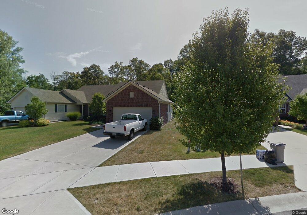
This home is located at 549 Dylan Dr Unit 6B, Avon, IN 46123 and is currently estimated at $310,354, approximately $193 per square foot. 549 Dylan Dr Unit 6B is a home located in Hendricks County with nearby schools including Maple Elementary School, White Oak Elementary School, and Avon Middle School North.
Ownership History
Date
Name
Owned For
Owner Type
Purchase Details
Closed on
Sep 25, 2025
Sold by
Miller Charles J and Miller Sue H
Bought by
Rowland Michael
Current Estimated Value
Home Financials for this Owner
Home Financials are based on the most recent Mortgage that was taken out on this home.
Original Mortgage
$306,697
Outstanding Balance
$306,697
Interest Rate
6.58%
Mortgage Type
New Conventional
Estimated Equity
$3,657
Purchase Details
Closed on
May 31, 2018
Sold by
Howell L
Bought by
Miller H
Home Financials for this Owner
Home Financials are based on the most recent Mortgage that was taken out on this home.
Original Mortgage
$361,650
Interest Rate
4.5%
Mortgage Type
Adjustable Rate Mortgage/ARM
Purchase Details
Closed on
May 30, 2018
Sold by
Howell Robert G and Howell Jessie L
Bought by
Miller Charles J and Miller Sue H
Home Financials for this Owner
Home Financials are based on the most recent Mortgage that was taken out on this home.
Original Mortgage
$361,650
Interest Rate
4.5%
Mortgage Type
Adjustable Rate Mortgage/ARM
Purchase Details
Closed on
Aug 21, 2008
Sold by
Hills Homes Of Indiana Llc
Bought by
Howell Robert G and Howell Jessie L
Create a Home Valuation Report for This Property
The Home Valuation Report is an in-depth analysis detailing your home's value as well as a comparison with similar homes in the area
Home Values in the Area
Average Home Value in this Area
Purchase History
| Date | Buyer | Sale Price | Title Company |
|---|---|---|---|
| Rowland Michael | -- | Meridian Title (Mtc) | |
| Miller H | $200,000 | -- | |
| Miller Charles J | -- | None Available | |
| Howell Robert G | -- | None Available |
Source: Public Records
Mortgage History
| Date | Status | Borrower | Loan Amount |
|---|---|---|---|
| Open | Rowland Michael | $306,697 | |
| Previous Owner | Miller Charles J | $361,650 |
Source: Public Records
Tax History Compared to Growth
Tax History
| Year | Tax Paid | Tax Assessment Tax Assessment Total Assessment is a certain percentage of the fair market value that is determined by local assessors to be the total taxable value of land and additions on the property. | Land | Improvement |
|---|---|---|---|---|
| 2024 | $6,861 | $306,300 | $52,800 | $253,500 |
| 2023 | $6,299 | $281,200 | $48,000 | $233,200 |
| 2022 | $3,129 | $270,300 | $45,700 | $224,600 |
| 2021 | $2,727 | $240,900 | $43,700 | $197,200 |
| 2020 | $2,612 | $228,900 | $43,700 | $185,200 |
| 2019 | $2,567 | $222,200 | $42,000 | $180,200 |
| 2018 | $2,310 | $197,200 | $42,000 | $155,200 |
| 2017 | $3,280 | $164,000 | $35,000 | $129,000 |
| 2016 | $3,196 | $159,800 | $35,000 | $124,800 |
| 2014 | $2,964 | $148,200 | $32,300 | $115,900 |
Source: Public Records
Map
Nearby Homes
- 430 Angelina Way
- 570 Corbin Way
- 9101 Stone Trace Blvd
- 614 Corbin Way
- 9397 Villa Woods Dr Unit 213
- 811 Stone Trace Ct
- 205 N County Road 900 E
- 9407 Avon Creek Unit A
- 569 Dalton Way
- 256 Strand Ln Unit C
- 9447 Jackson Way
- Riverton Plan at Brookstone - Crossings
- Fifth Avenue Plan at Brookstone - Landings
- Park Place Plan at Brookstone - Landings
- Greenfield Plan at Brookstone - Crossings
- Boardwalk Plan at Brookstone - Landings
- Hilltop Plan at Brookstone - Crossings
- Westchester Plan at Brookstone - Crossings
- 642 Port Dr
- 486 Hyannis Dr