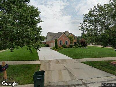
549 Manhattan Ct Canton, MI 48188
Estimated Value: $663,100 - $720,000
--
Bed
3
Baths
3,079
Sq Ft
$225/Sq Ft
Est. Value
About This Home
This home is located at 549 Manhattan Ct, Canton, MI 48188 and is currently estimated at $692,525, approximately $224 per square foot. 549 Manhattan Ct is a home located in Wayne County with nearby schools including Canton High School, Workman Elementary School, and Plymouth High School.
Ownership History
Date
Name
Owned For
Owner Type
Purchase Details
Closed on
Sep 24, 2004
Sold by
Martinolli Robert R and Martinolli Allayne K
Bought by
Kulkarni Dhananjay Bal
Current Estimated Value
Home Financials for this Owner
Home Financials are based on the most recent Mortgage that was taken out on this home.
Original Mortgage
$260,000
Interest Rate
5.93%
Mortgage Type
Unknown
Create a Home Valuation Report for This Property
The Home Valuation Report is an in-depth analysis detailing your home's value as well as a comparison with similar homes in the area
Home Values in the Area
Average Home Value in this Area
Purchase History
| Date | Buyer | Sale Price | Title Company |
|---|---|---|---|
| Kulkarni Dhananjay Bal | $480,000 | Metropolitan |
Source: Public Records
Mortgage History
| Date | Status | Borrower | Loan Amount |
|---|---|---|---|
| Closed | Kulkarni Dhananjay Bal | $140,000 | |
| Closed | Kulkarni Dhananjay Bal | $165,000 | |
| Closed | Kulkarni Dhananjay Bal | $260,000 |
Source: Public Records
Tax History Compared to Growth
Tax History
| Year | Tax Paid | Tax Assessment Tax Assessment Total Assessment is a certain percentage of the fair market value that is determined by local assessors to be the total taxable value of land and additions on the property. | Land | Improvement |
|---|---|---|---|---|
| 2024 | $4,129 | $288,600 | $0 | $0 |
| 2023 | $3,936 | $260,500 | $0 | $0 |
| 2022 | $8,470 | $249,100 | $0 | $0 |
| 2021 | $8,220 | $240,400 | $0 | $0 |
| 2020 | $8,123 | $237,600 | $0 | $0 |
| 2019 | $7,973 | $223,270 | $0 | $0 |
| 2018 | $3,346 | $218,670 | $0 | $0 |
| 2017 | $7,997 | $215,800 | $0 | $0 |
| 2016 | $7,236 | $220,200 | $0 | $0 |
| 2015 | $18,382 | $203,210 | $0 | $0 |
| 2013 | $17,808 | $199,280 | $0 | $0 |
| 2010 | -- | $165,370 | $97,557 | $67,813 |
Source: Public Records
Map
Nearby Homes
- 49110 Manhattan Cir
- 1549 McLaine St
- 1482 McLaine St
- 49651 Shire Ln
- 326 Province Ln
- 47822 Pavillon Rd
- 671 Roosevelt St Unit 60
- 48491 Inveraray Rd
- 50223 Monroe St
- 438 Filmore St
- 50197 Monroe St Unit 83
- 370 Roosevelt St
- 00000 Denton Rd
- 0000 Denton Rd
- 50107 Harding St Unit 122
- 50205 Harding St Unit 246
- 50509 Coolidge St Unit 428
- 50540 Paine St
- 254 Constitution St Unit 1
- 2042 Town Center Rd
- 549 Manhattan Ct
- 49352 Manhattan Cir
- 561 Manhattan Ct
- 540 Springfield Dr
- 550 Manhattan Ct
- 49374 Manhattan Cir
- 570 Manhattan Ct
- 560 Manhattan Ct
- 537 Springfield Dr
- 530 Springfield Dr
- 461 Harbor St
- 525 Springfield Dr
- 449 Harbor St
- 524 Springfield Dr
- 48936 Central Park Dr
- 1201 Liberty Ct
- 48969 Central Park Dr
- 435 Harbor St
- 1225 Liberty Ct
- 511 Springfield Dr