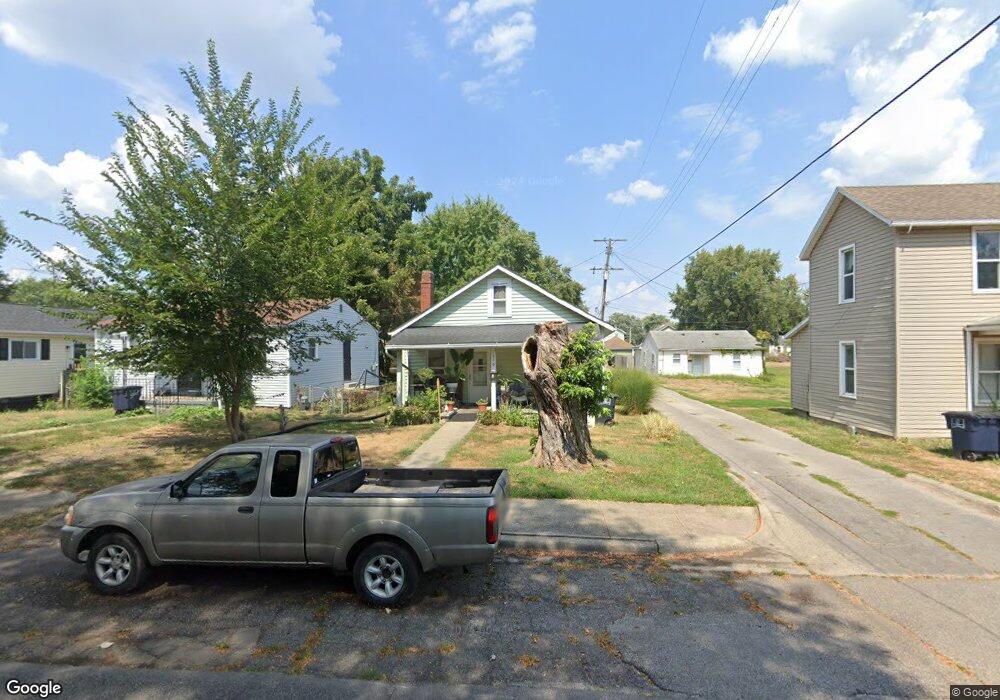
549 W Mulberry St Lancaster, OH 43130
Estimated Value: $97,000 - $138,000
2
Beds
1
Bath
877
Sq Ft
$141/Sq Ft
Est. Value
About This Home
This home is located at 549 W Mulberry St, Lancaster, OH 43130 and is currently estimated at $123,862, approximately $141 per square foot. 549 W Mulberry St is a home located in Fairfield County with nearby schools including General Sherman Junior High School, Lancaster High School, and St Mary Elementary School.
Ownership History
Date
Name
Owned For
Owner Type
Purchase Details
Closed on
Apr 16, 2020
Sold by
Willey Ralph E
Bought by
Cotterman Noa
Current Estimated Value
Purchase Details
Closed on
Jul 5, 2008
Sold by
Robitzer Phyllis Willey and Robitzer Richard
Bought by
Willey Ralph E
Purchase Details
Closed on
May 20, 2008
Sold by
Estate Of Herman J Willey
Bought by
Willey Ralph E and Robitzer Phyllis Willey
Purchase Details
Closed on
Oct 18, 1991
Sold by
Layberger Louella
Bought by
Willey Herman J
Create a Home Valuation Report for This Property
The Home Valuation Report is an in-depth analysis detailing your home's value as well as a comparison with similar homes in the area
Home Values in the Area
Average Home Value in this Area
Purchase History
| Date | Buyer | Sale Price | Title Company |
|---|---|---|---|
| Cotterman Noa | $37,500 | Valmer Land Title Agency Box | |
| Willey Ralph E | -- | Attorney | |
| Willey Ralph E | -- | None Available | |
| Willey Herman J | $18,000 | -- |
Source: Public Records
Tax History Compared to Growth
Tax History
| Year | Tax Paid | Tax Assessment Tax Assessment Total Assessment is a certain percentage of the fair market value that is determined by local assessors to be the total taxable value of land and additions on the property. | Land | Improvement |
|---|---|---|---|---|
| 2024 | $2,005 | $22,300 | $6,550 | $15,750 |
| 2023 | $950 | $22,300 | $6,550 | $15,750 |
| 2022 | $935 | $22,300 | $6,550 | $15,750 |
| 2021 | $799 | $17,400 | $6,550 | $10,850 |
| 2020 | $819 | $17,400 | $6,550 | $10,850 |
| 2019 | $754 | $17,400 | $6,550 | $10,850 |
| 2018 | $655 | $16,130 | $6,550 | $9,580 |
| 2017 | $655 | $16,020 | $6,550 | $9,470 |
| 2016 | $639 | $16,020 | $6,550 | $9,470 |
| 2015 | $619 | $16,070 | $6,550 | $9,520 |
| 2014 | $591 | $16,070 | $6,550 | $9,520 |
| 2013 | $591 | $16,070 | $6,550 | $9,520 |
Source: Public Records
Map
Nearby Homes
- 238 N George St
- 317 Harrison Ave
- 510 W Wheeling St
- 215 Harrison Ave
- 429 Harrison Ave
- 525 N Zane Ave
- 404 Garfield Ave
- 0 Slocum Ave
- 628 Harrison Ave
- 117 N Pierce Ave
- 140 Sherman Ave
- 136 Sherman Ave
- 0 N Memorial Dr
- 515 N Columbus St
- 1318 Cedar Hill Rd
- 526 N Columbus St
- 844 Washington Ave
- 0 N Columbus St
- 308 Hunter Ave
- 405 N Broad St
- 553 W Mulberry St
- 543 1/2 W Mulberry St
- 557 W Mulberry St
- 543 W Mulberry St
- 543 W Mulberry St
- 543 W Mulberry St Unit 1/2
- 535 W Mulberry St
- 542 W Mulberry St
- 565 W Mulberry St
- 540 W Mulberry St
- 531 W Mulberry St
- 529 W Mulberry St
- 601 W Mulberry St
- 536 W Mulberry St
- 230 Baker Alley
- 605 W Mulberry St
- 525 W Mulberry St
- 228 Baker Alley
- 228 Baker Alley
- 611 W Mulberry St