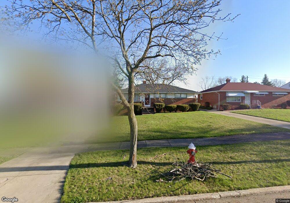
549 Westview Rd Bedford, OH 44146
Estimated Value: $158,897 - $184,000
3
Beds
1
Bath
1,066
Sq Ft
$160/Sq Ft
Est. Value
About This Home
This home is located at 549 Westview Rd, Bedford, OH 44146 and is currently estimated at $170,724, approximately $160 per square foot. 549 Westview Rd is a home located in Cuyahoga County with nearby schools including Heskett Middle School, Bedford High School, and Ohio College Preparatory School.
Ownership History
Date
Name
Owned For
Owner Type
Purchase Details
Closed on
Oct 21, 1998
Sold by
Horvath John
Bought by
Robinson Nancy L
Current Estimated Value
Home Financials for this Owner
Home Financials are based on the most recent Mortgage that was taken out on this home.
Original Mortgage
$81,953
Outstanding Balance
$17,912
Interest Rate
6.88%
Mortgage Type
FHA
Estimated Equity
$152,812
Purchase Details
Closed on
Jan 1, 1975
Bought by
Horvath Horvath A and Horvath B
Create a Home Valuation Report for This Property
The Home Valuation Report is an in-depth analysis detailing your home's value as well as a comparison with similar homes in the area
Home Values in the Area
Average Home Value in this Area
Purchase History
| Date | Buyer | Sale Price | Title Company |
|---|---|---|---|
| Robinson Nancy L | $82,000 | Gateway Title Agency Inc | |
| Horvath Horvath A | -- | -- |
Source: Public Records
Mortgage History
| Date | Status | Borrower | Loan Amount |
|---|---|---|---|
| Open | Robinson Nancy L | $81,953 |
Source: Public Records
Tax History Compared to Growth
Tax History
| Year | Tax Paid | Tax Assessment Tax Assessment Total Assessment is a certain percentage of the fair market value that is determined by local assessors to be the total taxable value of land and additions on the property. | Land | Improvement |
|---|---|---|---|---|
| 2024 | $4,182 | $54,915 | $10,080 | $44,835 |
| 2023 | $3,302 | $36,890 | $7,490 | $29,400 |
| 2022 | $2,920 | $36,890 | $7,490 | $29,400 |
| 2021 | $2,832 | $36,890 | $7,490 | $29,400 |
| 2020 | $2,354 | $27,130 | $5,500 | $21,630 |
| 2019 | $2,294 | $77,500 | $15,700 | $61,800 |
| 2018 | $2,276 | $27,130 | $5,500 | $21,630 |
| 2017 | $2,294 | $25,800 | $5,430 | $20,370 |
| 2016 | $2,275 | $25,800 | $5,430 | $20,370 |
| 2015 | $2,276 | $25,800 | $5,430 | $20,370 |
| 2014 | $2,276 | $28,040 | $5,920 | $22,120 |
Source: Public Records
Map
Nearby Homes
- 20620 Donny Brook Rd
- 20634 Centuryway Rd
- 20625 Centuryway Rd
- 20739 Donny Brook Rd
- 54 Willard Ave
- 62 Willard Ave
- 54 Hubbell Way
- 66 Hubbell Way
- 62 Hubbell Way
- 58 Hubbell Way
- 0 Hubbell Cir
- 20750 Bowling Green Rd
- 61 Hubbell Way
- 57 Hubbell Way
- 377 Hubbell Cir
- 179 Willard Ave
- 95 Noran Cir
- 19812 Stockton Ave
- 20716 Kenyon Dr
- 19289 Stafford Ave
- 553 Westview Rd
- 545 Westview Rd
- 541 Westview Rd
- 557 Westview Rd
- 561 Westview Rd
- 537 Westview Rd
- 548 Westview Rd
- 544 Westview Rd
- 552 Westview Rd
- 565 Westview Rd
- 540 Westview Rd
- 556 Westview Rd
- 533 Westview Rd
- 20624 Donny Brook Rd
- 20628 Donny Brook Rd
- 536 Westview Rd
- 20632 Donny Brook Rd
- 560 Westview Rd
- 20616 Donny Brook Rd
- 20636 Donny Brook Rd