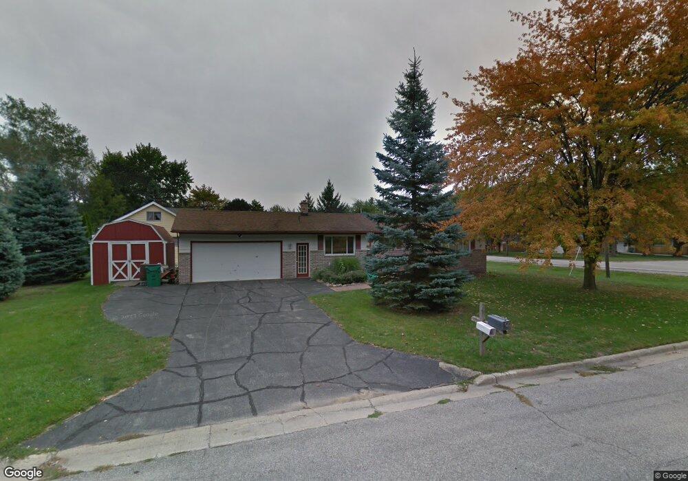
5491 Michael Rd Bay City, MI 48706
Estimated Value: $170,000 - $205,000
3
Beds
1
Bath
1,104
Sq Ft
$176/Sq Ft
Est. Value
About This Home
This home is located at 5491 Michael Rd, Bay City, MI 48706 and is currently estimated at $194,605, approximately $176 per square foot. 5491 Michael Rd is a home located in Bay County with nearby schools including Mackensen Elementary School, Western Middle School, and Bay City Western High School.
Ownership History
Date
Name
Owned For
Owner Type
Purchase Details
Closed on
Jul 19, 2019
Sold by
Pope Michael P and Pope Loretta K
Bought by
Lupo Casey
Current Estimated Value
Home Financials for this Owner
Home Financials are based on the most recent Mortgage that was taken out on this home.
Original Mortgage
$95,243
Outstanding Balance
$83,082
Interest Rate
3.82%
Mortgage Type
FHA
Estimated Equity
$111,523
Purchase Details
Closed on
May 3, 1996
Sold by
Bovin George W
Bought by
Pope Michael P and Pope Loretta K
Create a Home Valuation Report for This Property
The Home Valuation Report is an in-depth analysis detailing your home's value as well as a comparison with similar homes in the area
Home Values in the Area
Average Home Value in this Area
Purchase History
| Date | Buyer | Sale Price | Title Company |
|---|---|---|---|
| Lupo Casey | $97,000 | None Available | |
| Pope Michael P | $85,500 | -- |
Source: Public Records
Mortgage History
| Date | Status | Borrower | Loan Amount |
|---|---|---|---|
| Open | Lupo Casey | $95,243 |
Source: Public Records
Tax History
| Year | Tax Paid | Tax Assessment Tax Assessment Total Assessment is a certain percentage of the fair market value that is determined by local assessors to be the total taxable value of land and additions on the property. | Land | Improvement |
|---|---|---|---|---|
| 2025 | $1,258 | $104,600 | $0 | $0 |
| 2024 | $1,221 | $97,100 | $0 | $0 |
| 2023 | $1,164 | $97,400 | $0 | $0 |
| 2022 | $2,795 | $79,700 | $0 | $0 |
| 2021 | $2,608 | $85,100 | $85,100 | $0 |
| 2020 | $2,590 | $71,900 | $71,900 | $0 |
| 2019 | $2,180 | $61,900 | $0 | $0 |
| 2018 | $2,111 | $60,400 | $0 | $0 |
| 2017 | $2,045 | $61,300 | $0 | $0 |
| 2016 | $2,051 | $59,800 | $0 | $59,800 |
| 2015 | $869 | $61,100 | $0 | $61,100 |
| 2014 | $869 | $58,500 | $0 | $58,500 |
Source: Public Records
Map
Nearby Homes
- 158 Salzburg Rd
- 5620 W Spring Knoll Dr
- 2975 Continental Dr
- 5603 Firethorne Dr
- 2984 Thunderbird Dr
- 2994 Thunderbird Dr
- 5452 Goetz Ct
- 40 Westside Saginaw Rd
- 0 3 Mile Rd
- 5700 3 Mile Rd
- 3400 Fairway Dr
- 3052 E Fisher Rd
- 3118 E Fisher Rd
- 0 Fisher Rd
- 2469 2 Mile Rd
- 1305 S Euclid Ave
- 1303 S Euclid Ave
- 1901 S Mountain St
- 0 S Two Mile Rd Unit 50142051
- 1313 S Barclay St
- 5491 Michael Dr
- 5485 Michael Rd
- 5485 Michael Dr
- 5477 Michael Rd
- 2921 E Salzburg Rd
- 5478 Michael Rd
- 5478 Michael Rd
- 5466 Michael Rd
- 2914 Easy St
- 2929 E Salzburg Rd
- 5522 Michael Dr
- 2906 Easy St
- 2922 E Salzburg Rd
- 2937 E Salzburg Rd
- 5524 Michael Dr
- 2930 E Salzburg Rd
- 2867 E Salzburg Rd
- 5456 Michael Rd
- 5455 Easy St
- 5449 Michael Rd
Your Personal Tour Guide
Ask me questions while you tour the home.