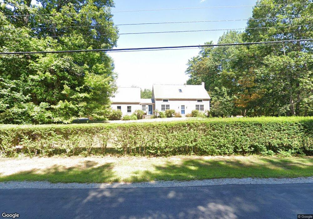
55 Jacobs Rd Moultonborough, NH 03254
Estimated Value: $622,000 - $863,000
3
Beds
2
Baths
1,701
Sq Ft
$430/Sq Ft
Est. Value
About This Home
This home is located at 55 Jacobs Rd, Moultonborough, NH 03254 and is currently estimated at $731,462, approximately $430 per square foot. 55 Jacobs Rd is a home located in Carroll County with nearby schools including Moultonborough Central School and Moultonborough Academy High School.
Ownership History
Date
Name
Owned For
Owner Type
Purchase Details
Closed on
Apr 13, 2009
Sold by
Orourke Michael and Orourke Robin
Bought by
Brown Sean M and Brown Carolyn
Current Estimated Value
Home Financials for this Owner
Home Financials are based on the most recent Mortgage that was taken out on this home.
Original Mortgage
$320,150
Outstanding Balance
$202,386
Interest Rate
4.94%
Mortgage Type
Purchase Money Mortgage
Estimated Equity
$529,076
Create a Home Valuation Report for This Property
The Home Valuation Report is an in-depth analysis detailing your home's value as well as a comparison with similar homes in the area
Home Values in the Area
Average Home Value in this Area
Purchase History
| Date | Buyer | Sale Price | Title Company |
|---|---|---|---|
| Brown Sean M | $337,000 | -- |
Source: Public Records
Mortgage History
| Date | Status | Borrower | Loan Amount |
|---|---|---|---|
| Open | Brown Sean M | $320,150 |
Source: Public Records
Tax History Compared to Growth
Tax History
| Year | Tax Paid | Tax Assessment Tax Assessment Total Assessment is a certain percentage of the fair market value that is determined by local assessors to be the total taxable value of land and additions on the property. | Land | Improvement |
|---|---|---|---|---|
| 2024 | $2,967 | $525,100 | $191,000 | $334,100 |
| 2023 | $2,761 | $484,400 | $157,100 | $327,300 |
| 2022 | $2,101 | $439,600 | $141,400 | $298,200 |
| 2021 | $2,452 | $351,300 | $96,700 | $254,600 |
| 2020 | $586 | $340,500 | $96,700 | $243,800 |
| 2019 | $544 | $341,700 | $96,300 | $245,400 |
| 2018 | $2,575 | $333,500 | $92,400 | $241,100 |
| 2017 | $2,549 | $310,100 | $92,400 | $217,700 |
| 2016 | $2,673 | $305,800 | $92,400 | $213,400 |
| 2015 | $2,617 | $290,500 | $92,400 | $198,100 |
| 2014 | $2,438 | $275,200 | $92,400 | $182,800 |
| 2013 | $2,433 | $280,000 | $92,400 | $187,600 |
Source: Public Records
Map
Nearby Homes
- 29 Kona Farm Rd
- 5 Ferry Rd
- 30 Leopards Leap
- 31 Rays Way
- 22 Tiger Trail
- 203 Krainewood Dr
- 21 Orton Ln
- 11 Geery Ln
- 1 Little Beaver Island
- 122 Toltec Point Rd
- 33 Blackadar Ln
- 320 Redding Ln
- 244 Wentworth Shores Rd
- 27 First Point Rd
- 4 Schneider Rd
- 2 Little Badger Island
- 16 Long Island Rd
- 41 Saint Gallen St
- 00 Grande St Unit 44
- 16 Myrtle Dr
- 3 Crowley Cir
- 10 Crowley Cir
- 20 Crowley Cir
- 18 Crowley Cir
- 2 Crowley Cir
- 16 Crowley Cir
- 00 Colby Rd
- 00 Colby Rd Unit 14000
- 22 Kings Ct
- 9 Stage Rd
- 50 Morrill Dr
- 27 Carriage Rd
- 30 Kings Ct
- 15 Forty Acre Field Rd
- 15 Forty Acre Field Rd Unit 15
- 12 Stage Rd
- 25 Carriage Rd
- 9 40 Acre Field Rd
- 39 Colby Rd
- 41 Morrill Dr