
Seller's Agent in 2025
Janet Nickerson
A House To Home Realty
(603) 723-9877
28 in this area
195 Total Sales
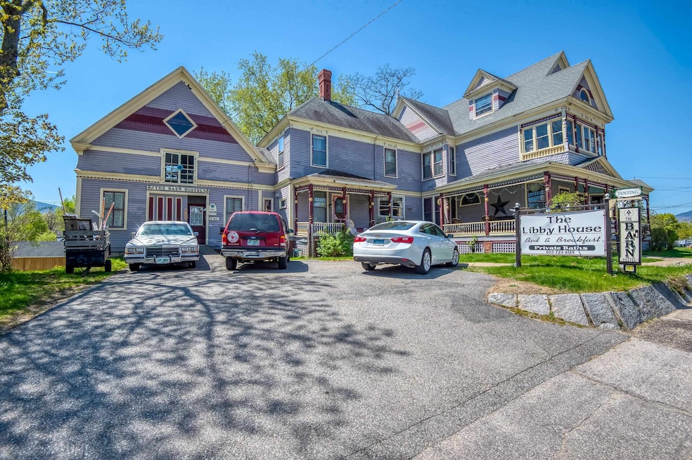
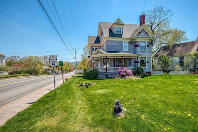
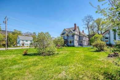

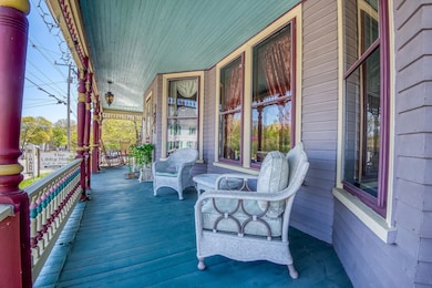
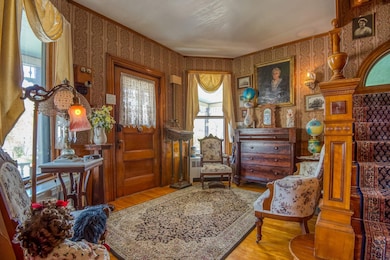
Charming Victorian Bed & Breakfast with Hostel – A Rare Income-Generating Gem Near the Appalachian Trail - The Libby House
Step into timeless elegance and endless opportunity with this beautifully maintained Victorian-style home, currently operating as a successful bed and breakfast. Nestled in a prime location that draws hikers from the nearby Appalachian Trail, this property offers a rare blend of historic charm and modern income potential.
The residence features gleaming hardwood floors, original architectural details, and an exquisite staircase that serves as the centerpiece of the grand foyer. Guests will love relaxing on the inviting wraparound covered porch, perfect for sipping morning coffee or unwinding after a day of adventure.
In addition to multiple guest rooms and welcoming common areas, the property includes separate owners' quarters for privacy and convenience. A converted barn functions as a cozy and popular hiker’s hostel, consistently attracting a steady flow of outdoor enthusiasts.
Enhancing the income potential even further, the property holds a valuable license for up to 15 tent sites in the backyard—an ideal setup for budget travelers and nature lovers alike.
This property is in a prime location! Whether you’re looking to continue operating this beloved bed and breakfast, expand its offerings, or simply enjoy the lifestyle it provides, this unique property offers charm, character, and consistent revenue in a sought-after location.
Last Agent to Sell the Property
A House To Home Realty Brokerage Phone: 603-723-9877 Listed on: 05/15/2025
| Date | Type | Sale Price | Title Company |
|---|---|---|---|
| Warranty Deed | $200,000 | -- |
| Date | Event | Price | List to Sale | Price per Sq Ft |
|---|---|---|---|---|
| 09/10/2025 09/10/25 | Sold | $389,000 | 0.0% | $142 / Sq Ft |
| 06/02/2025 06/02/25 | Price Changed | $389,000 | -2.5% | $142 / Sq Ft |
| 05/15/2025 05/15/25 | For Sale | $399,000 | -- | $146 / Sq Ft |
| Year | Tax Paid | Tax Assessment Tax Assessment Total Assessment is a certain percentage of the fair market value that is determined by local assessors to be the total taxable value of land and additions on the property. | Land | Improvement |
|---|---|---|---|---|
| 2024 | $14 | $500 | $0 | $500 |
| 2023 | $12 | $500 | $0 | $500 |
| 2022 | $12 | $500 | $0 | $500 |
| 2021 | $18 | $500 | $0 | $500 |
| 2020 | $16 | $500 | $0 | $500 |
| 2019 | $17 | $500 | $0 | $500 |
| 2018 | $18 | $500 | $0 | $500 |
| 2017 | $17 | $500 | $0 | $500 |
| 2014 | $12 | $400 | $0 | $400 |
| 2010 | $153 | $6,400 | $0 | $6,400 |
Seller's Agent in 2025
Janet Nickerson
A House To Home Realty
(603) 723-9877
28 in this area
195 Total Sales
Buyer's Agent in 2025
Jennifer Stewart
RE/MAX
(603) 723-4215
98 in this area
370 Total Sales
Source: PrimeMLS
MLS Number: 5041194
APN: GORH-000002-000000-000501-U000000
Disclaimer: Certain information contained herein is derived from information provided by parties other than Homes.com. All information provided is deemed reliable, but is not guaranteed to be accurate and should be independently verified.
![]() Copyright 2025 PrimeMLS, Inc. All rights reserved. This information is deemed reliable, but not guaranteed. The data relating to real estate displayed on this display comes in part from the IDX Program of PrimeMLS. The information being provided is for consumers’ personal, non-commercial use and may not be used for any purpose other than to identify prospective properties consumers may be interested in purchasing.
Copyright 2025 PrimeMLS, Inc. All rights reserved. This information is deemed reliable, but not guaranteed. The data relating to real estate displayed on this display comes in part from the IDX Program of PrimeMLS. The information being provided is for consumers’ personal, non-commercial use and may not be used for any purpose other than to identify prospective properties consumers may be interested in purchasing.