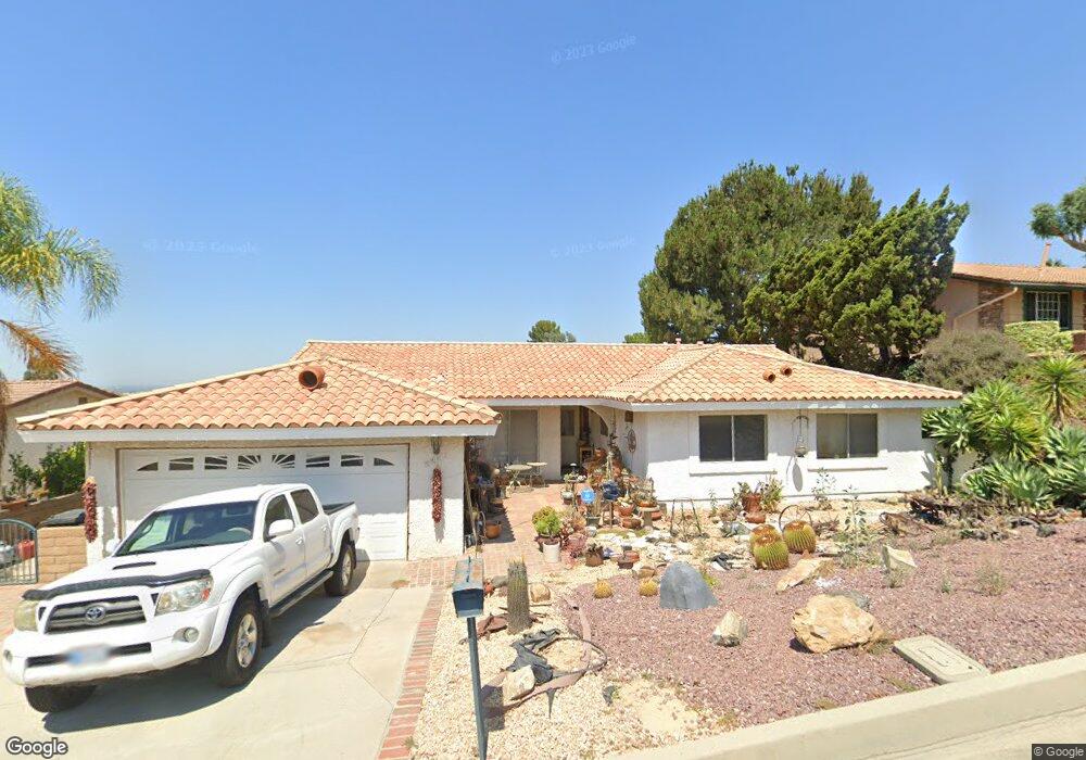
5503 Brookmead Dr Whittier, CA 90601
West Whittier NeighborhoodEstimated Value: $972,086 - $1,047,000
3
Beds
2
Baths
1,756
Sq Ft
$577/Sq Ft
Est. Value
About This Home
This home is located at 5503 Brookmead Dr, Whittier, CA 90601 and is currently estimated at $1,012,772, approximately $576 per square foot. 5503 Brookmead Dr is a home located in Los Angeles County with nearby schools including Longfellow Elementary School, Walter F. Dexter Middle School, and Whittier High School.
Ownership History
Date
Name
Owned For
Owner Type
Purchase Details
Closed on
Feb 22, 2006
Sold by
Dean Lawrence Warren Archie
Bought by
Dean Lawrence Warren Archie and Lawrence Warren Archie Dean Re
Current Estimated Value
Purchase Details
Closed on
Feb 4, 2003
Sold by
Dean Larry
Bought by
Dean Larry
Home Financials for this Owner
Home Financials are based on the most recent Mortgage that was taken out on this home.
Original Mortgage
$322,700
Interest Rate
5.76%
Create a Home Valuation Report for This Property
The Home Valuation Report is an in-depth analysis detailing your home's value as well as a comparison with similar homes in the area
Home Values in the Area
Average Home Value in this Area
Purchase History
| Date | Buyer | Sale Price | Title Company |
|---|---|---|---|
| Dean Lawrence Warren Archie | -- | None Available | |
| Dean Larry | -- | Fidelity National Title Co |
Source: Public Records
Mortgage History
| Date | Status | Borrower | Loan Amount |
|---|---|---|---|
| Closed | Dean Larry | $322,700 |
Source: Public Records
Tax History Compared to Growth
Tax History
| Year | Tax Paid | Tax Assessment Tax Assessment Total Assessment is a certain percentage of the fair market value that is determined by local assessors to be the total taxable value of land and additions on the property. | Land | Improvement |
|---|---|---|---|---|
| 2025 | $4,367 | $329,522 | $159,495 | $170,027 |
| 2024 | $4,367 | $323,062 | $156,368 | $166,694 |
| 2023 | $4,242 | $316,728 | $153,302 | $163,426 |
| 2022 | $4,112 | $310,519 | $150,297 | $160,222 |
| 2021 | $4,027 | $304,431 | $147,350 | $157,081 |
| 2019 | $3,950 | $295,404 | $142,981 | $152,423 |
| 2018 | $3,711 | $289,613 | $140,178 | $149,435 |
| 2016 | $3,550 | $278,369 | $134,736 | $143,633 |
| 2015 | $3,478 | $274,189 | $132,713 | $141,476 |
| 2014 | $3,436 | $268,819 | $130,114 | $138,705 |
Source: Public Records
Map
Nearby Homes
- 5655 Pickering Ave
- 12417 Rose Dr
- 5827 Washington Ave
- 5840 Citrus Ave
- 11818 Pocasset Dr
- 11840 Nixon Ln
- 6217 Greenleaf Ave
- 12031 Beverly Blvd Unit 1D
- 11905 Mendenhall Ln
- 11759 S Circle Dr
- 6242 Comstock Ave
- 6251 Milton Ave
- 6226 Washington Ave
- 6231 Painter Ave
- 6333 Milton Ave
- 6233 Haviland Ave
- 6340 Newlin Ave
- 11422 Ridgegate Dr
- 13570 Turnbull Canyon Rd
- 11511 Beverly Dr
- 5513 Brookmead Dr
- 5443 Brookmead Dr
- 12636 Mount Holly Dr
- 5519 Brookmead Dr
- 5433 Brookmead Dr
- 5450 Brookmead Dr
- 5508 Brookmead Dr
- 5442 Brookmead Dr
- 5516 Brookmead Dr
- 5527 Brookmead Dr
- 12646 Carinthia Dr
- 5524 Brookmead Dr
- 12624 Mount Holly Dr
- 12630 Carinthia Dr
- 5503 Greenleaf Ave
- 12744 Carinthia Dr
- 12704 Carinthia Dr
- 5535 Brookmead Dr
- 5511 Greenleaf Ave
- 12622 Carinthia Dr