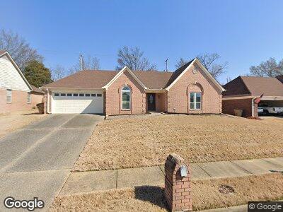
5504 Harvey Pointe Ln Memphis, TN 38125
Southern Shelby County NeighborhoodEstimated Value: $251,317 - $278,000
3
Beds
2
Baths
1,998
Sq Ft
$133/Sq Ft
Est. Value
About This Home
This home is located at 5504 Harvey Pointe Ln, Memphis, TN 38125 and is currently estimated at $265,579, approximately $132 per square foot. 5504 Harvey Pointe Ln is a home located in Shelby County with nearby schools including Highland Oaks Elementary School, Highland Oaks Middle School, and Southwind High School.
Ownership History
Date
Name
Owned For
Owner Type
Purchase Details
Closed on
Aug 20, 1999
Sold by
Boyd Gene L and Boyd Judy K
Bought by
Crutcher Lynnette E
Current Estimated Value
Home Financials for this Owner
Home Financials are based on the most recent Mortgage that was taken out on this home.
Original Mortgage
$95,000
Interest Rate
7.65%
Create a Home Valuation Report for This Property
The Home Valuation Report is an in-depth analysis detailing your home's value as well as a comparison with similar homes in the area
Home Values in the Area
Average Home Value in this Area
Purchase History
| Date | Buyer | Sale Price | Title Company |
|---|---|---|---|
| Crutcher Lynnette E | $120,500 | -- |
Source: Public Records
Mortgage History
| Date | Status | Borrower | Loan Amount |
|---|---|---|---|
| Closed | Crutcher Lynette | $93,050 | |
| Closed | Crutcher Lynnette E | $95,000 | |
| Previous Owner | Boyd Gene L | $80,000 |
Source: Public Records
Tax History Compared to Growth
Tax History
| Year | Tax Paid | Tax Assessment Tax Assessment Total Assessment is a certain percentage of the fair market value that is determined by local assessors to be the total taxable value of land and additions on the property. | Land | Improvement |
|---|---|---|---|---|
| 2024 | -- | $44,300 | $6,800 | $37,500 |
| 2023 | $1,502 | $44,300 | $6,800 | $37,500 |
| 2022 | $1,502 | $44,300 | $6,800 | $37,500 |
| 2021 | $1,528 | $44,300 | $6,800 | $37,500 |
| 2020 | $1,340 | $33,075 | $6,800 | $26,275 |
| 2019 | $1,340 | $33,075 | $6,800 | $26,275 |
| 2018 | $1,340 | $33,075 | $6,800 | $26,275 |
| 2017 | $1,359 | $33,075 | $6,800 | $26,275 |
| 2016 | $1,206 | $27,600 | $0 | $0 |
| 2014 | $1,206 | $27,600 | $0 | $0 |
Source: Public Records
Map
Nearby Homes
- 5474 Stone Arch Place
- 5450 Stone Arch Place
- 5456 Stone Arch Place
- 7602 Bridalbrook Ln
- 5462 Stone Arch Cove
- 5458 Glenstone Cove
- 5466 Glennstone Cove S
- 5435 Stone Arch Place
- 5401 Meadowbriar Trail
- 7350 Hunter Ridge
- 7317 Patsy Cir N
- 9320 Lacee Ln
- 9387 Joe Lyon Blvd
- 5627 Millers Cove
- 9416 Geneva Loop E
- 5265 Annandale Dr
- 9192 Rachel Shea Ave
- 7206 State Line Rd
- 9908 Vista Ridge Dr
- 9100 Champlain Dr
- 5504 Harvey Pointe Ln
- 5512 Harvey Pointe Ln
- 5496 Harvey Pointe Ln
- 5495 Riverstone Dr
- 7479 Charleston Run Cove
- 5505 Riverstone Dr
- 5520 Harvey Pointe Ln
- 5509 Riverstone Dr
- 5486 Harvey Pointe Ln
- 7480 Charleston Run Cove
- 5485 Riverstone Dr
- 550 Riverstone Dr
- 7471 Charleston Run Cove
- 5528 Harvey Pointe Ln
- 5476 Harvey Pointe Ln
- 5477 Riverstone Dr
- 5502 Riverstone Dr
- 7474 Beauregard Cove
- 7472 Charleston Run Cove
- 5488 Riverstone Dr