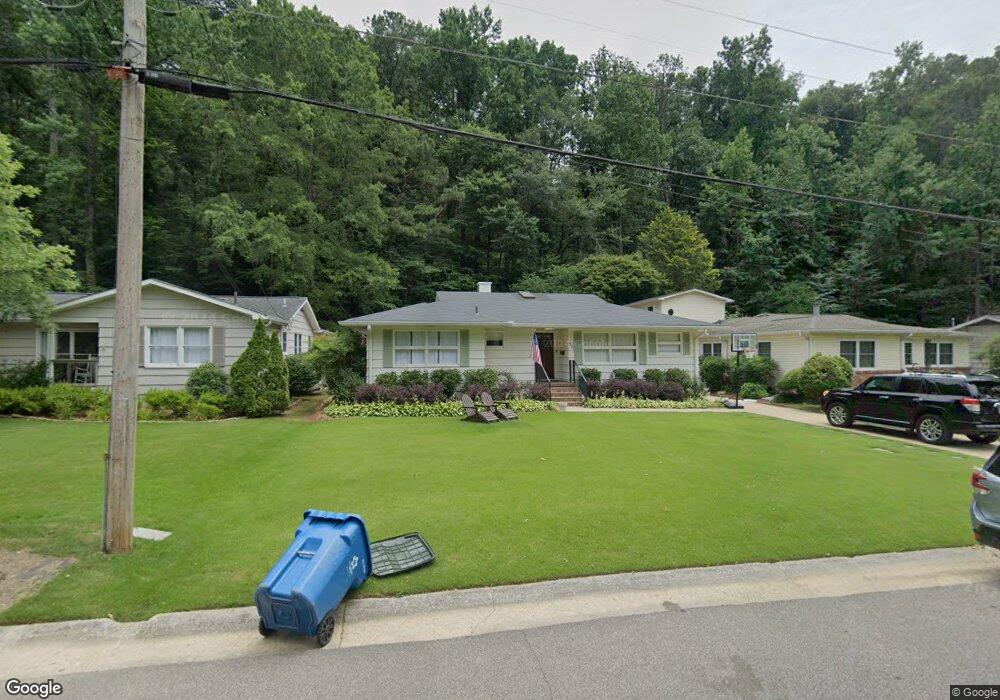
551 Forrest Dr S Birmingham, AL 35209
Estimated Value: $519,000 - $616,000
3
Beds
2
Baths
1,813
Sq Ft
$312/Sq Ft
Est. Value
About This Home
This home is located at 551 Forrest Dr S, Birmingham, AL 35209 and is currently estimated at $566,309, approximately $312 per square foot. 551 Forrest Dr S is a home located in Jefferson County with nearby schools including Edgewood Elementary School, Homewood Middle School, and Homewood High School.
Ownership History
Date
Name
Owned For
Owner Type
Purchase Details
Closed on
Dec 21, 2010
Sold by
Santoro Beth M
Bought by
Hall John Bagby and Ivey Leigh Anna
Current Estimated Value
Home Financials for this Owner
Home Financials are based on the most recent Mortgage that was taken out on this home.
Original Mortgage
$224,675
Interest Rate
4.52%
Mortgage Type
New Conventional
Purchase Details
Closed on
Sep 27, 2002
Sold by
Cundiff Andrew B and Cundiff Julie W
Bought by
Santoro Beth M
Home Financials for this Owner
Home Financials are based on the most recent Mortgage that was taken out on this home.
Original Mortgage
$143,900
Interest Rate
6.21%
Purchase Details
Closed on
Feb 18, 2000
Sold by
Morris L Daniel and Morris Henry M
Bought by
Cundiff Andrew B and Walton Julie L
Home Financials for this Owner
Home Financials are based on the most recent Mortgage that was taken out on this home.
Original Mortgage
$129,675
Interest Rate
8.37%
Create a Home Valuation Report for This Property
The Home Valuation Report is an in-depth analysis detailing your home's value as well as a comparison with similar homes in the area
Home Values in the Area
Average Home Value in this Area
Purchase History
| Date | Buyer | Sale Price | Title Company |
|---|---|---|---|
| Hall John Bagby | $236,500 | None Available | |
| Santoro Beth M | $179,900 | -- | |
| Cundiff Andrew B | $136,500 | -- |
Source: Public Records
Mortgage History
| Date | Status | Borrower | Loan Amount |
|---|---|---|---|
| Previous Owner | Hall John Bagby | $224,675 | |
| Previous Owner | Santoro Beth M | $143,900 | |
| Previous Owner | Cundiff Andrew B | $129,675 | |
| Closed | Santoro Beth M | $17,900 |
Source: Public Records
Tax History Compared to Growth
Tax History
| Year | Tax Paid | Tax Assessment Tax Assessment Total Assessment is a certain percentage of the fair market value that is determined by local assessors to be the total taxable value of land and additions on the property. | Land | Improvement |
|---|---|---|---|---|
| 2024 | $3,648 | $49,580 | -- | -- |
| 2022 | $3,457 | $47,030 | $28,000 | $19,030 |
| 2021 | $3,100 | $42,280 | $28,000 | $14,280 |
| 2020 | $2,524 | $34,590 | $21,900 | $12,690 |
| 2019 | $2,439 | $33,460 | $0 | $0 |
| 2018 | $2,127 | $29,300 | $0 | $0 |
| 2017 | $2,019 | $27,860 | $0 | $0 |
| 2016 | $1,807 | $25,040 | $0 | $0 |
| 2015 | $1,807 | $25,040 | $0 | $0 |
| 2014 | $1,883 | $25,980 | $0 | $0 |
| 2013 | $1,883 | $25,980 | $0 | $0 |
Source: Public Records
Map
Nearby Homes
- 112 Crest Dr
- 115 Crest Dr
- 590 Forrest Dr S
- 825 Sylvia Dr
- 803 Acton Ave
- 100 Acton Ave
- 413 Berry Ave
- 328 Redfern St
- 802 Wingate Cir
- 844 Acton Ave
- 831 Columbiana Rd
- 1307 Roseland Dr
- 74 Parkway Dr
- 1040 Broadway Park Unit 323
- 1040 Broadway Park Unit 306
- 401 Woodvale Ln
- 225 University Park Dr
- 213 Edgeview Ave Unit 10A
- 1103 Fern St
- 211 Saint Charles St
- 551 Forest Dr
- 555 Forrest Dr S
- 547 Forrest Dr S
- 559 S Forrest Dr
- 559 Forrest Dr S
- 543 Forest Dr
- 543 Forrest Dr S
- 563 Forrest Dr S
- 541 Forrest Dr S
- 548 Forest Dr
- 548 Forrest Dr S
- 544 Forrest Dr S
- 552 Forrest Dr S
- 575 Forrest Dr S
- 540 Forrest Dr S
- 118 Crest Dr
- 556 Forrest Dr S
- 556 S Forrest Dr
- 122 Crest Dr
- 124 Crest Dr