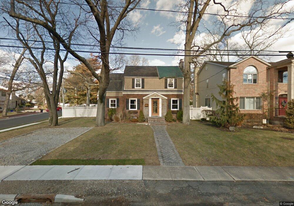
551 Grove Place Oceanside, NY 11572
Estimated Value: $956,884 - $1,121,000
3
Beds
2
Baths
1,708
Sq Ft
$608/Sq Ft
Est. Value
About This Home
This home is located at 551 Grove Place, Oceanside, NY 11572 and is currently estimated at $1,038,942, approximately $608 per square foot. 551 Grove Place is a home located in Nassau County with nearby schools including Oaks Elementary School - School 3, Oceanside Middle School, and Oceanside High School.
Ownership History
Date
Name
Owned For
Owner Type
Purchase Details
Closed on
Aug 9, 2013
Sold by
Fiumara Jayme and Holm Jayme
Bought by
Hiken Jesse and Hiken Nicole
Current Estimated Value
Home Financials for this Owner
Home Financials are based on the most recent Mortgage that was taken out on this home.
Original Mortgage
$318,750
Outstanding Balance
$237,327
Interest Rate
4.42%
Mortgage Type
New Conventional
Estimated Equity
$801,616
Purchase Details
Closed on
Dec 9, 2005
Sold by
Flumara Jayme
Create a Home Valuation Report for This Property
The Home Valuation Report is an in-depth analysis detailing your home's value as well as a comparison with similar homes in the area
Home Values in the Area
Average Home Value in this Area
Purchase History
| Date | Buyer | Sale Price | Title Company |
|---|---|---|---|
| Hiken Jesse | $375,000 | -- | |
| -- | -- | -- | |
| -- | -- | -- |
Source: Public Records
Mortgage History
| Date | Status | Borrower | Loan Amount |
|---|---|---|---|
| Open | Hiken Jesse | $318,750 |
Source: Public Records
Tax History Compared to Growth
Tax History
| Year | Tax Paid | Tax Assessment Tax Assessment Total Assessment is a certain percentage of the fair market value that is determined by local assessors to be the total taxable value of land and additions on the property. | Land | Improvement |
|---|---|---|---|---|
| 2025 | $15,961 | $668 | $367 | $301 |
| 2024 | $4,448 | $668 | $367 | $301 |
| 2023 | $13,855 | $604 | $390 | $214 |
| 2022 | $13,855 | $570 | $367 | $203 |
| 2021 | $16,390 | $515 | $281 | $234 |
| 2020 | $11,527 | $597 | $596 | $1 |
| 2019 | $10,151 | $640 | $639 | $1 |
| 2018 | $9,033 | $682 | $0 | $0 |
| 2017 | $5,855 | $725 | $724 | $1 |
| 2016 | $9,173 | $767 | $731 | $36 |
| 2015 | $4,468 | $1,022 | $974 | $48 |
| 2014 | $4,468 | $1,022 | $974 | $48 |
| 2013 | $4,153 | $1,022 | $974 | $48 |
Source: Public Records
Map
Nearby Homes
- 2941 Moreland Ave
- 613 Smith Place
- 31 Arthur St
- 647 Lincoln St
- 646 Lincoln St
- 653 Arthur St
- 25 Sunnybrook Dr E
- 3487 Anchor Place
- 3354 Knight St
- 3483 Frederick St
- 3066 Ann St
- 3432 Bayfield Blvd
- 2900 Yale Place
- 2929 Yale Place
- 528 Carpenter Ave
- 2917 Yale Place
- 3004 Harbor St
- 710 Fishermans Rd
- 719 Lincoln St
- 3522 Frederick St
- 559 Grove Place
- 548 Fir Place
- 2961 Allon St
- 573 Grove Place
- 573 Grove Place
- 2948 Allon St
- 501 Grove Place
- 2956 Allon St
- 560 Grove Place
- 540 Fir Place
- 562 Fir Place
- 2964 Allon St
- 2964 Allon St Unit House
- 566 Grove Place
- 581 Grove Place
- 2942 Allon St
- 2970 Allon St
- 2950 Moreland Ave
- 572 Grove Place
- 572 Fir Place