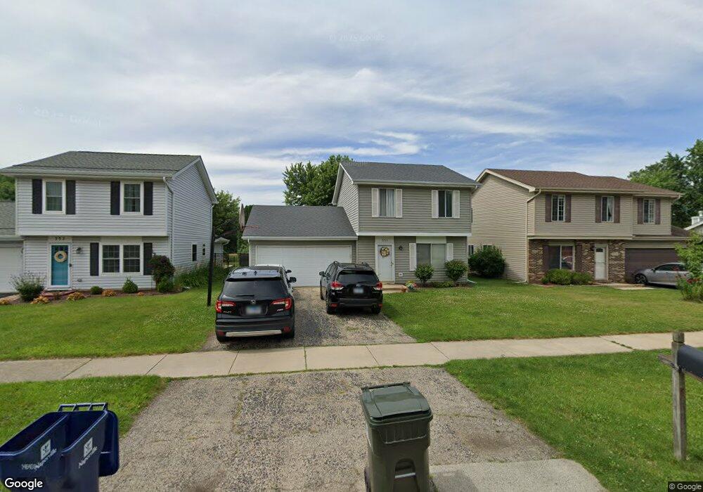
551 Springhill Cir Naperville, IL 60563
Springhill NeighborhoodEstimated Value: $383,092 - $450,000
Studio
1
Bath
1,620
Sq Ft
$259/Sq Ft
Est. Value
About This Home
This home is located at 551 Springhill Cir, Naperville, IL 60563 and is currently estimated at $419,273, approximately $258 per square foot. 551 Springhill Cir is a home located in DuPage County with nearby schools including Ellsworth Elementary School, Washington Jr High School, and Naperville North High School.
Ownership History
Date
Name
Owned For
Owner Type
Purchase Details
Closed on
Jul 29, 1994
Sold by
Rumel Peter C and Rumel Lynn Marie
Bought by
Brandt Cynthia A
Current Estimated Value
Home Financials for this Owner
Home Financials are based on the most recent Mortgage that was taken out on this home.
Original Mortgage
$96,500
Interest Rate
6.75%
Create a Home Valuation Report for This Property
The Home Valuation Report is an in-depth analysis detailing your home's value as well as a comparison with similar homes in the area
Home Values in the Area
Average Home Value in this Area
Purchase History
| Date | Buyer | Sale Price | Title Company |
|---|---|---|---|
| Brandt Cynthia A | $136,500 | Land Title Group Inc |
Source: Public Records
Mortgage History
| Date | Status | Borrower | Loan Amount |
|---|---|---|---|
| Closed | Brandt Cynthia A | $96,500 |
Source: Public Records
Tax History
| Year | Tax Paid | Tax Assessment Tax Assessment Total Assessment is a certain percentage of the fair market value that is determined by local assessors to be the total taxable value of land and additions on the property. | Land | Improvement |
|---|---|---|---|---|
| 2024 | $6,812 | $119,191 | $50,567 | $68,624 |
| 2023 | $6,549 | $108,780 | $46,150 | $62,630 |
| 2022 | $6,156 | $101,120 | $42,900 | $58,220 |
| 2021 | $5,926 | $97,300 | $41,280 | $56,020 |
| 2020 | $5,797 | $95,550 | $40,540 | $55,010 |
| 2019 | $5,622 | $91,420 | $38,790 | $52,630 |
| 2018 | $5,393 | $87,910 | $37,300 | $50,610 |
| 2017 | $5,279 | $84,940 | $36,040 | $48,900 |
| 2016 | $5,168 | $81,870 | $34,740 | $47,130 |
| 2015 | $4,960 | $77,090 | $32,710 | $44,380 |
| 2014 | $4,921 | $74,310 | $31,530 | $42,780 |
| 2013 | $4,848 | $74,490 | $31,610 | $42,880 |
Source: Public Records
Map
Nearby Homes
- 25W313 Mayflower Ave
- 941 Coletta Cir
- 1111 Samstag Ct
- 825 Biltmore Ct
- 906 Coletta Cir
- 6S241 Concord Rd
- 1165 Dickens Ave
- 5S504 Radcliff Rd
- 30w130 Wheeler Cir
- 1437 N Charles Ave
- 634 E 5th Ave
- 596 Windham Ln
- 5S365 Vest Ave
- 5S300 Tuthill Rd
- 5S661 Wright St
- 26W250 Case St
- 221 Olesen Dr
- 340 N Wright St
- 6S422 Naper Blvd
- 24 S Huffman St
- 563 Springhill Cir
- 543 Springhill Cir
- 531 Springhill Cir
- 571 Springhill Cir
- 523 Springhill Cir
- 542 Springhill Cir
- 583 Springhill Cir
- 556 Springhill Cir
- 532 Springhill Cir
- 536 Springhill Cir
- 591 Springhill Cir
- 511 Springhill Cir
- 562 Springhill Cir
- 526 Springhill Cir
- 522 Springhill Cir
- 510 Springhill Cir
- 566 Springhill Cir
- 603 Springhill Cir
- 572 Springhill Cir
- 518 Springhill Cir
Your Personal Tour Guide
Ask me questions while you tour the home.