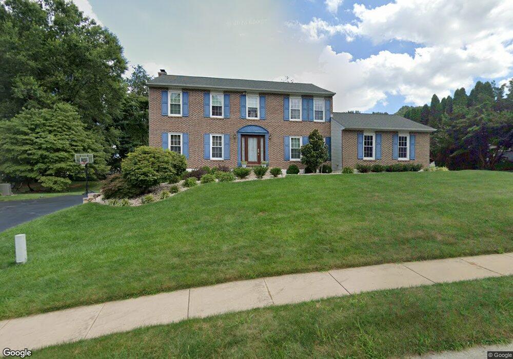
551 Stenning Dr Hockessin, DE 19707
Estimated Value: $711,000 - $746,000
4
Beds
3
Baths
2,708
Sq Ft
$267/Sq Ft
Est. Value
About This Home
This home is located at 551 Stenning Dr, Hockessin, DE 19707 and is currently estimated at $722,733, approximately $266 per square foot. 551 Stenning Dr is a home located in New Castle County with nearby schools including North Star Elementary School, Dupont (H.B.) Middle School, and Alexis I. du Pont High School.
Ownership History
Date
Name
Owned For
Owner Type
Purchase Details
Closed on
Jul 22, 2021
Sold by
Joswick Eugene B and Joswick Joanna M
Bought by
Mathew Shinoj and Mathew Joseph Rosamma
Current Estimated Value
Home Financials for this Owner
Home Financials are based on the most recent Mortgage that was taken out on this home.
Original Mortgage
$400,000
Interest Rate
2.93%
Mortgage Type
New Conventional
Purchase Details
Closed on
Dec 29, 1988
Bought by
Joswick Eugene B and Joswick Joanna M
Create a Home Valuation Report for This Property
The Home Valuation Report is an in-depth analysis detailing your home's value as well as a comparison with similar homes in the area
Home Values in the Area
Average Home Value in this Area
Purchase History
| Date | Buyer | Sale Price | Title Company |
|---|---|---|---|
| Mathew Shinoj | $445,000 | None Listed On Document | |
| Joswick Eugene B | $228,300 | -- |
Source: Public Records
Mortgage History
| Date | Status | Borrower | Loan Amount |
|---|---|---|---|
| Previous Owner | Mathew Shinoj | $400,000 |
Source: Public Records
Tax History
| Year | Tax Paid | Tax Assessment Tax Assessment Total Assessment is a certain percentage of the fair market value that is determined by local assessors to be the total taxable value of land and additions on the property. | Land | Improvement |
|---|---|---|---|---|
| 2024 | $5,712 | $149,100 | $31,300 | $117,800 |
| 2023 | $5,066 | $149,100 | $31,300 | $117,800 |
| 2022 | $5,094 | $149,100 | $31,300 | $117,800 |
| 2021 | $4,819 | $139,500 | $31,300 | $108,200 |
| 2020 | $4,762 | $139,500 | $31,300 | $108,200 |
| 2019 | $4,819 | $139,500 | $31,300 | $108,200 |
| 2018 | $69 | $139,500 | $31,300 | $108,200 |
| 2017 | $4,398 | $139,500 | $31,300 | $108,200 |
| 2016 | $4,398 | $139,500 | $31,300 | $108,200 |
| 2015 | $4,133 | $139,500 | $31,300 | $108,200 |
| 2014 | $3,840 | $139,500 | $31,300 | $108,200 |
Source: Public Records
Map
Nearby Homes
- 87 Chandler Ct
- 7 Piersons Ridge Unit RG
- 257 Grove View Dr
- 255 Grove View Dr
- 567 Southwood Rd
- 809 Christopher Ct
- 301 Hollins Rd Unit 97
- 634 Grant Ave
- 832 Evanson Rd
- 411 Harrison Dr
- 308 Detjen Dr
- 513 Pershing Rd
- 105 Bellfield Ct
- 408 Willowbend Ct
- 515 Massaferi Way
- 253 Peoples Way
- 3 Kings Ct
- 112 Cameron Dr
- 1611 Brackenville Rd
- 8 Bayberry Close
- 549 Stenning Dr
- 30 Halloran Ct
- 32 Halloran Ct
- 31 Piersons Ridge Unit RG
- 33 Piersons Ridge Unit RG
- 29 Piersons Ridge Unit RG
- 28 Eynon Ct
- 547 Stenning Dr
- 35 Piersons Ridge Unit RG
- 536 Stenning Dr
- 34 Halloran Ct
- 26 Eynon Ct
- 33 Halloran Ct
- 31 Halloran Ct
- 27 Piersons Ridge Unit RG
- 35 Halloran Ct
- 37 Piersons Ridge Unit RG
- 545 Stenning Dr
- 23 Eynon Ct
- 1 Ruthana Way
Your Personal Tour Guide
Ask me questions while you tour the home.