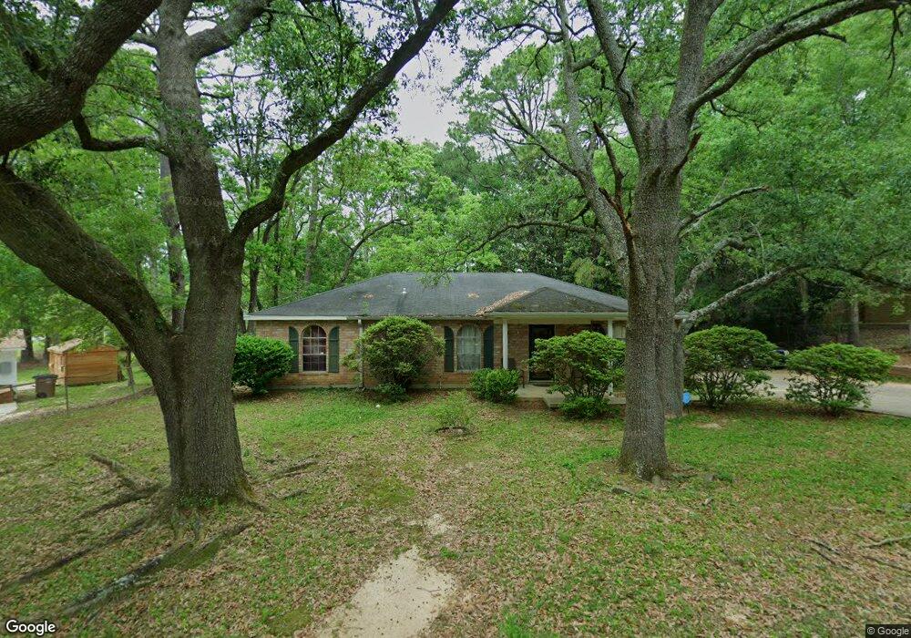
5516 Oakado Dr S Mobile, AL 36609
Malibar Heights NeighborhoodEstimated Value: $169,013 - $213,000
4
Beds
2
Baths
1,450
Sq Ft
$134/Sq Ft
Est. Value
About This Home
This home is located at 5516 Oakado Dr S, Mobile, AL 36609 and is currently estimated at $195,003, approximately $134 per square foot. 5516 Oakado Dr S is a home located in Mobile County with nearby schools including Olive J. Dodge Elementary School, Burns Middle School, and WP Davidson High School.
Ownership History
Date
Name
Owned For
Owner Type
Purchase Details
Closed on
Jun 22, 2007
Sold by
Hayes Charles E and Hayes Barbara C
Bought by
Giddens Reginald L and Seltzer Gwendolyn I
Current Estimated Value
Home Financials for this Owner
Home Financials are based on the most recent Mortgage that was taken out on this home.
Original Mortgage
$134,850
Outstanding Balance
$82,111
Interest Rate
6.1%
Mortgage Type
Unknown
Estimated Equity
$112,892
Purchase Details
Closed on
May 14, 2007
Sold by
Joiner Paul D and Joiner Tony Dale
Bought by
Hayes Charles E and Hayes Barbara C
Home Financials for this Owner
Home Financials are based on the most recent Mortgage that was taken out on this home.
Original Mortgage
$134,850
Outstanding Balance
$82,111
Interest Rate
6.1%
Mortgage Type
Unknown
Estimated Equity
$112,892
Purchase Details
Closed on
Jun 21, 2000
Sold by
Douglas Joiner Cary and Douglas Dorothy L
Bought by
Lynch Dorothy
Create a Home Valuation Report for This Property
The Home Valuation Report is an in-depth analysis detailing your home's value as well as a comparison with similar homes in the area
Home Values in the Area
Average Home Value in this Area
Purchase History
| Date | Buyer | Sale Price | Title Company |
|---|---|---|---|
| Giddens Reginald L | $135,350 | Slt | |
| Hayes Charles E | -- | Slt | |
| Lynch Dorothy | -- | -- |
Source: Public Records
Mortgage History
| Date | Status | Borrower | Loan Amount |
|---|---|---|---|
| Open | Giddens Reginald L | $134,850 |
Source: Public Records
Tax History Compared to Growth
Tax History
| Year | Tax Paid | Tax Assessment Tax Assessment Total Assessment is a certain percentage of the fair market value that is determined by local assessors to be the total taxable value of land and additions on the property. | Land | Improvement |
|---|---|---|---|---|
| 2024 | -- | $12,040 | $2,000 | $10,040 |
| 2023 | $0 | $10,880 | $1,950 | $8,930 |
| 2022 | $0 | $10,300 | $1,800 | $8,500 |
| 2021 | $0 | $9,490 | $1,500 | $7,990 |
| 2020 | $501 | $9,490 | $1,500 | $7,990 |
| 2019 | $539 | $9,540 | $1,500 | $8,040 |
| 2018 | $511 | $9,100 | $0 | $0 |
| 2017 | $597 | $10,460 | $0 | $0 |
| 2016 | $492 | $8,800 | $0 | $0 |
| 2013 | $700 | $10,600 | $0 | $0 |
Source: Public Records
Map
Nearby Homes
- 4458 Wolf Creek Dr N
- 708 Monarch Dr W
- 5552 Fairfield Place
- 5409 Cortez Dr
- 1609 Oak Forest Ct
- 1933 Wildwood Place
- 1508 Oak Cliff Ct
- 1028 Oakland Dr
- 4303 Panorama Blvd
- 1712 Rustic Wood Ct
- 1833 Spring Brook Ct
- 5305 Oak Bend Ct
- 767 Kasserine Pass
- 5738 Green Tree Rd
- 2120 Panorama Dr
- 4259 Raines Dr
- 786 Kasserine Pass
- 5612 Bentley Ln
- 4300 David St
- 1429 Regency Oaks Dr E
- 5512 Oakado Dr S
- 1807 Panorama Blvd W
- 1804 Oakado Ct
- 1801 Panorama Blvd W
- 1803 Panorama Blvd W
- 5519 Oakado Dr S
- 1808 Oakado Ct
- 5515 Oakado Dr S
- 5505 Panorama Blvd
- 1815 Panorama Blvd W
- 5511 Oakado Dr S
- 1800 Oakado Ct
- 1804 Panorama Blvd W
- 1800 Panorama Blvd W
- 5501 Panorama Blvd
- 1808 Panorama Blvd W
- 1819 Panorama Blvd W
- 1816 Panorama Blvd W
- 5507 Oakado Dr S
- 1812 Panorama Blvd W