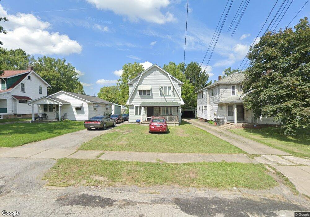
552 E Judson Ave Youngstown, OH 44502
Lansingville NeighborhoodEstimated Value: $55,000 - $100,000
4
Beds
2
Baths
1,838
Sq Ft
$41/Sq Ft
Est. Value
About This Home
This home is located at 552 E Judson Ave, Youngstown, OH 44502 and is currently estimated at $75,056, approximately $40 per square foot. 552 E Judson Ave is a home located in Mahoning County with nearby schools including Taft Elementary School, Williamson Elementary School, and East High School.
Ownership History
Date
Name
Owned For
Owner Type
Purchase Details
Closed on
Mar 10, 2020
Sold by
Green Dorothy
Bought by
Green Derick
Current Estimated Value
Purchase Details
Closed on
Jul 25, 2011
Sold by
Fresh Start Homes Llc
Bought by
Green Dorothy
Purchase Details
Closed on
Aug 5, 2009
Sold by
Inkinen Esko
Bought by
Fresh Start Homes Llc
Purchase Details
Closed on
Nov 2, 1992
Bought by
Inkinen Esko
Create a Home Valuation Report for This Property
The Home Valuation Report is an in-depth analysis detailing your home's value as well as a comparison with similar homes in the area
Home Values in the Area
Average Home Value in this Area
Purchase History
| Date | Buyer | Sale Price | Title Company |
|---|---|---|---|
| Green Derick | -- | None Available | |
| Green Dorothy | $1,500 | None Available | |
| Fresh Start Homes Llc | $2,000 | None Available | |
| Inkinen Esko | $27,000 | -- |
Source: Public Records
Tax History
| Year | Tax Paid | Tax Assessment Tax Assessment Total Assessment is a certain percentage of the fair market value that is determined by local assessors to be the total taxable value of land and additions on the property. | Land | Improvement |
|---|---|---|---|---|
| 2025 | $368 | $8,490 | $620 | $7,870 |
| 2024 | $417 | $8,490 | $620 | $7,870 |
| 2023 | $414 | $8,490 | $620 | $7,870 |
| 2022 | $393 | $6,200 | $690 | $5,510 |
| 2021 | $393 | $6,200 | $690 | $5,510 |
| 2020 | $395 | $6,200 | $690 | $5,510 |
| 2019 | $402 | $5,630 | $620 | $5,010 |
| 2018 | $469 | $5,630 | $620 | $5,010 |
| 2017 | $514 | $5,630 | $620 | $5,010 |
| 2016 | $625 | $7,150 | $620 | $6,530 |
| 2015 | $489 | $7,150 | $620 | $6,530 |
| 2014 | $462 | $7,150 | $620 | $6,530 |
| 2013 | $456 | $7,150 | $620 | $6,530 |
Source: Public Records
Map
Nearby Homes
- 715 Roxbury Ave
- 582 Roxbury Ave
- 359 Potomac Ave
- 4038 Sunset Blvd
- 3919 Rush Blvd
- 320 E Auburndale Ave
- 4212 South Ave
- 4206 Rush Blvd
- 192 Hollywood Ave
- 221 E Avondale Ave
- 178 E Ravenwood Ave
- 173 Clarencedale Ave
- 196 Maywood Dr
- 124 E Midlothian Blvd
- 328 Marmion Ave
- 353 Cornell Ave
- 1208 Aberdeen Ave Unit 212
- 1321 Detroit Ave
- 1210 Aberdeen Ave
- 852 Marmion Ave
- 548 E Judson Ave
- 544 E Judson Ave
- 564 E Judson Ave
- 536 E Judson Ave
- 555 Roxbury Ave
- 563 Roxbury Ave
- 559 Roxbury Ave
- 568 E Judson Ave
- 530 E Judson Ave
- 567 Roxbury Ave
- 547 Roxbury Ave
- 571 Roxbury Ave
- 553 E Judson Ave
- 555 E Judson Ave
- 572 E Judson Ave
- 541 E Judson Ave
- 561 E Judson Ave
- 537 E Judson Ave
- 575 Roxbury Ave
- 565 E Judson Ave
Your Personal Tour Guide
Ask me questions while you tour the home.