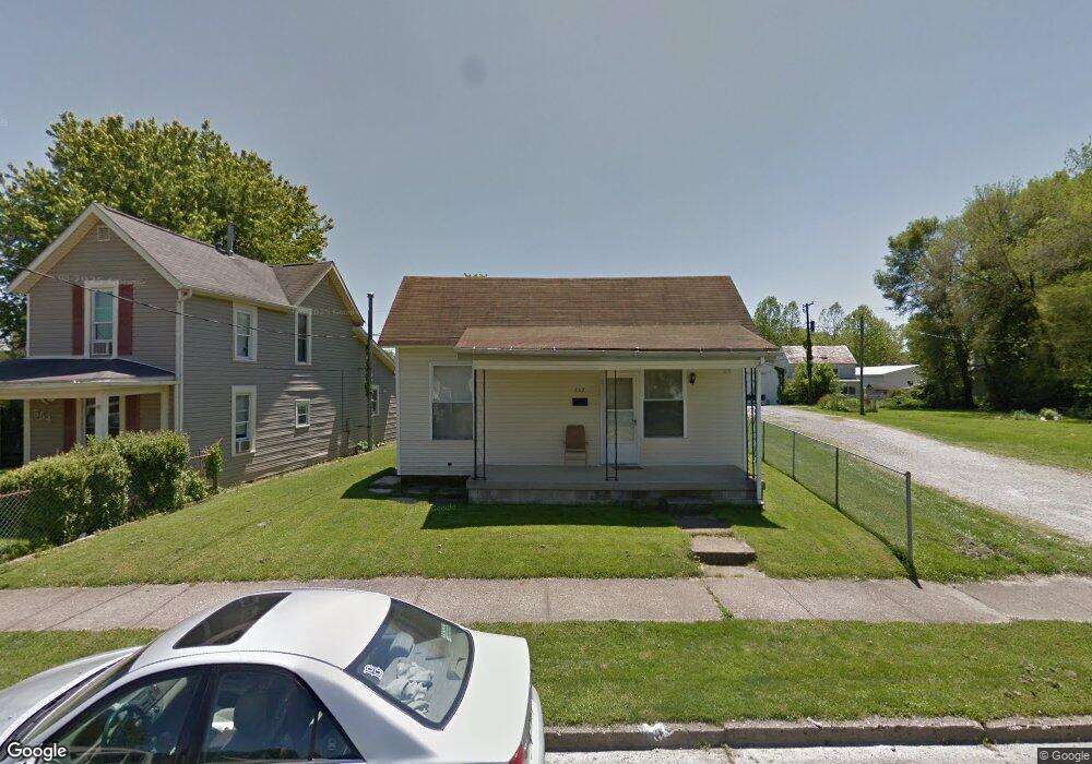
552 E Locust St Lancaster, OH 43130
Estimated Value: $168,000 - $182,000
3
Beds
1
Bath
1,288
Sq Ft
$135/Sq Ft
Est. Value
About This Home
This home is located at 552 E Locust St, Lancaster, OH 43130 and is currently estimated at $173,369, approximately $134 per square foot. 552 E Locust St is a home located in Fairfield County with nearby schools including Thomas Ewing Junior High School, Lancaster High School, and St Mary Elementary School.
Create a Home Valuation Report for This Property
The Home Valuation Report is an in-depth analysis detailing your home's value as well as a comparison with similar homes in the area
Home Values in the Area
Average Home Value in this Area
Tax History
| Year | Tax Paid | Tax Assessment Tax Assessment Total Assessment is a certain percentage of the fair market value that is determined by local assessors to be the total taxable value of land and additions on the property. | Land | Improvement |
|---|---|---|---|---|
| 2025 | $3,199 | $50,240 | $10,570 | $39,670 |
| 2024 | $3,199 | $35,580 | $6,950 | $28,630 |
| 2023 | $961 | $35,580 | $6,950 | $28,630 |
| 2022 | $980 | $35,580 | $6,950 | $28,630 |
| 2021 | $828 | $29,980 | $6,950 | $23,030 |
| 2020 | $832 | $29,980 | $6,950 | $23,030 |
| 2019 | $754 | $29,980 | $6,950 | $23,030 |
| 2018 | $559 | $23,610 | $6,950 | $16,660 |
| 2017 | $560 | $23,720 | $6,950 | $16,770 |
| 2016 | $545 | $23,720 | $6,950 | $16,770 |
| 2015 | $537 | $23,050 | $6,950 | $16,100 |
| 2014 | $511 | $23,050 | $6,950 | $16,100 |
| 2013 | $511 | $23,050 | $6,950 | $16,100 |
Source: Public Records
Map
Nearby Homes
- 414 E Walnut St
- 515 E Chestnut St
- 342 E Chestnut St
- 545 E Main St
- 534 E Wheeling St
- 547 E Mulberry St
- 621 E Mulberry St
- 154 E Main St
- 249 N Pearl Ave
- 846 E Main St
- 844 E Wheeling St
- 641 King St
- 810 4th St
- 1106 E Walnut St
- 1113 E Locust St
- 517 N Maple St
- 859 E Mulberry St
- 869 E Mulberry St
- 924 Woodland Ave
- 0 N Columbus St
Your Personal Tour Guide
Ask me questions while you tour the home.