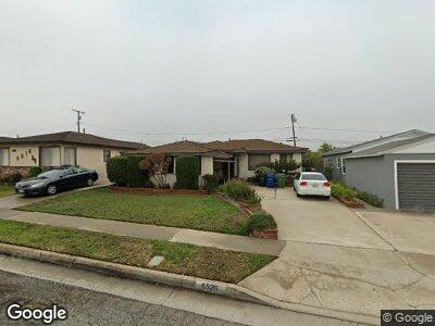
5520 W 139th St Hawthorne, CA 90250
Estimated Value: $1,111,214 - $1,356,000
3
Beds
2
Baths
1,120
Sq Ft
$1,078/Sq Ft
Est. Value
About This Home
This home is located at 5520 W 139th St, Hawthorne, CA 90250 and is currently estimated at $1,207,054, approximately $1,077 per square foot. 5520 W 139th St is a home located in Los Angeles County with nearby schools including Aviation Elementary School, Hollyglen Elementary School, and Richard Henry Dana Middle School.
Ownership History
Date
Name
Owned For
Owner Type
Purchase Details
Closed on
Nov 3, 2008
Sold by
Brady Stacy D
Bought by
Brady John A
Current Estimated Value
Purchase Details
Closed on
Sep 23, 2008
Sold by
Brady Stacy D and Hull Michele E
Bought by
Brady John A
Purchase Details
Closed on
Apr 23, 2008
Sold by
Stephen & Gwendolyn Crosby Family Trust
Bought by
Brady Stacy D and Crosby Stacy Deneen
Purchase Details
Closed on
Nov 16, 2004
Sold by
Stephen & Gwendolyn Crosby Family Trust
Bought by
Crosby Stephen J
Purchase Details
Closed on
Jan 23, 2002
Sold by
Crosby Stephen J and Crosby Gwendolyn A
Bought by
Crosby Stephen J
Create a Home Valuation Report for This Property
The Home Valuation Report is an in-depth analysis detailing your home's value as well as a comparison with similar homes in the area
Home Values in the Area
Average Home Value in this Area
Purchase History
| Date | Buyer | Sale Price | Title Company |
|---|---|---|---|
| Brady John A | -- | None Available | |
| Brady John A | -- | None Available | |
| Brady Stacy D | -- | None Available | |
| Crosby Stephen J | -- | -- | |
| Crosby Stephen J | -- | -- |
Source: Public Records
Tax History Compared to Growth
Tax History
| Year | Tax Paid | Tax Assessment Tax Assessment Total Assessment is a certain percentage of the fair market value that is determined by local assessors to be the total taxable value of land and additions on the property. | Land | Improvement |
|---|---|---|---|---|
| 2024 | $1,491 | $81,657 | $40,346 | $41,311 |
| 2023 | $1,451 | $80,056 | $39,555 | $40,501 |
| 2022 | $1,443 | $78,487 | $38,780 | $39,707 |
| 2021 | $1,402 | $76,949 | $38,020 | $38,929 |
| 2019 | $1,390 | $74,669 | $36,894 | $37,775 |
| 2018 | $1,311 | $73,206 | $36,171 | $37,035 |
| 2016 | $1,256 | $70,365 | $34,767 | $35,598 |
| 2015 | $1,249 | $69,309 | $34,245 | $35,064 |
| 2014 | $1,246 | $67,953 | $33,575 | $34,378 |
Source: Public Records
Map
Nearby Homes
- 5536 W 139th St
- 5510 W 142nd Place
- 14117 Hindry Ave
- 5320 W 142nd Place
- 5244 W 137th Place
- 13303 Judah Ave
- 5174 W 135th St
- 5405 W 149th Place Unit 4
- 5146 W 135th St
- 5550 Boardwalk Unit 102
- 5410 W 149th Place Unit 10
- 13126 Union Ave Unit 203
- 13029 Central Ave Unit 204
- 5447 Marine Ave Unit 7
- 5039 W 135th St
- 12920 Central Ave Unit 301
- 15 Tiburon Ct Unit 1
- 5527 Strand Unit 106
- 5225 Pacific Terrace
- 4840 W 139th St
- 5520 W 139th St
- 5516 W 139th St
- 5524 W 139th St
- 5512 W 139th St
- 5521 W 140th St
- 5528 W 139th St
- 5517 W 140th St
- 5525 W 140th St Unit 733A3
- 5525 W 140th St
- 5513 W 140th St
- 5529 W 140th St
- 5508 W 139th St
- 5532 W 139th St
- 5519 W 139th St
- 5515 W 139th St
- 5523 W 139th St
- 5509 W 140th St
- 5533 W 140th St
- 5511 W 139th St
- 5527 W 139th St