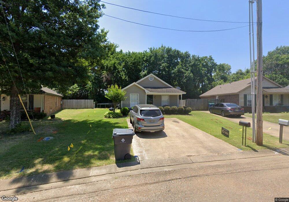
553 Shady Grove E Hernando, MS 38632
Estimated Value: $195,000 - $248,000
3
Beds
2
Baths
1,050
Sq Ft
$203/Sq Ft
Est. Value
About This Home
This home is located at 553 Shady Grove E, Hernando, MS 38632 and is currently estimated at $213,323, approximately $203 per square foot. 553 Shady Grove E is a home located in DeSoto County with nearby schools including Oak Grove Central Elementary School, Hernando Elementary School, and Hernando Hills Elementary.
Ownership History
Date
Name
Owned For
Owner Type
Purchase Details
Closed on
Aug 16, 2022
Sold by
Keel Brandi M
Bought by
Grant Brandi Marie and Grant Gary Michael
Current Estimated Value
Home Financials for this Owner
Home Financials are based on the most recent Mortgage that was taken out on this home.
Original Mortgage
$95,000
Outstanding Balance
$90,478
Interest Rate
5.54%
Mortgage Type
New Conventional
Estimated Equity
$122,845
Purchase Details
Closed on
Oct 19, 2012
Sold by
Keel Billy M
Bought by
Keel Brandi M
Create a Home Valuation Report for This Property
The Home Valuation Report is an in-depth analysis detailing your home's value as well as a comparison with similar homes in the area
Home Values in the Area
Average Home Value in this Area
Purchase History
| Date | Buyer | Sale Price | Title Company |
|---|---|---|---|
| Grant Brandi Marie | -- | -- | |
| Keel Brandi M | -- | None Available |
Source: Public Records
Mortgage History
| Date | Status | Borrower | Loan Amount |
|---|---|---|---|
| Open | Grant Brandi Marie | $95,000 |
Source: Public Records
Tax History
| Year | Tax Paid | Tax Assessment Tax Assessment Total Assessment is a certain percentage of the fair market value that is determined by local assessors to be the total taxable value of land and additions on the property. | Land | Improvement |
|---|---|---|---|---|
| 2025 | $987 | $8,472 | $1,600 | $6,872 |
| 2024 | $880 | $6,345 | $1,600 | $4,745 |
| 2023 | $880 | $6,345 | $0 | $0 |
| 2022 | $880 | $6,345 | $1,600 | $4,745 |
| 2021 | $880 | $6,345 | $1,600 | $4,745 |
| 2020 | $828 | $5,966 | $0 | $0 |
| 2019 | $828 | $5,966 | $1,600 | $4,366 |
| 2017 | $808 | $9,988 | $5,794 | $4,194 |
| 2016 | $774 | $5,794 | $1,600 | $4,194 |
| 2015 | $774 | $9,988 | $5,794 | $4,194 |
| 2014 | $756 | $5,794 | $0 | $0 |
| 2013 | $522 | $5,794 | $0 | $0 |
Source: Public Records
Map
Nearby Homes
- 0 E Commerce St
- 1335 Creekside Blvd
- 665 Cedar Grove Cove
- 1705 Cedar Lake Cove
- 186 E South St
- 5 W Commerce St
- 2833 Mount Pleasant S
- 120 N Parkway St
- 4770 Mccracken Rd
- 136 N Parkway St
- 2035 Highway 51 S
- 1 E Oak Grove Rd
- 5188 Reserve Way
- 2197 Hyacinth Ln
- 3066 Meadows Way
- 1254 Creekside Ln
- 69 Lake Pointe Dr
- 1742 Keenlan Dr W
- 2953 Dove Cove
- 1106 Fawn Dr
- 547 Shady Grove E
- 561 Shady Grove E
- 541 Shady Grove E
- 567 Shady Grove E
- 567 Shady Grove E
- 365 Shady Lane Cove
- 362 Shady Lane Cove
- 363 Shady Lane Cove
- 364 Shady Lane Cove
- 360 Shady Lane Cove
- 361 Shady Lane Cove
- 358 Shady Lane Cove
- 359 Shady Lane Cove
- 356 Shady Lane Cove
- 357 Shady Lane Cove
- 355 Shady Lane Cove
- 353 Shady Lane Cove
- 347 Shady Lane Cove
- 348 Shady Lane Cove
- 349 Shady Lane Cove
Your Personal Tour Guide
Ask me questions while you tour the home.