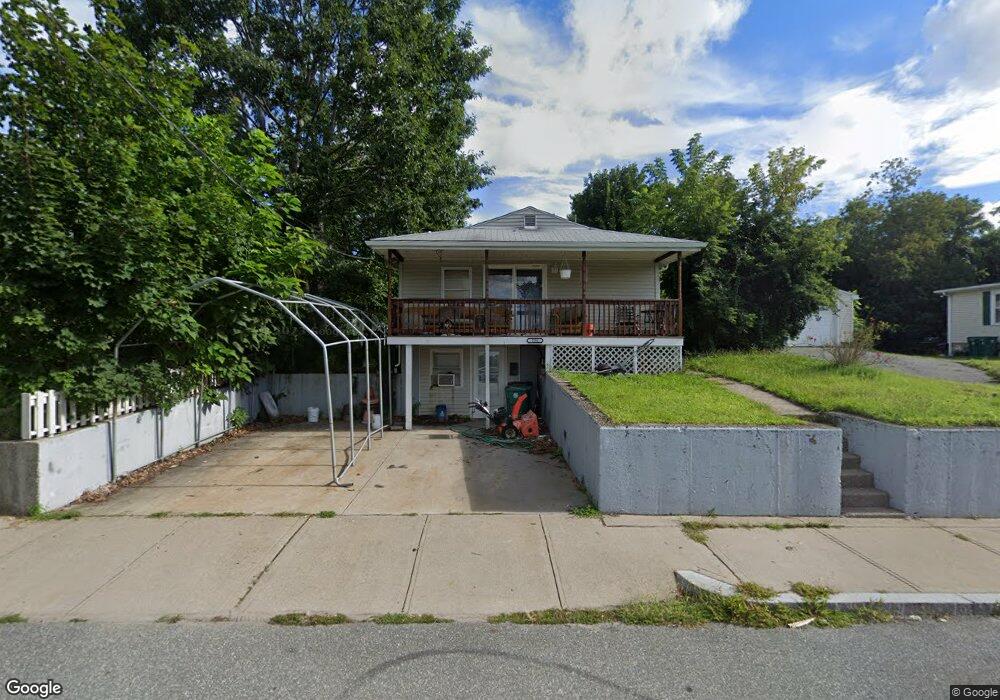
554 Robinson St Woonsocket, RI 02895
East Woonsocket NeighborhoodEstimated Value: $352,000 - $487,000
3
Beds
2
Baths
1,500
Sq Ft
$261/Sq Ft
Est. Value
About This Home
This home is located at 554 Robinson St, Woonsocket, RI 02895 and is currently estimated at $391,051, approximately $260 per square foot. 554 Robinson St is a home located in Providence County with nearby schools including Woonsocket High School, Rise Prep Mayoral Academy Middle School, and Good Shepherd Catholic School.
Ownership History
Date
Name
Owned For
Owner Type
Purchase Details
Closed on
Jun 30, 2003
Sold by
Bank Of Newyork
Bought by
Lanctot Renee
Current Estimated Value
Purchase Details
Closed on
Jan 16, 2003
Sold by
Bank Of New York
Bought by
Bank Of New York
Purchase Details
Closed on
May 5, 1998
Sold by
Blais Constance G
Bought by
Blais Bruce P
Purchase Details
Closed on
Mar 5, 1997
Sold by
Morin Albert N and Morin Jeannette
Bought by
Blais Constance G
Create a Home Valuation Report for This Property
The Home Valuation Report is an in-depth analysis detailing your home's value as well as a comparison with similar homes in the area
Home Values in the Area
Average Home Value in this Area
Purchase History
| Date | Buyer | Sale Price | Title Company |
|---|---|---|---|
| Lanctot Renee | $140,000 | -- | |
| Bank Of New York | $113,000 | -- | |
| Blais Bruce P | $83,000 | -- | |
| Blais Constance G | $50,000 | -- | |
| Lanctot Renee | $140,000 | -- | |
| Bank Of New York | $113,000 | -- | |
| Blais Bruce P | $83,000 | -- | |
| Blais Constance G | $50,000 | -- |
Source: Public Records
Mortgage History
| Date | Status | Borrower | Loan Amount |
|---|---|---|---|
| Open | Blais Constance G | $157,000 | |
| Closed | Blais Constance G | $23,000 |
Source: Public Records
Tax History
| Year | Tax Paid | Tax Assessment Tax Assessment Total Assessment is a certain percentage of the fair market value that is determined by local assessors to be the total taxable value of land and additions on the property. | Land | Improvement |
|---|---|---|---|---|
| 2025 | $3,580 | $318,800 | $87,900 | $230,900 |
| 2024 | $3,423 | $235,400 | $89,500 | $145,900 |
| 2023 | $3,291 | $235,400 | $89,500 | $145,900 |
| 2022 | $3,291 | $235,400 | $89,500 | $145,900 |
| 2021 | $3,235 | $136,200 | $35,600 | $100,600 |
| 2020 | $3,269 | $136,200 | $35,600 | $100,600 |
| 2018 | $3,280 | $136,200 | $35,600 | $100,600 |
| 2017 | $3,452 | $114,700 | $40,000 | $74,700 |
| 2016 | $3,652 | $114,700 | $40,000 | $74,700 |
| 2015 | $4,196 | $114,700 | $40,000 | $74,700 |
| 2014 | $2,860 | $113,700 | $44,000 | $69,700 |
Source: Public Records
Map
Nearby Homes
- 23 Rutland St
- 568 Elm St
- 34 Heroux Ave
- 110 Saint Leon Ave
- 56 Mailloux St
- 311 Elm St
- 271 Elm St
- 263 Elm St
- 212 Saint Louis Ave
- 188 Saint Louis Ave
- 178 Saint Louis Ave
- 685 Social St Unit 308
- 685 Social St Unit 211
- 685 Social St Unit 115
- 142 Brook St
- 95 Mitris Blvd
- 88 Mill St Unit 304
- 96 Mill St Unit 303
- 752 Social St
- 68 Kenwood St
- 574 Robinson St
- 101 Rutland St
- 61 Rutland St Unit 2R
- 524 Robinson St
- 569 Robinson St
- 115 Rutland St
- 514 Robinson St
- 112 Rutland St
- 527 Robinson St
- 589 Robinson St
- 41 Rutland St Unit 3R
- 131 Rutland St
- 594 Robinson St
- 124 Rutland St
- 597 Robinson St
- 113 Winthrop St
- 44 Florida St
- 31 Rutland St Unit 210
- 31 Rutland St
- 31 Rutland St Unit 1
Your Personal Tour Guide
Ask me questions while you tour the home.