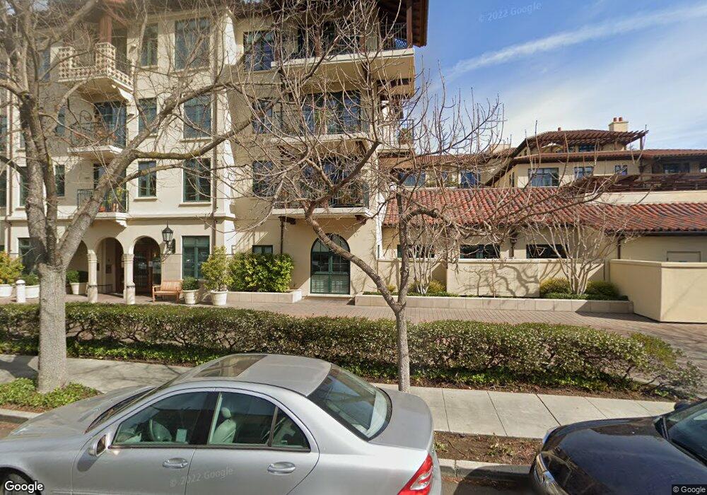
555 Byron St Unit 209 Palo Alto, CA 94301
University South NeighborhoodEstimated Value: $2,039,000 - $2,387,000
3
Beds
3
Baths
2,067
Sq Ft
$1,050/Sq Ft
Est. Value
About This Home
This home is located at 555 Byron St Unit 209, Palo Alto, CA 94301 and is currently estimated at $2,170,996, approximately $1,050 per square foot. 555 Byron St Unit 209 is a home located in Santa Clara County with nearby schools including Addison Elementary School, Frank S. Greene Jr. Middle, and Palo Alto High School.
Ownership History
Date
Name
Owned For
Owner Type
Purchase Details
Closed on
Dec 4, 2003
Sold by
Fiester Thelma Christine
Bought by
Gilbert David I and Gilbert Carol S
Current Estimated Value
Purchase Details
Closed on
Sep 29, 1998
Sold by
Fiester Thelma Christine
Bought by
Fiester Thelma Christine
Purchase Details
Closed on
Nov 4, 1997
Sold by
The Hamilton Group Lp
Bought by
Fiester Thelma Christine
Home Financials for this Owner
Home Financials are based on the most recent Mortgage that was taken out on this home.
Original Mortgage
$550,000
Interest Rate
7.87%
Create a Home Valuation Report for This Property
The Home Valuation Report is an in-depth analysis detailing your home's value as well as a comparison with similar homes in the area
Home Values in the Area
Average Home Value in this Area
Purchase History
| Date | Buyer | Sale Price | Title Company |
|---|---|---|---|
| Gilbert David I | -- | Chicago Title | |
| Fiester Thelma Christine | -- | -- | |
| Fiester Thelma Christine | $1,150,000 | Old Republic Title Company |
Source: Public Records
Mortgage History
| Date | Status | Borrower | Loan Amount |
|---|---|---|---|
| Previous Owner | Fiester Thelma Christine | $550,000 |
Source: Public Records
Tax History Compared to Growth
Tax History
| Year | Tax Paid | Tax Assessment Tax Assessment Total Assessment is a certain percentage of the fair market value that is determined by local assessors to be the total taxable value of land and additions on the property. | Land | Improvement |
|---|---|---|---|---|
| 2025 | $1,670 | $144,567 | $41,554 | $103,013 |
| 2024 | $1,670 | $141,734 | $40,740 | $100,994 |
| 2023 | $1,644 | $138,956 | $39,942 | $99,014 |
| 2022 | $1,623 | $136,232 | $39,159 | $97,073 |
| 2021 | $1,589 | $133,562 | $38,392 | $95,170 |
| 2020 | $1,556 | $132,194 | $37,999 | $94,195 |
| 2019 | $1,538 | $129,603 | $37,254 | $92,349 |
| 2018 | $1,508 | $127,063 | $36,524 | $90,539 |
| 2017 | $1,481 | $124,572 | $35,808 | $88,764 |
| 2016 | $1,430 | $122,130 | $35,106 | $87,024 |
| 2015 | $1,415 | $120,296 | $34,579 | $85,717 |
| 2014 | $1,394 | $117,940 | $33,902 | $84,038 |
Source: Public Records
Map
Nearby Homes
- 707 Webster St
- 755 Homer Ave
- 759 Cowper St
- 637 Channing Ave
- 251 Middlefield Rd
- 447 Homer Ave
- 678 Hawthorne Ave
- 756 Waverley St
- 560 Addison Ave
- 315 Homer Ave Unit 105
- 660 Palo Alto Ave
- 536 Addison Ave
- 1101 Hamilton Ave
- 1033 Guinda St
- 770 Bryant St
- 961 Channing Ave
- 160 Waverley St
- 1027 Waverley St
- 115 Waverley St
- 162 Waverley St
- 555 Byron St Unit 102
- 555 Byron St Unit 101
- 555 Byron St Unit 208
- 555 Byron St Unit 207
- 555 Byron St Unit 206
- 555 Byron St Unit 205
- 555 Byron St Unit 204
- 555 Byron St Unit 203
- 555 Byron St Unit 202
- 555 Byron St Unit 201
- 555 Byron St Unit 109
- 555 Byron St Unit 107
- 555 Byron St Unit 106
- 555 Byron St Unit 105
- 555 Byron St Unit 103
- 555 Byron St Unit 411
- 555 Byron St Unit 410
- 555 Byron St Unit 409
- 555 Byron St Unit 403
- 555 Byron St Unit 402