Estimated Value: $464,000 - $642,046
3
Beds
4
Baths
3,470
Sq Ft
$154/Sq Ft
Est. Value
About This Home
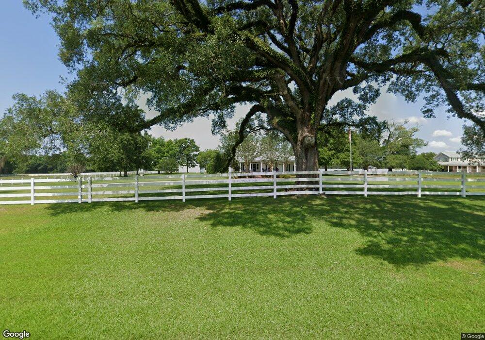
This home is located at 555 Stewart Rd, Dixie, GA 31629 and is currently estimated at $534,762, approximately $154 per square foot. 555 Stewart Rd is a home located in Brooks County with nearby schools including Quitman Elementary School and Westbrook School.
Ownership History
Date
Name
Owned For
Owner Type
Purchase Details
Closed on
Jan 27, 2010
Sold by
Bank Of America
Bought by
Wilenius Robert and Wilenius Sarah Francine
Current Estimated Value
Purchase Details
Closed on
Sep 1, 2009
Sold by
Duke Danna G
Bought by
Bank Of America Na
Purchase Details
Closed on
Jan 19, 2007
Sold by
Duke James N & Danna G Trustees
Bought by
Duke James N and Duke Danna G
Home Financials for this Owner
Home Financials are based on the most recent Mortgage that was taken out on this home.
Original Mortgage
$984,800
Interest Rate
6.5%
Mortgage Type
New Conventional
Purchase Details
Closed on
Apr 14, 2003
Sold by
Hiers Lloyde B and Hiers Judy L
Bought by
Duke James N & Danna G Trustees
Purchase Details
Closed on
May 5, 1993
Sold by
Stewart Evelyn E
Bought by
Hiers Lloyde B and Hiers Judy L
Purchase Details
Closed on
Apr 24, 1992
Sold by
Stewart Robert S
Bought by
Stewart Evelyn E
Create a Home Valuation Report for This Property
The Home Valuation Report is an in-depth analysis detailing your home's value as well as a comparison with similar homes in the area
Purchase History
| Date | Buyer | Sale Price | Title Company |
|---|---|---|---|
| Wilenius Robert | $256,450 | -- | |
| Bank Of America Na | $490,500 | -- | |
| Duke James N | -- | -- | |
| Duke James N & Danna G Trustees | $125,000 | -- | |
| Hiers Lloyde B | $68,500 | -- | |
| Stewart Evelyn E | -- | -- |
Source: Public Records
Mortgage History
| Date | Status | Borrower | Loan Amount |
|---|---|---|---|
| Previous Owner | Duke James N | $984,800 |
Source: Public Records
Tax History
| Year | Tax Paid | Tax Assessment Tax Assessment Total Assessment is a certain percentage of the fair market value that is determined by local assessors to be the total taxable value of land and additions on the property. | Land | Improvement |
|---|---|---|---|---|
| 2025 | $5,861 | $214,896 | $31,120 | $183,776 |
| 2024 | $5,861 | $214,896 | $31,120 | $183,776 |
| 2023 | $5,603 | $204,776 | $28,160 | $176,616 |
| 2022 | $5,077 | $167,816 | $26,840 | $140,976 |
| 2021 | $4,599 | $150,496 | $26,280 | $124,216 |
| 2020 | $4,178 | $150,456 | $26,280 | $124,176 |
| 2019 | $4,271 | $140,856 | $26,840 | $114,016 |
| 2018 | $4,279 | $146,496 | $30,480 | $116,016 |
| 2017 | $4,354 | $141,216 | $30,480 | $110,736 |
| 2016 | $4,407 | $142,696 | $30,480 | $112,216 |
| 2015 | -- | $142,136 | $30,480 | $111,656 |
| 2014 | -- | $144,536 | $30,480 | $114,056 |
| 2013 | -- | $138,456 | $24,400 | $114,056 |
Source: Public Records
Map
Nearby Homes
- 5199 U S 84
- Dixie Rd
- 2156 County Road 78
- 431 Dry Lake Rd
- 804 Westlake Dr
- 9900 Ozell Rd
- 309 Eastlake Dr
- 1001 W Bartow St
- 901 W Boundary St
- 304 W Rountree St
- 203 W Gordon St
- 0 W Swamp St
- 606 N Court St
- 536 N Leaphart St
- Lot 14 Dawn Ln
- 417 N Court St
- 621 N Court St
- 807 N Court St
- 0 Madison Hwy Unit Quitman GA
- 0 Madison Hwy Unit 147194
- 671 Stewart Rd
- 650 Stewart Rd
- 741 Stewart Rd
- 724 Stewart Rd
- 431 Stewart Rd
- 3519 Us Highway 84
- 3205 U S 84
- 3400 U S 84
- 4951 Dixie Rd
- 225 Dixie Barwick Rd
- 5039 Dixie Rd
- 353 Stewart Rd
- 347 Dixie Barwick Rd
- 347 Dixie Barwick Rd
- 5103 Dixie Rd
- 4824 Dixie Rd
- 5207 Dixie Rd
- 302 Church St
- 303 Church St
- 105 Church St
Your Personal Tour Guide
Ask me questions while you tour the home.