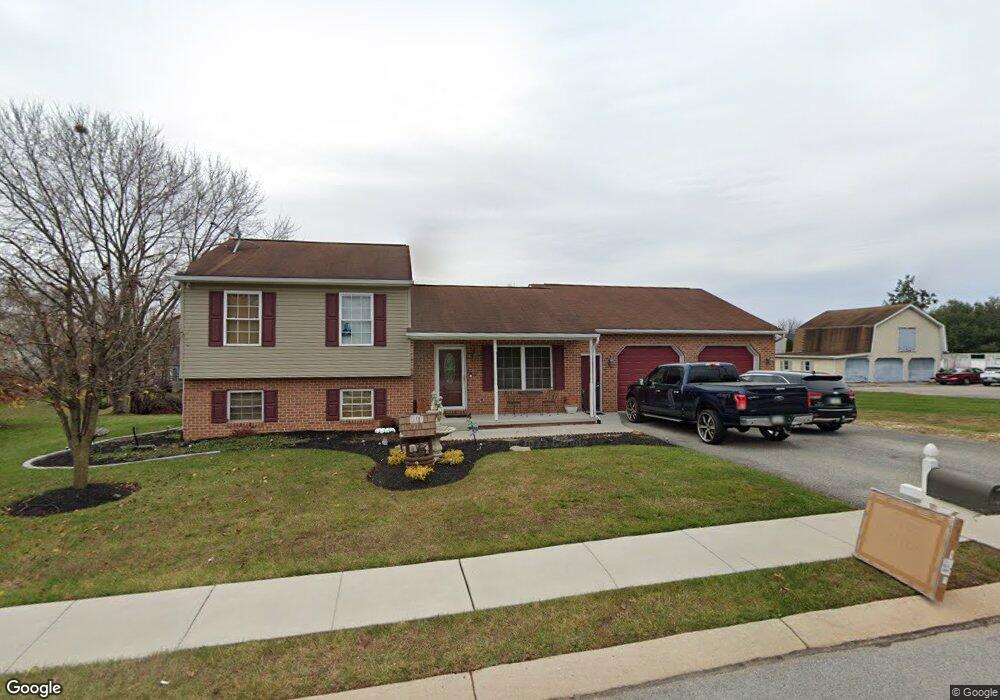
555 Sutton Rd Unit 30 Abbottstown, PA 17301
Estimated Value: $220,000 - $305,000
3
Beds
2
Baths
1,432
Sq Ft
$186/Sq Ft
Est. Value
About This Home
This home is located at 555 Sutton Rd Unit 30, Abbottstown, PA 17301 and is currently estimated at $265,852, approximately $185 per square foot. 555 Sutton Rd Unit 30 is a home located in Adams County with nearby schools including New Oxford Senior High School, Paradise School, and Oxford Christian Academy.
Ownership History
Date
Name
Owned For
Owner Type
Purchase Details
Closed on
Jun 29, 2009
Sold by
Welch Thomas D and Welch Karen P
Bought by
Madrigal Adrian G
Current Estimated Value
Home Financials for this Owner
Home Financials are based on the most recent Mortgage that was taken out on this home.
Original Mortgage
$196,278
Outstanding Balance
$125,142
Interest Rate
4.86%
Mortgage Type
FHA
Estimated Equity
$140,710
Create a Home Valuation Report for This Property
The Home Valuation Report is an in-depth analysis detailing your home's value as well as a comparison with similar homes in the area
Home Values in the Area
Average Home Value in this Area
Purchase History
| Date | Buyer | Sale Price | Title Company |
|---|---|---|---|
| Madrigal Adrian G | $199,900 | -- |
Source: Public Records
Mortgage History
| Date | Status | Borrower | Loan Amount |
|---|---|---|---|
| Open | Madrigal Adrian G | $196,278 |
Source: Public Records
Tax History Compared to Growth
Tax History
| Year | Tax Paid | Tax Assessment Tax Assessment Total Assessment is a certain percentage of the fair market value that is determined by local assessors to be the total taxable value of land and additions on the property. | Land | Improvement |
|---|---|---|---|---|
| 2025 | $4,426 | $180,400 | $27,200 | $153,200 |
| 2024 | $4,097 | $180,400 | $27,200 | $153,200 |
| 2023 | $3,904 | $180,400 | $27,200 | $153,200 |
| 2022 | $3,786 | $180,400 | $27,200 | $153,200 |
| 2021 | $3,691 | $180,400 | $27,200 | $153,200 |
| 2020 | $3,618 | $180,400 | $27,200 | $153,200 |
| 2019 | $3,545 | $180,400 | $27,200 | $153,200 |
| 2018 | $3,292 | $180,400 | $27,200 | $153,200 |
| 2017 | $3,197 | $180,400 | $27,200 | $153,200 |
| 2016 | -- | $180,400 | $27,200 | $153,200 |
| 2015 | -- | $180,400 | $27,200 | $153,200 |
| 2014 | -- | $180,400 | $27,200 | $153,200 |
Source: Public Records
Map
Nearby Homes
- 201 Kinneman Rd Unit 25
- 221 Kinneman Rd Unit 28
- 6 Lobell Rd
- 0 Woods Rd
- 486 W King St
- 507 Bullet Way
- 224 W King St
- 290 Woods Rd Unit 1
- 28 Town Cir Unit 12A
- 334 Rolling Ln Unit 2
- 484 Brough Rd
- 6431 York Rd
- 57 Blue Heron Dr
- 54 Fox Meadow Dr Unit 12
- 23 Broadwing Dr
- 104 Raptor Dr
- 85 Raptor Dr
- 53 Raptor Dr
- 3392 Carlisle Pike
- 30 Raptor Dr
- 569 Sutton Rd Unit 29
- 170 Abbotts Dr Unit 24
- 583 Sutton Rd Unit 28
- 541 Sutton Rd Unit 2
- 158 Abbotts Dr Unit 23
- 554 Sutton Rd
- 190 Abbotts Dr Unit 26
- 595 Sutton Rd Unit 27
- 146 Abbotts Dr Unit 22
- 0 Kinneman Rd
- 0 Kinneman Rd
- 516 Sutton Rd
- 120 Kinneman Rd Unit 37
- 173 Abbotts Dr Unit 38
- 163 Abbotts Dr Unit 39
- 132 Abbotts Dr Unit 21
- 5 Kinneman Rd
- 66 Lobell Rd
- 203 Lobell Rd
- 201 Lobell Rd