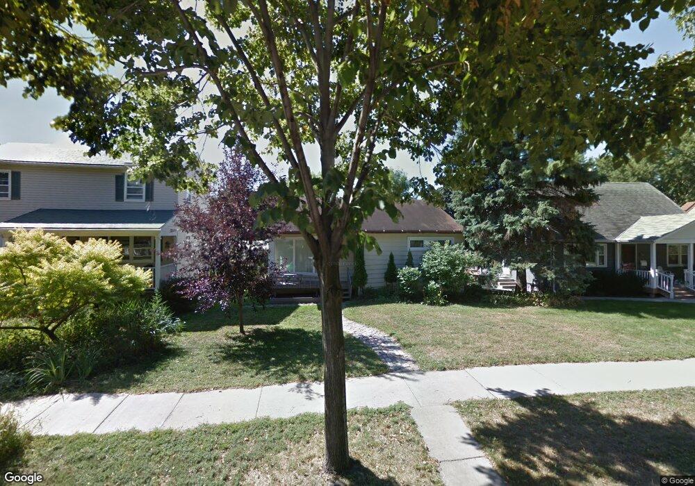
559 Desnoyer Ave Saint Paul, MN 55104
Union Park NeighborhoodEstimated Value: $421,000 - $435,000
4
Beds
2
Baths
1,593
Sq Ft
$270/Sq Ft
Est. Value
About This Home
This home is located at 559 Desnoyer Ave, Saint Paul, MN 55104 and is currently estimated at $430,015, approximately $269 per square foot. 559 Desnoyer Ave is a home located in Ramsey County with nearby schools including Groveland Park Elementary School, Hidden River Middle School, and Central Senior High School.
Ownership History
Date
Name
Owned For
Owner Type
Purchase Details
Closed on
Mar 19, 2021
Sold by
Coughlin Nick
Bought by
Strand Sara Helena and Strand Nicolas Mark
Current Estimated Value
Home Financials for this Owner
Home Financials are based on the most recent Mortgage that was taken out on this home.
Original Mortgage
$366,700
Outstanding Balance
$329,824
Interest Rate
2.9%
Mortgage Type
New Conventional
Estimated Equity
$100,191
Purchase Details
Closed on
May 31, 2019
Sold by
Johnson Mark E and Flanagan Carrie
Bought by
Coughlin Nick
Home Financials for this Owner
Home Financials are based on the most recent Mortgage that was taken out on this home.
Original Mortgage
$230,578
Interest Rate
4.2%
Mortgage Type
New Conventional
Purchase Details
Closed on
May 17, 2002
Sold by
Harrassowitz Christiane and Curtis Milburn A
Bought by
Johnson Mark E
Create a Home Valuation Report for This Property
The Home Valuation Report is an in-depth analysis detailing your home's value as well as a comparison with similar homes in the area
Home Values in the Area
Average Home Value in this Area
Purchase History
| Date | Buyer | Sale Price | Title Company |
|---|---|---|---|
| Strand Sara Helena | $397,697 | Network Title Inc | |
| Coughlin Nick | $270,000 | Minnesota Title | |
| Johnson Mark E | $189,000 | -- | |
| Strand Nicolas Nicolas | $386,000 | -- |
Source: Public Records
Mortgage History
| Date | Status | Borrower | Loan Amount |
|---|---|---|---|
| Open | Strand Sara Helena | $366,700 | |
| Previous Owner | Coughlin Nick | $230,578 | |
| Closed | Strand Nicolas Nicolas | $366,700 |
Source: Public Records
Tax History Compared to Growth
Tax History
| Year | Tax Paid | Tax Assessment Tax Assessment Total Assessment is a certain percentage of the fair market value that is determined by local assessors to be the total taxable value of land and additions on the property. | Land | Improvement |
|---|---|---|---|---|
| 2025 | $5,502 | $430,300 | $112,200 | $318,100 |
| 2023 | $5,502 | $351,600 | $112,200 | $239,400 |
| 2022 | $5,080 | $372,000 | $112,200 | $259,800 |
| 2021 | $4,896 | $319,900 | $112,200 | $207,700 |
| 2020 | $4,880 | $301,800 | $112,200 | $189,600 |
| 2019 | $4,548 | $274,400 | $112,200 | $162,200 |
| 2018 | $4,100 | $256,300 | $112,200 | $144,100 |
| 2017 | $4,020 | $238,200 | $112,200 | $126,000 |
| 2016 | $4,130 | $0 | $0 | $0 |
| 2015 | $4,062 | $227,800 | $112,200 | $115,600 |
| 2014 | $4,062 | $0 | $0 | $0 |
Source: Public Records
Map
Nearby Homes
- 572 Desnoyer Ave
- 563 Eustis St
- 583 Cromwell Ave
- 606 Cromwell Ave
- 515 Raymond Ave
- 215 Warwick St SE
- 2616 40th Ave S
- 1909 E River Pkwy
- 2565 Franklin Ave Unit 313
- 2565 Franklin Ave Unit 207
- 820 Emerald St Unit 402
- 820 Emerald St Unit 110
- 820 Emerald St SE Unit 314
- 2156 Saint Anthony Ave
- 2566 Ellis Ave Unit 303
- 2566 Ellis Ave Unit 116
- 2566 Ellis Ave Unit 103
- 3112 45th Ave S
- 2508 37th Ave S
- 2650 University Ave W Unit 1
- 553 Desnoyer Ave
- 563 Desnoyer Ave
- 549 Desnoyer Ave
- 567 Desnoyer Ave
- 575 Desnoyer Ave
- 542 Otis Ave
- 548 Otis Ave
- 538 Otis Ave
- 560 Desnoyer Ave
- 556 Desnoyer Ave
- 534 Otis Ave
- 554 Otis Ave
- 552 Desnoyer Ave
- 566 Desnoyer Ave
- 581 Desnoyer Ave
- 491 Eustis St
- 560 Otis Ave
- 576 Desnoyer Ave
- 585 Desnoyer Ave
- 526 Otis Ave