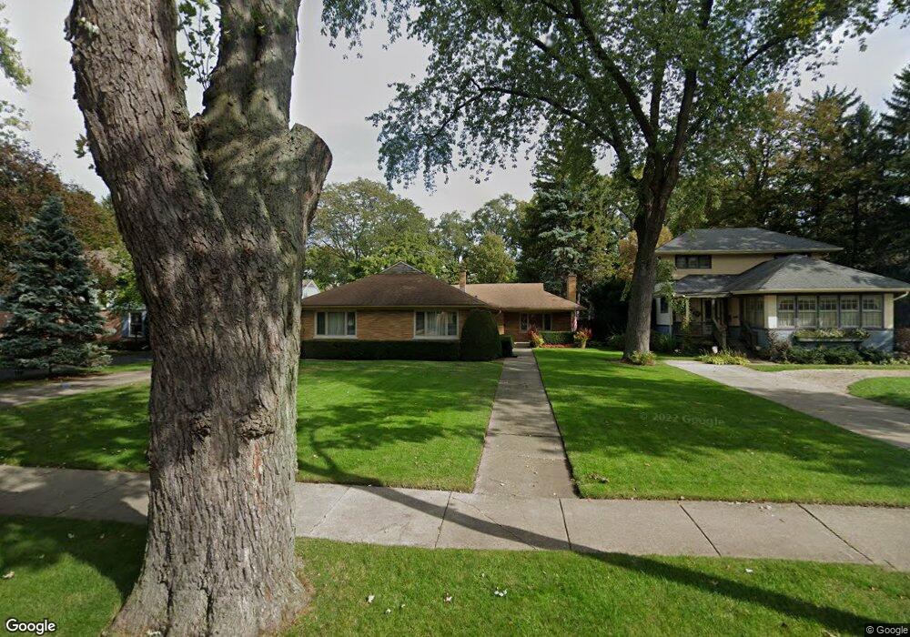
559 Webford Ave Des Plaines, IL 60016
Estimated Value: $502,000 - $630,000
4
Beds
2
Baths
2,107
Sq Ft
$260/Sq Ft
Est. Value
About This Home
This home is located at 559 Webford Ave, Des Plaines, IL 60016 and is currently estimated at $547,459, approximately $259 per square foot. 559 Webford Ave is a home located in Cook County with nearby schools including Central Elementary School, Chippewa Middle School, and Maine West High School.
Ownership History
Date
Name
Owned For
Owner Type
Purchase Details
Closed on
Sep 4, 2007
Sold by
Zaleski Mary F
Bought by
Zaleski John A and Locsmandy Susan J
Current Estimated Value
Home Financials for this Owner
Home Financials are based on the most recent Mortgage that was taken out on this home.
Original Mortgage
$320,000
Outstanding Balance
$203,224
Interest Rate
6.63%
Mortgage Type
Unknown
Estimated Equity
$344,235
Create a Home Valuation Report for This Property
The Home Valuation Report is an in-depth analysis detailing your home's value as well as a comparison with similar homes in the area
Home Values in the Area
Average Home Value in this Area
Purchase History
| Date | Buyer | Sale Price | Title Company |
|---|---|---|---|
| Zaleski John A | $400,000 | Heritage Title Company |
Source: Public Records
Mortgage History
| Date | Status | Borrower | Loan Amount |
|---|---|---|---|
| Open | Zaleski John A | $320,000 |
Source: Public Records
Tax History Compared to Growth
Tax History
| Year | Tax Paid | Tax Assessment Tax Assessment Total Assessment is a certain percentage of the fair market value that is determined by local assessors to be the total taxable value of land and additions on the property. | Land | Improvement |
|---|---|---|---|---|
| 2024 | $8,973 | $40,000 | $17,520 | $22,480 |
| 2023 | $8,708 | $40,000 | $17,520 | $22,480 |
| 2022 | $8,708 | $40,000 | $17,520 | $22,480 |
| 2021 | $7,765 | $28,591 | $14,235 | $14,356 |
| 2020 | $7,703 | $28,591 | $14,235 | $14,356 |
| 2019 | $7,626 | $31,768 | $14,235 | $17,533 |
| 2018 | $8,771 | $32,764 | $12,592 | $20,172 |
| 2017 | $8,634 | $32,764 | $12,592 | $20,172 |
| 2016 | $8,411 | $32,764 | $12,592 | $20,172 |
| 2015 | $8,951 | $32,231 | $10,950 | $21,281 |
| 2014 | $8,778 | $32,231 | $10,950 | $21,281 |
| 2013 | $8,542 | $32,231 | $10,950 | $21,281 |
Source: Public Records
Map
Nearby Homes
- 1325 Perry St Unit 401
- 648 1st Ave
- 1353 Perry St Unit 6
- 1258 Brown St Unit 302
- 1374 Jefferson St
- 1363 Perry St Unit 1B
- 1389 Perry St Unit 303
- 1057 Hollywood Ave
- 390 S Western Ave Unit 604
- 370 S Western Ave Unit 505
- 1279 Harding Ave Unit 3D
- 476 Alles St Unit 508
- 501 Alles St Unit 501A
- 501 Alles St Unit 302A
- 799 Graceland Ave Unit 504A
- 395 Graceland Ave Unit 207
- 395 Graceland Ave Unit 308
- 821 Lexington Cir E
- 365 Graceland Ave Unit 205A
- 843 Lexington Cir E
- 569 Webford Ave
- 555 Webford Ave
- 575 Webford Ave
- 553 Webford Ave
- 583 Webford Ave
- 547 Webford Ave
- 570 Webford Ave
- 566 Webford Ave
- 572 Webford Ave
- 564 Webford Ave
- 562 Webford Ave
- 587 Webford Ave
- 576 Webford Ave
- 535 Webford Ave
- 560 Webford Ave
- 556 Webford Ave
- 1264 E Northwest Hwy
- 584 Webford Ave
- 531 Webford Ave
- 593 Webford Ave