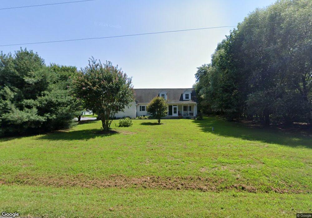
5598 Watson Rd Laurel, DE 19956
Estimated Value: $322,000 - $373,000
3
Beds
--
Bath
1,437
Sq Ft
$239/Sq Ft
Est. Value
About This Home
This home is located at 5598 Watson Rd, Laurel, DE 19956 and is currently estimated at $343,847, approximately $239 per square foot. 5598 Watson Rd is a home located in Sussex County with nearby schools including North Laurel Elementary School, Laurel Elementary School, and Laurel Intermediate Middle School.
Ownership History
Date
Name
Owned For
Owner Type
Purchase Details
Closed on
Oct 31, 2016
Sold by
Bounds Christopher J and Bounds Kenneth M
Bought by
Wright Eric G
Current Estimated Value
Home Financials for this Owner
Home Financials are based on the most recent Mortgage that was taken out on this home.
Original Mortgage
$172,000
Outstanding Balance
$136,595
Interest Rate
3.42%
Mortgage Type
New Conventional
Estimated Equity
$207,252
Purchase Details
Closed on
Mar 27, 2015
Sold by
Grayson L Grayson L
Bought by
Bounds Christopher J and Bounds Kenneth M
Create a Home Valuation Report for This Property
The Home Valuation Report is an in-depth analysis detailing your home's value as well as a comparison with similar homes in the area
Home Values in the Area
Average Home Value in this Area
Purchase History
| Date | Buyer | Sale Price | Title Company |
|---|---|---|---|
| Wright Eric G | $172,000 | None Available | |
| Bounds Christopher J | -- | -- |
Source: Public Records
Mortgage History
| Date | Status | Borrower | Loan Amount |
|---|---|---|---|
| Open | Wright Eric G | $172,000 |
Source: Public Records
Tax History
| Year | Tax Paid | Tax Assessment Tax Assessment Total Assessment is a certain percentage of the fair market value that is determined by local assessors to be the total taxable value of land and additions on the property. | Land | Improvement |
|---|---|---|---|---|
| 2025 | $1,128 | $17,850 | $1,250 | $16,600 |
| 2024 | $931 | $17,850 | $1,250 | $16,600 |
| 2023 | $1,061 | $17,850 | $1,250 | $16,600 |
| 2022 | $922 | $17,850 | $1,250 | $16,600 |
| 2021 | $914 | $17,850 | $1,250 | $16,600 |
| 2020 | $937 | $17,850 | $1,250 | $16,600 |
| 2019 | $939 | $17,850 | $1,250 | $16,600 |
| 2018 | $1,024 | $17,850 | $0 | $0 |
| 2017 | $993 | $17,850 | $0 | $0 |
| 2016 | $1,030 | $17,850 | $0 | $0 |
| 2015 | $889 | $17,850 | $0 | $0 |
| 2014 | $788 | $17,850 | $0 | $0 |
Source: Public Records
Map
Nearby Homes
- 6474 Pleasant Dr
- 32427 Mount Pleasant Rd
- 32733 Tussock Dr
- 32725 Tussock Dr
- 32722 Tussock Dr
- 6503 Pleasant Dr
- 31568 Mount Pleasant Rd
- 32901 Mount Pleasant Rd
- 31348 Mount Pleasant Rd
- 6761 Sharptown Rd
- 7132 Airport Rd
- 33015 Forest Knoll Dr
- 30804 River Rd
- 30845 Al Jan Dr
- 33016 Forest Knoll Dr
- 30772 River Rd
- 34037 Old Hickory Rd
- 3150 Old Sharptown Rd
- 34463 Rider Rd
- 7857 Holly Branch Dr
- 5611 Watson Rd
- 5560 Watson Rd
- 6022 Watson Rd
- 5542 Watson Rd
- 5537 Watson Rd
- 0 Watson Rd Unit 1001372304
- 0 Watson Rd Unit 1001065236
- 0 Watson Rd Unit 1001065204
- 0 Watson Rd Unit 1001065222
- 0 Watson Rd Unit 1001065190
- 5623 Watson Rd
- 6066 Watson Rd
- 5491 Watson Rd
- 5583 Watson Rd
- 32861 Champlins Five Ln
- 6088 Watson Rd
- 6092 Watson Rd
- 6107 Watson Rd
- 6093 Watson Rd
- 6096 Watson Rd
Your Personal Tour Guide
Ask me questions while you tour the home.