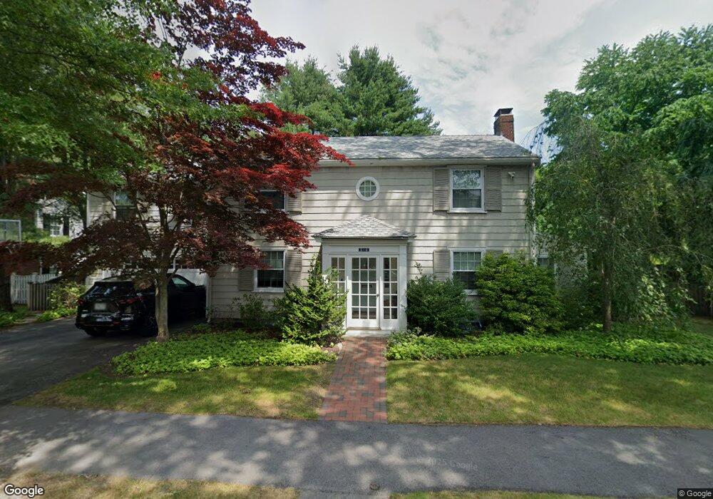
56 Lincoln Cir Unit 1 Swampscott, MA 01907
Estimated Value: $1,332,000 - $1,538,000
4
Beds
3
Baths
2,618
Sq Ft
$559/Sq Ft
Est. Value
About This Home
This home is located at 56 Lincoln Cir Unit 1, Swampscott, MA 01907 and is currently estimated at $1,464,345, approximately $559 per square foot. 56 Lincoln Cir Unit 1 is a home located in Essex County with nearby schools including Swampscott Middle School, Swampscott High School, and Devereux School.
Ownership History
Date
Name
Owned For
Owner Type
Purchase Details
Closed on
Aug 8, 2017
Sold by
Wallen Adam R and Wallen Ariel L
Bought by
Rosenstein Alex and Rosenstein Laura
Current Estimated Value
Home Financials for this Owner
Home Financials are based on the most recent Mortgage that was taken out on this home.
Original Mortgage
$513,500
Outstanding Balance
$423,929
Interest Rate
3.75%
Mortgage Type
New Conventional
Estimated Equity
$1,040,416
Purchase Details
Closed on
Jun 27, 2007
Sold by
Finkel Debra W and Finkel Robert M
Bought by
Wallen Adam R and Wallen Ariel Lee
Purchase Details
Closed on
Jun 25, 1993
Sold by
Kafker Jerald L
Bought by
Finkel Robert M and Finkel Debra
Create a Home Valuation Report for This Property
The Home Valuation Report is an in-depth analysis detailing your home's value as well as a comparison with similar homes in the area
Home Values in the Area
Average Home Value in this Area
Purchase History
| Date | Buyer | Sale Price | Title Company |
|---|---|---|---|
| Rosenstein Alex | $838,000 | -- | |
| Rosenstein Alex | $838,000 | -- | |
| Wallen Adam R | $737,000 | -- | |
| Wallen Adam R | $737,000 | -- | |
| Finkel Robert M | $290,000 | -- | |
| Finkel Robert M | $290,000 | -- |
Source: Public Records
Mortgage History
| Date | Status | Borrower | Loan Amount |
|---|---|---|---|
| Open | Rosenstein Alex | $513,500 | |
| Closed | Rosenstein Alex | $513,500 | |
| Previous Owner | Finkel Robert M | $417,000 | |
| Previous Owner | Finkel Robert M | $143,000 |
Source: Public Records
Tax History Compared to Growth
Tax History
| Year | Tax Paid | Tax Assessment Tax Assessment Total Assessment is a certain percentage of the fair market value that is determined by local assessors to be the total taxable value of land and additions on the property. | Land | Improvement |
|---|---|---|---|---|
| 2025 | $14,312 | $1,247,800 | $401,700 | $846,100 |
| 2024 | $13,886 | $1,208,500 | $382,100 | $826,400 |
| 2023 | $12,814 | $1,091,500 | $342,900 | $748,600 |
| 2022 | $12,240 | $954,000 | $293,900 | $660,100 |
| 2021 | $12,097 | $876,600 | $274,300 | $602,300 |
| 2020 | $12,331 | $862,300 | $274,300 | $588,000 |
| 2019 | $13,481 | $886,900 | $254,700 | $632,200 |
| 2018 | $13,806 | $862,900 | $254,700 | $608,200 |
| 2017 | $14,049 | $805,100 | $235,100 | $570,000 |
| 2016 | $13,826 | $797,800 | $227,800 | $570,000 |
| 2015 | $13,682 | $797,800 | $227,800 | $570,000 |
| 2014 | $13,202 | $706,000 | $227,800 | $478,200 |
Source: Public Records
Map
Nearby Homes
- 179 Beach Bluff Ave
- 48 Bellevue Rd
- 25 Manton Rd
- 37 Stanley Rd
- 212 Humphrey St Unit 205
- 201 Humphrey St Unit 2
- 24 Orchard Cir
- 19 Elmwood Rd
- 25 Tedesco St
- 35 Alden Rd
- 35 Littles Point Rd Unit S201
- 9 Tedesco Pond Place Unit 9
- 2 Wilfred Terrace
- 1006 Paradise Rd Unit 3R
- 1004 Paradise Rd Unit PHJ
- 71 Walnut Rd
- 110 Galloupes Point Rd
- 83 Lafayette St
- 6 Loring Hills Ave Unit D3
- 2 Martin St
- 56 Lincoln Cir
- 14 Lincoln Cir
- 44 Lincoln Cir
- 60 Lincoln Cir
- 53 Lincoln Cir
- 24 Lincoln Cir
- 10 Lincoln Cir
- 45 Lincoln Cir
- 61 Lincoln Cir
- 160 Phillips Ave
- 21 Estabrook Rd
- 166 Phillips Ave
- 23 Lincoln Cir
- 35 Lincoln Cir
- 25 Lincoln Cir
- 25 Mostyn St
- 5 Estabrook Rd
- 148 Phillips Ave
- 35 Estabrook Rd
- 21 Mostyn St