Estimated Value: $1,330,000 - $1,601,801
3
Beds
3
Baths
2,106
Sq Ft
$709/Sq Ft
Est. Value
About This Home
This home is located at 56 Riverside Rd Unit W, Avon, CO 81620 and is currently estimated at $1,492,950, approximately $708 per square foot. 56 Riverside Rd Unit W is a home located in Eagle County with nearby schools including Homestake Peak School, Battle Mountain High School, and Eagle County Charter Academy.
Ownership History
Date
Name
Owned For
Owner Type
Purchase Details
Closed on
Feb 24, 2011
Sold by
Wells Fargo Bank Na
Bought by
Kaarid Mark A
Current Estimated Value
Home Financials for this Owner
Home Financials are based on the most recent Mortgage that was taken out on this home.
Original Mortgage
$366,630
Outstanding Balance
$255,382
Interest Rate
4.7%
Mortgage Type
FHA
Estimated Equity
$1,237,568
Purchase Details
Closed on
Feb 7, 2011
Sold by
Federal Home Loan Mortgage Corporation
Bought by
Wells Fargo Bank Na
Home Financials for this Owner
Home Financials are based on the most recent Mortgage that was taken out on this home.
Original Mortgage
$366,630
Outstanding Balance
$255,382
Interest Rate
4.7%
Mortgage Type
FHA
Estimated Equity
$1,237,568
Purchase Details
Closed on
Oct 5, 2010
Sold by
Ansted Albert W and Ansted Phyllis L
Bought by
Federal Home Loan Mortgage Corp
Create a Home Valuation Report for This Property
The Home Valuation Report is an in-depth analysis detailing your home's value as well as a comparison with similar homes in the area
Home Values in the Area
Average Home Value in this Area
Purchase History
| Date | Buyer | Sale Price | Title Company |
|---|---|---|---|
| Kaarid Mark A | $378,000 | Servicelink | |
| Wells Fargo Bank Na | -- | Servicelink | |
| Federal Home Loan Mortgage Corp | -- | None Available |
Source: Public Records
Mortgage History
| Date | Status | Borrower | Loan Amount |
|---|---|---|---|
| Open | Kaarid Mark A | $366,630 | |
| Previous Owner | Ansted Albert W | $389,000 | |
| Previous Owner | Ansted Albert W | $100,000 | |
| Previous Owner | Ansted Albert W | $235,000 | |
| Previous Owner | Ansted Albert W | $182,650 |
Source: Public Records
Tax History Compared to Growth
Tax History
| Year | Tax Paid | Tax Assessment Tax Assessment Total Assessment is a certain percentage of the fair market value that is determined by local assessors to be the total taxable value of land and additions on the property. | Land | Improvement |
|---|---|---|---|---|
| 2024 | $5,031 | $81,920 | $21,750 | $60,170 |
| 2023 | $5,031 | $81,920 | $21,750 | $60,170 |
| 2022 | $4,062 | $54,570 | $15,590 | $38,980 |
| 2021 | $4,034 | $56,130 | $16,030 | $40,100 |
| 2020 | $3,827 | $52,660 | $16,030 | $36,630 |
| 2019 | $3,808 | $52,660 | $16,030 | $36,630 |
| 2018 | $3,110 | $41,770 | $8,820 | $32,950 |
| 2017 | $3,078 | $41,770 | $8,820 | $32,950 |
| 2016 | $3,097 | $41,400 | $10,350 | $31,050 |
| 2015 | -- | $41,400 | $10,350 | $31,050 |
| 2014 | $2,070 | $29,020 | $7,560 | $21,460 |
Source: Public Records
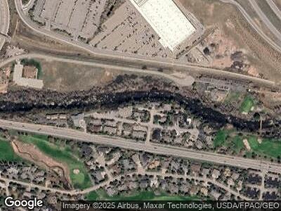
Map
Nearby Homes
- 790 Stone Creek Dr Unit 1
- 790 Stone Creek Dr Unit 4
- 258 Deer Blvd Unit B
- 100 Goldfinch Ln Unit 2A
- 405 Greenwaye Cir Unit 11-A
- 200 Goldfinch Ln Unit 1B
- 200 Goldfinch Ln Unit 1C
- 155 Goldfinch Ln Unit 3D
- 155 Goldfinch Ln Unit 3B
- 205 Kestrel Dr Unit 6A
- 39377 Hwy 6 Unit E-204
- 39377 Hwy 6 Unit F-105
- 358 Stone Creek Dr Unit 1
- 1690 Deer Blvd
- 282 Elk Ln Unit 2
- 1469 Deer Blvd
- 54 Columbine Cir Unit C20
- 54 Columbine Cir Unit 15
- 038596 Hwy 6 Unit E302
- 38596 Hwy 6 Unit A-201
- 56 Riverside Rd Unit W
- 56 Riverside Rd Unit E
- 61 E Riverside Rd Unit E
- 95 Riverside Ct
- 133 Riverside Ct Unit 3
- 133 Riverside Ct Unit 6
- 133 Riverside Dr Unit 3
- 57 Riverside Rd Unit E
- 57 Riverside Rd Unit W
- 133 Riverside Ct Unit 6
- 112 Riverside Dr Unit C
- 112 Riverside Dr
- 57 Riverside
- 59 Riversedge Ct
- 112 Riverside Ct Unit B
- 112 Riverside Ct
- 112 Riverside Ct Unit C
- 112 Riverside Ct Unit A
- 112 Riverside Ct Unit D
- 90 Riverside Ct Unit A