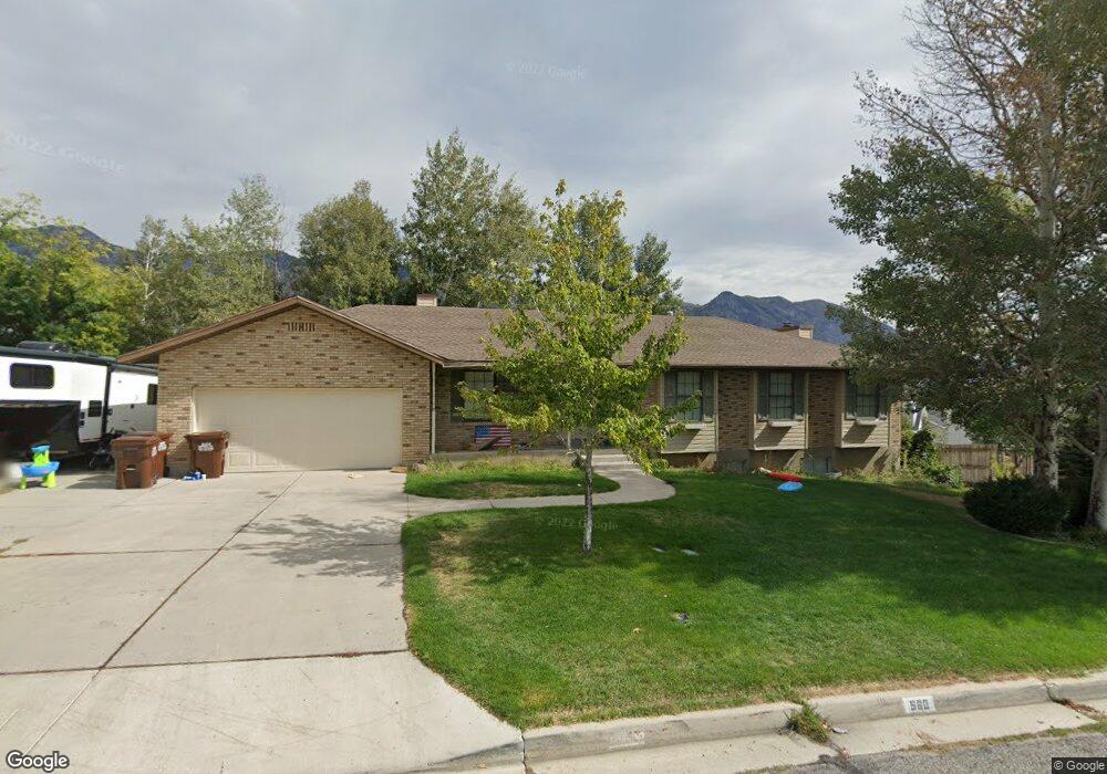
560 N 400 W Alpine, UT 84004
Estimated Value: $666,000 - $881,000
5
Beds
3
Baths
2,869
Sq Ft
$252/Sq Ft
Est. Value
About This Home
This home is located at 560 N 400 W, Alpine, UT 84004 and is currently estimated at $724,035, approximately $252 per square foot. 560 N 400 W is a home located in Utah County with nearby schools including Westfield School, Timberline Middle School, and Lone Peak High School.
Ownership History
Date
Name
Owned For
Owner Type
Purchase Details
Closed on
Sep 3, 2015
Sold by
Porter Michael W
Bought by
Richards Taylor Mckay
Current Estimated Value
Home Financials for this Owner
Home Financials are based on the most recent Mortgage that was taken out on this home.
Original Mortgage
$290,147
Outstanding Balance
$230,502
Interest Rate
4.25%
Mortgage Type
FHA
Estimated Equity
$493,533
Purchase Details
Closed on
Jan 9, 2012
Sold by
Inv Hsw560 Llc
Bought by
Porter Michael W
Purchase Details
Closed on
Aug 3, 2004
Sold by
Orvin Russell L and Orvin Cynthia L
Bought by
Porter Michael W and Porter Christine C
Home Financials for this Owner
Home Financials are based on the most recent Mortgage that was taken out on this home.
Original Mortgage
$175,500
Interest Rate
6.24%
Mortgage Type
Purchase Money Mortgage
Create a Home Valuation Report for This Property
The Home Valuation Report is an in-depth analysis detailing your home's value as well as a comparison with similar homes in the area
Home Values in the Area
Average Home Value in this Area
Purchase History
| Date | Buyer | Sale Price | Title Company |
|---|---|---|---|
| Richards Taylor Mckay | -- | Eagle Pointe Title Ins | |
| Porter Michael W | -- | Capitol Title | |
| Porter Michael W | -- | Affiliated First Title Comp |
Source: Public Records
Mortgage History
| Date | Status | Borrower | Loan Amount |
|---|---|---|---|
| Open | Richards Taylor Mckay | $290,147 | |
| Previous Owner | Porter Michael W | $175,500 | |
| Closed | Porter Michael W | $35,100 |
Source: Public Records
Tax History
| Year | Tax Paid | Tax Assessment Tax Assessment Total Assessment is a certain percentage of the fair market value that is determined by local assessors to be the total taxable value of land and additions on the property. | Land | Improvement |
|---|---|---|---|---|
| 2025 | $2,700 | $319,220 | -- | -- |
| 2024 | $2,700 | $314,655 | $0 | $0 |
| 2023 | $2,541 | $317,900 | $0 | $0 |
| 2022 | $2,580 | $313,555 | $0 | $0 |
| 2021 | $2,240 | $422,900 | $185,000 | $237,900 |
| 2020 | $2,098 | $387,500 | $160,900 | $226,600 |
| 2019 | $1,856 | $357,900 | $160,900 | $197,000 |
| 2018 | $1,764 | $336,100 | $148,000 | $188,100 |
| 2017 | $1,585 | $160,765 | $0 | $0 |
| 2016 | $1,584 | $149,765 | $0 | $0 |
| 2015 | $1,603 | $143,385 | $0 | $0 |
| 2014 | $1,398 | $123,640 | $0 | $0 |
Source: Public Records
Map
Nearby Homes
- 501 W Devey Dr
- 353 International Way
- 820 Eagleview Dr
- 684 N Summit Way
- 151 Glacier Lily Dr
- 248 Deerfield Dr
- 522 N Pfeifferhorn Dr
- 591 N Pfeifferhorn Dr
- 475 Grove Dr
- 30 S Main St
- 48 N 100 E
- 19 E Elk Ct
- 12513 Timberline Dr
- 5886 W Timber Ridge Ln
- 259 Twin River Loop
- 128 E Deer Crest Ln Unit 304
- 250 S Main St Unit 25
- 250 S Main St Unit 9
- 250 S Main St Unit 7
- 512 Eastridge Cir
- 580 N 400 W
- 536 N 400 W
- 565 Hillside Dr
- 565 Hillside Cir
- 567 Hillside Dr
- 527 Hillside Cir
- 528 Hillside Dr
- 543 Hillside Dr
- 587 Hillside Dr
- 587 Hillside Dr Unit Basement
- 543 N Hillside Dr
- 557 N 400 W
- 557 N 400 W Unit 9
- 514 N 400 W
- 606 N 400 W
- 595 N 400 W
- 9103 N Hillside Dr Unit 14
- 633 Hillside Dr
- 607 Hillside Dr
- 362 N Hillside Dr
Your Personal Tour Guide
Ask me questions while you tour the home.