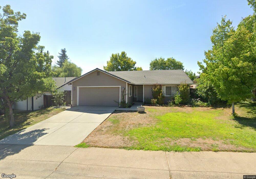
560 Viewpoint Dr Redding, CA 96003
Tanglewood NeighborhoodEstimated Value: $290,000 - $337,000
3
Beds
2
Baths
1,300
Sq Ft
$243/Sq Ft
Est. Value
About This Home
This home is located at 560 Viewpoint Dr, Redding, CA 96003 and is currently estimated at $315,362, approximately $242 per square foot. 560 Viewpoint Dr is a home located in Shasta County with nearby schools including Boulder Creek Elementary School, Enterprise High School, and Country Christian School.
Ownership History
Date
Name
Owned For
Owner Type
Purchase Details
Closed on
Dec 26, 2000
Sold by
Va
Bought by
Mccauley Terry S and Mccauley Alicia W
Current Estimated Value
Home Financials for this Owner
Home Financials are based on the most recent Mortgage that was taken out on this home.
Original Mortgage
$88,400
Interest Rate
7.71%
Purchase Details
Closed on
Aug 14, 2000
Sold by
Wells Fargo Home Mtg Inc
Bought by
Va
Purchase Details
Closed on
Jun 11, 1998
Sold by
Shearing Donald A
Bought by
Curtis Todd B and Curtis Anna M
Home Financials for this Owner
Home Financials are based on the most recent Mortgage that was taken out on this home.
Original Mortgage
$100,950
Interest Rate
7.17%
Mortgage Type
VA
Create a Home Valuation Report for This Property
The Home Valuation Report is an in-depth analysis detailing your home's value as well as a comparison with similar homes in the area
Home Values in the Area
Average Home Value in this Area
Purchase History
| Date | Buyer | Sale Price | Title Company |
|---|---|---|---|
| Mccauley Terry S | $110,500 | Chicago Title Co | |
| Va | -- | First American Title Ins Co | |
| Wells Fargo Home Mtg Inc | $90,774 | First American Title Ins Co | |
| Curtis Todd B | $99,000 | Redding Title Company |
Source: Public Records
Mortgage History
| Date | Status | Borrower | Loan Amount |
|---|---|---|---|
| Closed | Mccauley Terry S | $88,400 | |
| Previous Owner | Curtis Todd B | $100,950 |
Source: Public Records
Tax History
| Year | Tax Paid | Tax Assessment Tax Assessment Total Assessment is a certain percentage of the fair market value that is determined by local assessors to be the total taxable value of land and additions on the property. | Land | Improvement |
|---|---|---|---|---|
| 2025 | $1,827 | $166,482 | $42,178 | $124,304 |
| 2024 | $1,801 | $163,218 | $41,351 | $121,867 |
| 2023 | $1,801 | $160,019 | $40,541 | $119,478 |
| 2022 | $1,750 | $156,883 | $39,747 | $117,136 |
| 2021 | $1,691 | $153,808 | $38,968 | $114,840 |
| 2020 | $1,683 | $152,232 | $38,569 | $113,663 |
| 2019 | $1,669 | $149,248 | $37,813 | $111,435 |
| 2018 | $1,650 | $146,322 | $37,072 | $109,250 |
| 2017 | $1,708 | $143,454 | $36,346 | $107,108 |
| 2016 | $1,600 | $140,642 | $35,634 | $105,008 |
| 2015 | $1,588 | $138,530 | $35,099 | $103,431 |
| 2014 | $1,577 | $135,817 | $34,412 | $101,405 |
Source: Public Records
Map
Nearby Homes
- 651 Mission de Oro Dr
- 771 Flower Ash Ln
- 592 Mill Valley Pkwy
- 531 Fair Hill Dr
- 825 Mission Sierra Ct
- 856 Mission de Oro Dr
- 667 Reddington Dr
- 707 Alamine Dr
- 790 Volcano View Trail
- 720 Stonebriar Trail
- 639 Alamine Dr
- 775 Stonebriar Trail
- 1026 Palisades Ave
- 1088 Burton Dr
- 724 Oakhurst Trail
- 1285 Lancers Ln
- 454 Alamine Dr
- 1110 Grouse Dr
- 225 Ridgetop Dr Unit 214
- 332 Franciscan Trail
- 550 Viewpoint Dr
- 570 Viewpoint Dr
- 879 Montcrest Dr
- 885 Montcrest Dr
- 873 Montcrest Dr
- 540 Viewpoint Dr
- 935 Montcrest Dr
- 929 Montcrest Dr
- 867 Montcrest Dr
- 555 Viewpoint Dr
- 565 Viewpoint Dr
- 921 Montcrest Dr
- 545 Viewpoint Dr
- 530 Viewpoint Dr
- 945 Montcrest Dr
- 861 Montcrest Dr
- 485 Viewpoint Dr
- 960 Viewpoint Dr
- 951 Montcrest Dr
- 560 Montcrest Ct
Your Personal Tour Guide
Ask me questions while you tour the home.