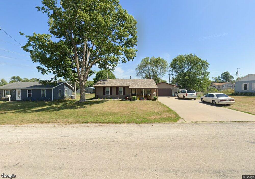
5619 J St SW Cedar Rapids, IA 52404
Lincolnway Village NeighborhoodEstimated Value: $176,000 - $191,000
3
Beds
1
Bath
894
Sq Ft
$204/Sq Ft
Est. Value
About This Home
This home is located at 5619 J St SW, Cedar Rapids, IA 52404 and is currently estimated at $182,016, approximately $203 per square foot. 5619 J St SW is a home located in Linn County with nearby schools including Prairie Heights Elementary School, Prairie View Elementary School, and Prairie Crest Elementary School.
Ownership History
Date
Name
Owned For
Owner Type
Purchase Details
Closed on
May 6, 2022
Sold by
Marie Clark Leah
Bought by
Kirk Leah Marie
Current Estimated Value
Purchase Details
Closed on
Dec 8, 2021
Sold by
Clark Janice M
Bought by
Kirk Leah M
Purchase Details
Closed on
Jul 16, 2020
Sold by
Clark Janica M and Clark Donald L
Bought by
Kirk Leah M
Create a Home Valuation Report for This Property
The Home Valuation Report is an in-depth analysis detailing your home's value as well as a comparison with similar homes in the area
Home Values in the Area
Average Home Value in this Area
Purchase History
| Date | Buyer | Sale Price | Title Company |
|---|---|---|---|
| Kirk Leah Marie | -- | -- | |
| Kirk Leah M | -- | None Listed On Document | |
| Kirk Leah M | $70,000 | None Available |
Source: Public Records
Mortgage History
| Date | Status | Borrower | Loan Amount |
|---|---|---|---|
| Previous Owner | Kirk Leah Marie | $50,700 |
Source: Public Records
Tax History Compared to Growth
Tax History
| Year | Tax Paid | Tax Assessment Tax Assessment Total Assessment is a certain percentage of the fair market value that is determined by local assessors to be the total taxable value of land and additions on the property. | Land | Improvement |
|---|---|---|---|---|
| 2025 | $2,498 | $163,100 | $29,800 | $133,300 |
| 2024 | $2,364 | $142,300 | $29,800 | $112,500 |
| 2023 | $2,364 | $142,300 | $29,800 | $112,500 |
| 2022 | $2,476 | $115,600 | $25,500 | $90,100 |
| 2021 | $2,206 | $113,900 | $25,500 | $88,400 |
| 2020 | $2,206 | $105,500 | $21,300 | $84,200 |
| 2019 | $2,028 | $98,900 | $21,300 | $77,600 |
| 2018 | $1,968 | $98,900 | $21,300 | $77,600 |
| 2017 | $1,917 | $95,300 | $21,300 | $74,000 |
| 2016 | $1,917 | $88,600 | $21,300 | $67,300 |
| 2015 | $2,071 | $96,269 | $21,250 | $75,019 |
| 2014 | $1,884 | $96,269 | $21,250 | $75,019 |
| 2013 | $1,786 | $96,269 | $21,250 | $75,019 |
Source: Public Records
Map
Nearby Homes
- 5750 J St SW
- 5610 Briarwood St SW
- 6601 Ohio St SW
- 62 Oklahoma Ave SW
- 270 Miller Ave SW
- 5655 Deerwood St SW
- 72 Miller Ave SW Unit 8
- 51 Oklahoma Ave SW
- 6620 Preston Terrace Ct SW
- 7000 Harlan Eddy Dr SW
- 0 6th St & 76th Ave SW Unit 202505956
- 6812 Artesa Bell Dr SW
- 7006 Colpepper Dr SW
- 6612 Artesa Bell Dr SW
- 7113 Chenango Ln SW
- 142 Brighton Cir SW
- 0 41st Avenue Dr SW Unit 202507355
- 0 41st Avenue Dr SW Unit 1 Ac
- 0 41st Avenue Dr SW Unit 2.25 Ac
- 1410 Scarlet Sage Dr SW
- 5609 J St SW
- 5629 J St SW
- 5620 Ohio St SW
- 5610 Ohio St SW
- 5630 Ohio St SW
- 5639 J St SW
- 195 Mayden Ave SW
- 185 Mayden Ave SW
- 237 Mayden Ave SW
- 175 Mayden Ave SW
- 5649 J St SW
- 5650 Ohio St SW
- 243 Mayden Ave SW
- 5609 Ohio St SW
- 5629 Ohio St SW
- 165 Mayden Ave SW
- 249 Mayden Ave SW
- 198 Oklahoma Ave SW
- 5639 Ohio St SW
- 188 Oklahoma Ave SW