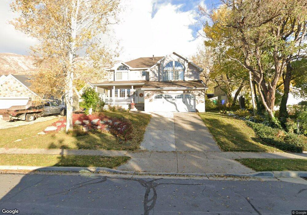
562 Pheasant Way Centerville, UT 84014
Estimated Value: $509,000 - $719,000
3
Beds
3
Baths
2,381
Sq Ft
$259/Sq Ft
Est. Value
About This Home
This home is located at 562 Pheasant Way, Centerville, UT 84014 and is currently estimated at $615,861, approximately $258 per square foot. 562 Pheasant Way is a home located in Davis County with nearby schools including Centerville Elementary, Centerville Jr High, and Viewmont High School.
Ownership History
Date
Name
Owned For
Owner Type
Purchase Details
Closed on
Jun 24, 2021
Sold by
Henderson Melody M and Henderson Jay A
Bought by
Henderson Melody
Current Estimated Value
Home Financials for this Owner
Home Financials are based on the most recent Mortgage that was taken out on this home.
Original Mortgage
$840,000
Outstanding Balance
$365,916
Interest Rate
3.8%
Mortgage Type
Reverse Mortgage Home Equity Conversion Mortgage
Estimated Equity
$249,945
Create a Home Valuation Report for This Property
The Home Valuation Report is an in-depth analysis detailing your home's value as well as a comparison with similar homes in the area
Purchase History
| Date | Buyer | Sale Price | Title Company |
|---|---|---|---|
| Henderson Melody | -- | None Listed On Document | |
| Henderson Melody | -- | None Listed On Document |
Source: Public Records
Mortgage History
| Date | Status | Borrower | Loan Amount |
|---|---|---|---|
| Open | Henderson Melody | $840,000 | |
| Closed | Henderson Melody | $840,000 | |
| Closed | Henderson Melody | $840,000 |
Source: Public Records
Tax History
| Year | Tax Paid | Tax Assessment Tax Assessment Total Assessment is a certain percentage of the fair market value that is determined by local assessors to be the total taxable value of land and additions on the property. | Land | Improvement |
|---|---|---|---|---|
| 2025 | $3,289 | $314,600 | $184,194 | $130,406 |
| 2024 | $3,115 | $303,049 | $170,916 | $132,133 |
| 2023 | $1,812 | $289,850 | $150,317 | $139,532 |
| 2022 | $3,165 | $557,000 | $253,511 | $303,489 |
| 2021 | $2,845 | $429,000 | $220,926 | $208,074 |
| 2020 | $2,786 | $420,000 | $211,659 | $208,341 |
| 2019 | $2,832 | $417,000 | $198,414 | $218,586 |
| 2018 | $2,571 | $374,000 | $181,704 | $192,296 |
| 2016 | $2,276 | $183,975 | $69,072 | $114,903 |
| 2015 | $2,228 | $169,950 | $69,072 | $100,878 |
| 2014 | $2,494 | $194,618 | $69,072 | $125,546 |
| 2013 | -- | $146,968 | $55,954 | $91,014 |
Source: Public Records
Map
Nearby Homes
- 295 E 500 N
- 380 E 400 N
- 563 N 220 E
- 252 N 400 E
- 984 N 500 E
- 360 E Center St
- 56 W 200 N
- 16 S 200 E
- 66 Brookside Ln
- 775 Pheasantbrook Cir
- 328 E 1100 S
- 132 W 200 N
- 282 W 605 N Unit A
- 282 W 605 N Unit I
- 281 W 650 N Unit B
- 292 W 680 N
- 303 W 650 N Unit I
- 88 W 50 S Unit C-3
- 88 W 50 S Unit B5
- 781 Pheasantbrook Dr
- 562 Pheasant Way Unit 2
- 575 Pheasant Way
- 558 Pheasant Way
- 582 Pheasant Way
- 563 Pheasant Way
- 529 N 400 E
- 528 Pheasant Way
- 585 N 400 E
- 602 Pheasant Way
- 569 N 400 E
- 557 Pheasant Way
- 517 N 400 E
- 364 London Rd
- 583 Pheasant Way
- 613 N 400 E
- 321 E 500 N
- 502 Pheasant Way
- 489 N 400 E
- 306 London Rd
- 562 N 400 E
Your Personal Tour Guide
Ask me questions while you tour the home.