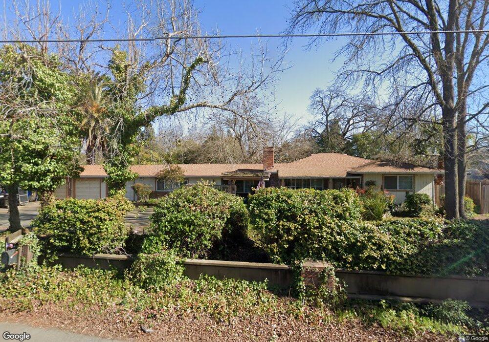
5620 Kenneth Ave Fair Oaks, CA 95628
Estimated Value: $594,000 - $761,000
4
Beds
2
Baths
2,298
Sq Ft
$299/Sq Ft
Est. Value
About This Home
This home is located at 5620 Kenneth Ave, Fair Oaks, CA 95628 and is currently estimated at $687,350, approximately $299 per square foot. 5620 Kenneth Ave is a home located in Sacramento County with nearby schools including Northridge Elementary School, Andrew Carnegie Middle School, and Bella Vista High School.
Ownership History
Date
Name
Owned For
Owner Type
Purchase Details
Closed on
Apr 16, 2003
Sold by
Hunt Larry and Hunt Barbara
Bought by
Mcdonald David R and Mcdonald Kelley Crosby
Current Estimated Value
Home Financials for this Owner
Home Financials are based on the most recent Mortgage that was taken out on this home.
Original Mortgage
$280,000
Outstanding Balance
$104,779
Interest Rate
4%
Mortgage Type
Purchase Money Mortgage
Estimated Equity
$582,571
Create a Home Valuation Report for This Property
The Home Valuation Report is an in-depth analysis detailing your home's value as well as a comparison with similar homes in the area
Home Values in the Area
Average Home Value in this Area
Purchase History
| Date | Buyer | Sale Price | Title Company |
|---|---|---|---|
| Mcdonald David R | $350,000 | Old Republic Title Company |
Source: Public Records
Mortgage History
| Date | Status | Borrower | Loan Amount |
|---|---|---|---|
| Open | Mcdonald David R | $280,000 |
Source: Public Records
Tax History Compared to Growth
Tax History
| Year | Tax Paid | Tax Assessment Tax Assessment Total Assessment is a certain percentage of the fair market value that is determined by local assessors to be the total taxable value of land and additions on the property. | Land | Improvement |
|---|---|---|---|---|
| 2025 | $6,141 | $506,895 | $144,820 | $362,075 |
| 2024 | $6,141 | $496,957 | $141,981 | $354,976 |
| 2023 | $5,963 | $487,214 | $139,198 | $348,016 |
| 2022 | $5,941 | $477,662 | $136,469 | $341,193 |
| 2021 | $5,827 | $468,297 | $133,794 | $334,503 |
| 2020 | $5,744 | $463,497 | $132,423 | $331,074 |
| 2019 | $5,599 | $454,410 | $129,827 | $324,583 |
| 2018 | $5,476 | $445,501 | $127,282 | $318,219 |
| 2017 | $5,422 | $436,767 | $124,787 | $311,980 |
| 2016 | $5,067 | $428,204 | $122,341 | $305,863 |
| 2015 | $4,711 | $398,611 | $113,887 | $284,724 |
| 2014 | $4,525 | $383,280 | $109,507 | $273,773 |
Source: Public Records
Map
Nearby Homes
- 8300 Mallee Cir
- 8496 Mallee Cir
- 8492 Mallee Cir
- 8304 Mallee Cir
- 8488 Mallee Cir
- 8497 Mallee Cir
- 8484 Mallee Cir
- 8301 Mallee Cir
- 8493 Mallee Cir
- 8489 Mallee Cir
- 8305 Mallee Cir
- 8480 Mallee Cir
- 8309 Mallee Cir
- 8476 Mallee Cir
- 8472 Mallee Cir
- 8483 Wattle Way
- 8490 Wattle Way
- 5533 Tuckeroo Way
- 8479 Wattle Way
- 8486 Wattle Way
- 5636 Kenneth Ave
- 8506 Oak Harbour Ct
- 8500 Oak Harbour Ct
- 8512 Oak Harbour Ct
- 8523 Oak Harbour Ct
- 5640 Kenneth Ave
- 8518 Oak Harbour Ct
- 8508 Pershing Ave
- 5643 Marchese Ct
- 8516 Pershing Ave
- 5550 Kenneth Ave
- 8507 Sheraton Dr
- 8524 Oak Harbour Ct
- 5637 Marchese Ct
- 8500 Pershing Ave
- 8513 Sheraton Dr
- 5631 Marchese Ct
- 8530 Oak Harbour Ct
- 8519 Sheraton Dr
- 5649 Marchese Ct