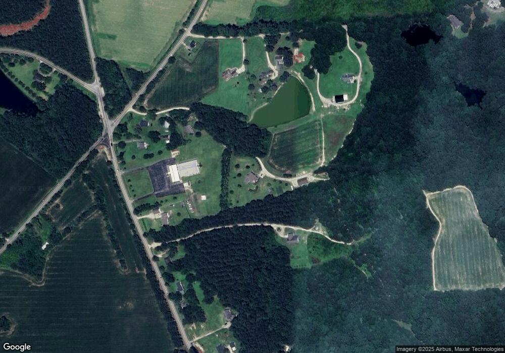
5624 Beagle Ridge Ln Knightdale, NC 27545
Shotwell NeighborhoodEstimated Value: $477,000 - $818,946
--
Bed
3
Baths
2,404
Sq Ft
$259/Sq Ft
Est. Value
About This Home
This home is located at 5624 Beagle Ridge Ln, Knightdale, NC 27545 and is currently estimated at $623,237, approximately $259 per square foot. 5624 Beagle Ridge Ln is a home located in Wake County with nearby schools including Lake Myra Elementary, Wendell Middle School, and East Wake High School.
Ownership History
Date
Name
Owned For
Owner Type
Purchase Details
Closed on
Mar 21, 2007
Sold by
Poor Boy Farms Inc
Bought by
Dutton Robert Andrew and Dutton Angela W
Current Estimated Value
Home Financials for this Owner
Home Financials are based on the most recent Mortgage that was taken out on this home.
Original Mortgage
$39,938
Interest Rate
6.22%
Mortgage Type
Seller Take Back
Purchase Details
Closed on
Sep 18, 2000
Sold by
Poor Boy Farms Inc
Bought by
Dutton Robert Andrew and Dutton Angela W
Home Financials for this Owner
Home Financials are based on the most recent Mortgage that was taken out on this home.
Original Mortgage
$61,000
Interest Rate
8.17%
Mortgage Type
Seller Take Back
Create a Home Valuation Report for This Property
The Home Valuation Report is an in-depth analysis detailing your home's value as well as a comparison with similar homes in the area
Home Values in the Area
Average Home Value in this Area
Purchase History
| Date | Buyer | Sale Price | Title Company |
|---|---|---|---|
| Dutton Robert Andrew | $42,000 | None Available | |
| Dutton Robert Andrew | $62,500 | -- |
Source: Public Records
Mortgage History
| Date | Status | Borrower | Loan Amount |
|---|---|---|---|
| Closed | Dutton Robert Andrew | $39,938 | |
| Previous Owner | Dutton Robert Andrew | $61,000 |
Source: Public Records
Tax History Compared to Growth
Tax History
| Year | Tax Paid | Tax Assessment Tax Assessment Total Assessment is a certain percentage of the fair market value that is determined by local assessors to be the total taxable value of land and additions on the property. | Land | Improvement |
|---|---|---|---|---|
| 2025 | $4,499 | $700,355 | $234,000 | $466,355 |
| 2024 | $3,418 | $547,211 | $234,000 | $313,211 |
| 2023 | $2,996 | $381,715 | $156,000 | $225,715 |
| 2022 | $2,777 | $381,715 | $156,000 | $225,715 |
| 2021 | $2,702 | $381,715 | $156,000 | $225,715 |
| 2020 | $2,658 | $381,715 | $156,000 | $225,715 |
| 2019 | $2,421 | $293,927 | $123,000 | $170,927 |
| 2018 | $2,226 | $293,927 | $123,000 | $170,927 |
| 2017 | $2,110 | $293,927 | $123,000 | $170,927 |
| 2016 | $2,067 | $293,927 | $123,000 | $170,927 |
| 2015 | $2,338 | $333,710 | $165,000 | $168,710 |
| 2014 | $2,216 | $333,710 | $165,000 | $168,710 |
Source: Public Records
Map
Nearby Homes
- 4600 Smithfield Rd
- 6220 Turnipseed Rd
- 4620 Smithfield Rd
- 1208 Poplar Stone Dr
- 1417 Slate Ridge Rd
- 1449 White Opal Dr
- 1417 White Opal Dr
- 5312 Sapphire Springs Dr
- 5509 Weathered Rock Ct
- 6328 Bissette Rd
- 5212 Sapphire Springs Dr
- 4920 Stonewood Pines Dr
- 1417 Stone Wealth Dr
- 1157 Rutledge Landing Dr
- 920 Knotts Hill Place
- 5104 Parkerwood Dr
- 1128 Rutledge Landing Dr
- 5200 Limewood St
- 4421 Black Lion Way
- 1240 Sweetgrass St
- 4421 S Smithfield Rd
- 5716 Catfish Ln
- 4437 S Smithfield Rd
- 4429 S Smithfield Rd
- 4405 S Smithfield Rd
- 5724 Catfish Ln
- 1545 Major Slade Rd
- 5728 Catfish Ln
- 5732 Catfish Ln
- 4457 S Smithfield Rd
- 1537 Major Slade Rd
- 4461 S Smithfield Rd
- 4345 Smithfield Rd S
- 4345 Smithfield Rd
- 4505 Smithfield Rd
- 2862 Mial Plantation Rd
- 4517 Smithfield Rd
- 4301 Mial Plantation Rd
- 5800 Turnipseed Rd
- 6620 Grasshopper Rd
