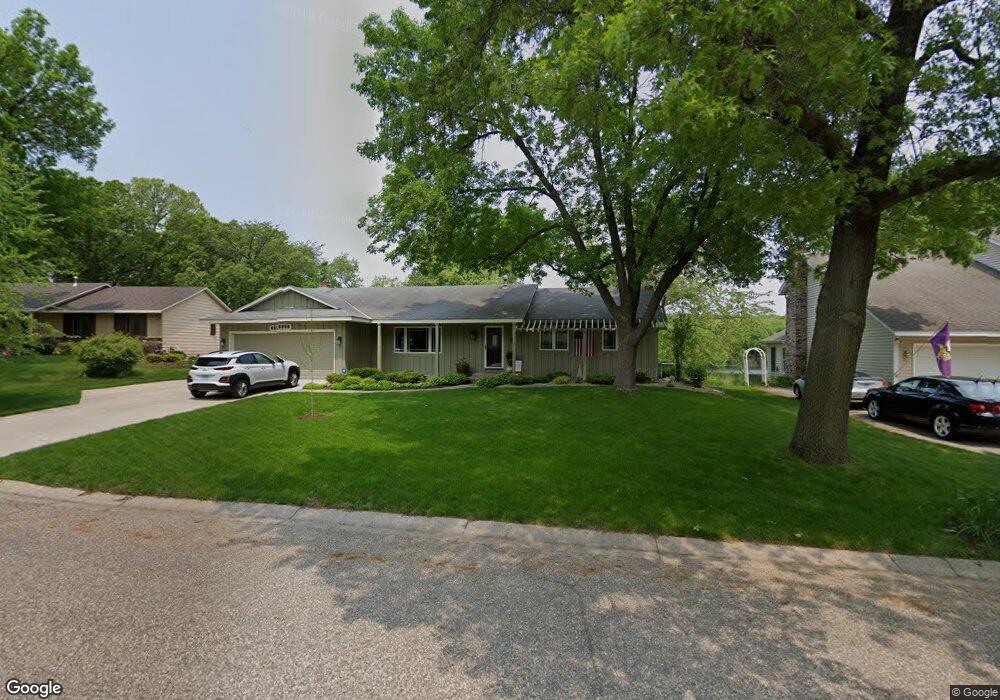
5635 133rd Street Ct Saint Paul, MN 55124
Scott Highlands NeighborhoodEstimated Value: $517,000 - $615,000
4
Beds
3
Baths
1,792
Sq Ft
$314/Sq Ft
Est. Value
About This Home
This home is located at 5635 133rd Street Ct, Saint Paul, MN 55124 and is currently estimated at $563,138, approximately $314 per square foot. 5635 133rd Street Ct is a home located in Dakota County with nearby schools including Highland Elementary School, Falcon Ridge Middle School, and Eastview Senior High School.
Ownership History
Date
Name
Owned For
Owner Type
Purchase Details
Closed on
Jun 12, 2008
Sold by
Vanlangen Kim C and Van Langen Robin
Bought by
Wertis Robert J and Wertis Patricia
Current Estimated Value
Home Financials for this Owner
Home Financials are based on the most recent Mortgage that was taken out on this home.
Original Mortgage
$230,000
Outstanding Balance
$147,515
Interest Rate
6.04%
Mortgage Type
New Conventional
Estimated Equity
$415,623
Create a Home Valuation Report for This Property
The Home Valuation Report is an in-depth analysis detailing your home's value as well as a comparison with similar homes in the area
Home Values in the Area
Average Home Value in this Area
Purchase History
| Date | Buyer | Sale Price | Title Company |
|---|---|---|---|
| Wertis Robert J | $335,500 | -- |
Source: Public Records
Mortgage History
| Date | Status | Borrower | Loan Amount |
|---|---|---|---|
| Open | Wertis Robert J | $230,000 |
Source: Public Records
Tax History Compared to Growth
Tax History
| Year | Tax Paid | Tax Assessment Tax Assessment Total Assessment is a certain percentage of the fair market value that is determined by local assessors to be the total taxable value of land and additions on the property. | Land | Improvement |
|---|---|---|---|---|
| 2024 | $2,418 | $497,700 | $109,500 | $388,200 |
| 2023 | $2,418 | $513,000 | $109,700 | $403,300 |
| 2022 | $1,558 | $513,000 | $109,300 | $403,700 |
| 2021 | $1,270 | $433,800 | $95,100 | $338,700 |
| 2020 | $1,242 | $406,700 | $90,500 | $316,200 |
| 2019 | $833 | $401,100 | $86,200 | $314,900 |
| 2018 | $535 | $370,800 | $82,100 | $288,700 |
| 2017 | $217 | $343,400 | $78,200 | $265,200 |
| 2016 | $155 | $316,700 | $74,500 | $242,200 |
| 2015 | $1,923 | $11,800 | $2,800 | $9,000 |
| 2014 | -- | $147,100 | $34,900 | $112,200 |
| 2013 | -- | $0 | $0 | $0 |
Source: Public Records
Map
Nearby Homes
- 13641 Everton Ave
- 6118 132nd St W
- 13150 Elderberry Ct
- 12740 Eveleth Path
- 13169X Diamond Path
- 13000 Echo Ln
- 12640 Eveleth Path
- 13213 Ferris Ave
- 13937 Ember Ct
- 12785 Edinbrook Path
- 12816 Falcon Dr
- 13930 Ember Ct
- 13877 Elkhart Rd
- 12932 Echo Ln
- 12888 Falcon Dr
- 13912 Farmington Way
- 5040 127th St W
- 13973 Falcon Ave
- 14049 Essex Ct
- 13760 Duluth Dr
- 5617 133rd Street Ct
- 5653 133rd Street Ct
- 5597 133rd Street Ct
- 5673 133rd Street Ct
- 5642 133rd Street Ct
- 5666 133rd Street Ct
- 5583 133rd Street Ct
- 5688 133rd Street Ct
- 5689 133rd Street Ct
- 5563 133rd Street Ct
- 5546 133rd Street Ct
- 5545 133rd Street Ct
- 13301 Everest Ave
- 13362 Everest Ave
- 13241 Everest Ave
- 13281 Everest Ave
- 13321 Everest Ave
- 13261 Everest Ave
- 5536 133rd Street Ct
- 13066 Euclid Ave