5639 County Road 9100 West Plains, MO 65775
Estimated Value: $205,928 - $338,000
--
Bed
--
Bath
--
Sq Ft
60
Acres
About This Home
This home is located at 5639 County Road 9100, West Plains, MO 65775 and is currently estimated at $288,732. 5639 County Road 9100 is a home with nearby schools including Glenwood Elementary School.
Ownership History
Date
Name
Owned For
Owner Type
Purchase Details
Closed on
Apr 7, 2021
Sold by
Launius Grant W
Bought by
Launius Christina M and Acosta Donna Jean
Current Estimated Value
Purchase Details
Closed on
Jan 20, 2021
Sold by
Launius Grant W
Bought by
Launius Grant W and Launius Christina M
Purchase Details
Closed on
Mar 10, 2012
Sold by
Moore Dorothy L
Bought by
Launius Grant W and Launius Pamela K
Home Financials for this Owner
Home Financials are based on the most recent Mortgage that was taken out on this home.
Original Mortgage
$10,000
Outstanding Balance
$6,882
Interest Rate
3.91%
Mortgage Type
Seller Take Back
Estimated Equity
$281,850
Purchase Details
Closed on
Apr 2, 2009
Sold by
Launius Kineth and Launius Irma
Bought by
Launius Grant
Create a Home Valuation Report for This Property
The Home Valuation Report is an in-depth analysis detailing your home's value as well as a comparison with similar homes in the area
Home Values in the Area
Average Home Value in this Area
Purchase History
| Date | Buyer | Sale Price | Title Company |
|---|---|---|---|
| Launius Christina M | -- | None Available | |
| Launius Grant W | -- | None Available | |
| Launius Grant W | -- | Btc | |
| Launius Grant | -- | None Available |
Source: Public Records
Mortgage History
| Date | Status | Borrower | Loan Amount |
|---|---|---|---|
| Open | Launius Grant W | $10,000 |
Source: Public Records
Tax History Compared to Growth
Tax History
| Year | Tax Paid | Tax Assessment Tax Assessment Total Assessment is a certain percentage of the fair market value that is determined by local assessors to be the total taxable value of land and additions on the property. | Land | Improvement |
|---|---|---|---|---|
| 2025 | $149 | $4,020 | $3,290 | $730 |
| 2024 | $136 | $3,680 | -- | -- |
| 2023 | $136 | $3,680 | $0 | $0 |
| 2022 | $136 | $3,680 | $0 | $0 |
| 2021 | $140 | $3,680 | $0 | $0 |
| 2020 | $140 | $3,680 | $0 | $0 |
| 2019 | $146 | $3,680 | $0 | $0 |
| 2018 | $126 | $3,170 | $0 | $0 |
| 2017 | $124 | $3,170 | $0 | $0 |
| 2015 | -- | $3,170 | $0 | $0 |
| 2014 | -- | $3,120 | $0 | $0 |
| 2013 | -- | $3,120 | $0 | $0 |
Source: Public Records
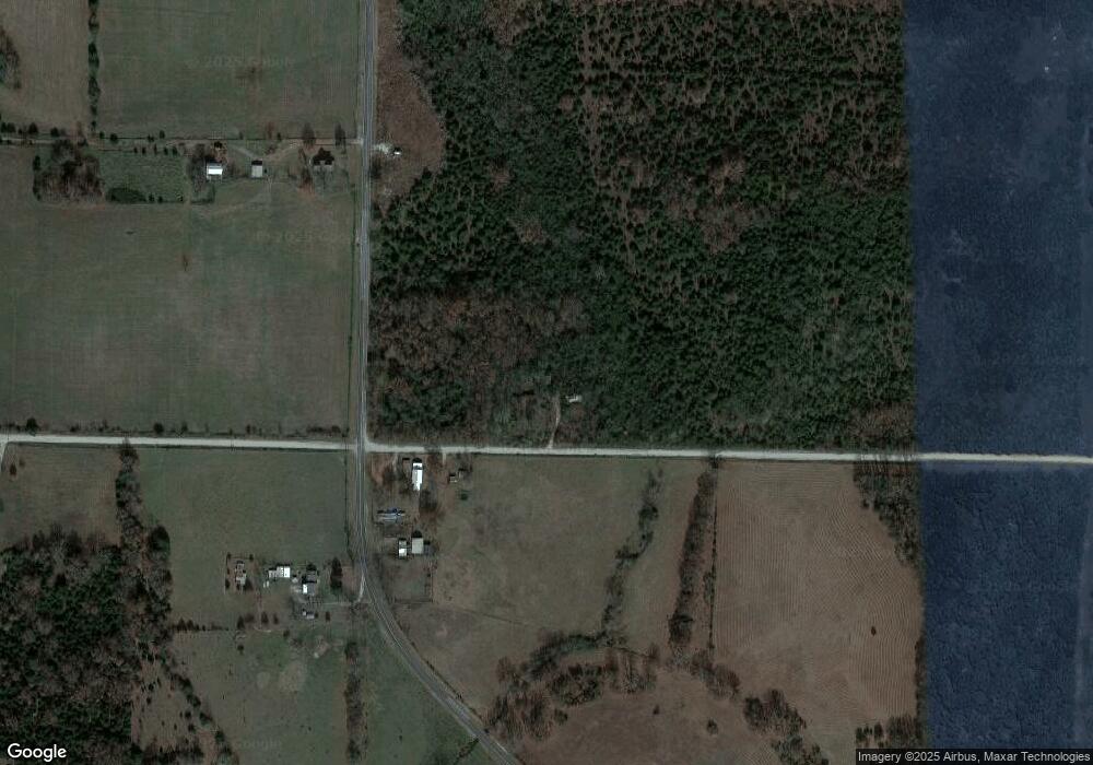
Map
Nearby Homes
- 5506 County Road 9100
- 000 State Route 17 S
- 10567 County Road 8130
- 5038 County Road 8940
- 10733 County Road 8070
- 000 Arrowhead Acres
- 0 Lanton Rd
- 4808 County Road 8940
- 000 County Road 8800
- 5019 Private Road 8948
- 4117 Private Road 7201
- 000 Private Road 8825
- Lot 2 State Highway Jj
- 4154 Private Road 7201
- 4180 Private Road 7201
- 5160 County Road 9380
- 0 State Route Jj
- 6226 County Road 9300
- 5122 County Road 9380
- 12301 Missouri 17
- 000 County Road 9100
- 11006 State Route 17
- 11004 State Route 17
- St Rt 17 County Road 9100
- 5763 County Road 9100
- 5602 County Road 9100
- 10950 State Route 17
- 5768 County Road 9100
- 11119 State Route 17
- 5843 County Road 9100
- 5675 Private Road 9134
- 5530 County Road 9100
- 11215 County Road 8470
- 5636 Private Road 9134
- 5680 Private Road 9134
- 5621 Private Road 9136
- 11534 Private Road 9135
- 10904 State Route 17
- 5601 Private Road 9136
- 11208 State Route 17