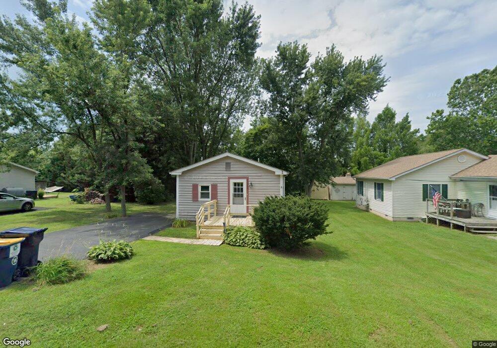
564 Chestnut St Townsend, DE 19734
Estimated Value: $175,000 - $235,917
1
Bed
1
Bath
475
Sq Ft
$446/Sq Ft
Est. Value
About This Home
This home is located at 564 Chestnut St, Townsend, DE 19734 and is currently estimated at $211,979, approximately $446 per square foot. 564 Chestnut St is a home located in New Castle County with nearby schools including Townsend Elementary School, Everett Meredith Middle School, and Odessa High School.
Ownership History
Date
Name
Owned For
Owner Type
Purchase Details
Closed on
Jan 8, 2021
Sold by
Campbell King Charles
Bought by
Prop 111 113 Llc
Current Estimated Value
Purchase Details
Closed on
Jun 30, 2009
Sold by
Campbell King Charles and King Wayne E
Bought by
Campbell King Charles
Purchase Details
Closed on
Jun 14, 2007
Sold by
Grimminger Alfred O and Grimminger Janet L
Bought by
Campbell King Charles and King Wayne E
Home Financials for this Owner
Home Financials are based on the most recent Mortgage that was taken out on this home.
Original Mortgage
$74,000
Interest Rate
6.48%
Mortgage Type
Unknown
Create a Home Valuation Report for This Property
The Home Valuation Report is an in-depth analysis detailing your home's value as well as a comparison with similar homes in the area
Home Values in the Area
Average Home Value in this Area
Purchase History
| Date | Buyer | Sale Price | Title Company |
|---|---|---|---|
| Prop 111 113 Llc | -- | None Available | |
| Campbell King Charles | -- | None Available | |
| Campbell King Charles | $92,500 | None Available |
Source: Public Records
Mortgage History
| Date | Status | Borrower | Loan Amount |
|---|---|---|---|
| Previous Owner | Campbell King Charles | $74,000 |
Source: Public Records
Tax History Compared to Growth
Tax History
| Year | Tax Paid | Tax Assessment Tax Assessment Total Assessment is a certain percentage of the fair market value that is determined by local assessors to be the total taxable value of land and additions on the property. | Land | Improvement |
|---|---|---|---|---|
| 2024 | $822 | $21,900 | $2,700 | $19,200 |
| 2023 | $690 | $21,900 | $2,700 | $19,200 |
| 2022 | $689 | $21,900 | $2,700 | $19,200 |
| 2021 | $680 | $21,900 | $2,700 | $19,200 |
| 2020 | $672 | $21,900 | $2,700 | $19,200 |
| 2019 | $735 | $21,900 | $2,700 | $19,200 |
| 2018 | $115 | $21,900 | $2,700 | $19,200 |
| 2017 | $534 | $21,900 | $2,700 | $19,200 |
| 2016 | $534 | $21,900 | $2,700 | $19,200 |
| 2015 | -- | $21,900 | $2,700 | $19,200 |
| 2014 | -- | $21,900 | $2,700 | $19,200 |
Source: Public Records
Map
Nearby Homes
- 308 Gray St
- 735 Tracy Cir
- 306 Lattomus St
- 325 Helen Dr
- 200 Karins Blvd
- 4 Brook Ramble Ln
- 100 Karins Blvd
- 422 Bellflower Way Unit CHALFONT PLAN
- 420 Bellflower Way Unit MERION PLAN
- 418 Bellflower Way Unit MONTCHANIN PLAN
- 416 Bellflower Way Unit PENNSBURY PLAN
- 414 Bellflower Way Unit FALLSTON PLAN
- 338 Coralroot Dr
- 340 Coralroot Dr
- 341 Coralroot Dr
- 5756 Summit Bridge Rd
- 199 Pine Tree Rd
- 197 Pine Tree Rd
- 174 Pine Tree Rd
- 202 Pine Tree Rd
- 562 Chestnut St
- 568 Chestnut St
- 560 Chestnut St
- 564 Railroad Ave
- 566 Railroad Ave
- 562 Railroad Ave
- 567 Wilson St
- 658 Wiggins Mill Rd
- 568 Railroad Ave
- 570 Railroad Ave
- 572 Chestnut St
- 572 Railroad Ave
- 671 Wiggins Mill Rd
- 574 Chestnut St
- 574 Railroad Ave
- 576 Railroad Ave
- 576 Chestnut St
- 578 Railroad Ave
- 558 Walnut St
- 560 Walnut St