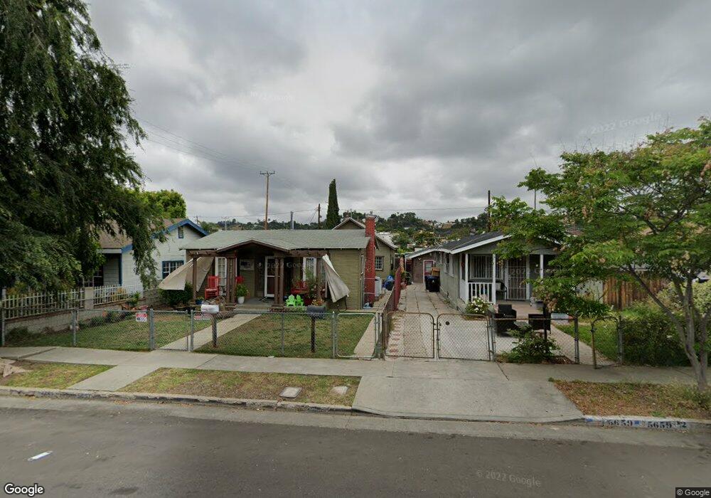
5655 Baltimore St Los Angeles, CA 90042
Estimated Value: $1,024,000 - $1,090,000
4
Beds
1
Bath
1,564
Sq Ft
$674/Sq Ft
Est. Value
About This Home
This home is located at 5655 Baltimore St, Los Angeles, CA 90042 and is currently estimated at $1,054,587, approximately $674 per square foot. 5655 Baltimore St is a home located in Los Angeles County with nearby schools including Yorkdale Elementary, Benjamin Franklin High School, and Luther Burbank Middle School.
Ownership History
Date
Name
Owned For
Owner Type
Purchase Details
Closed on
Jun 22, 2017
Sold by
Rangel Richard and Rangel Gloria P
Bought by
Rangel Richard and Rangel Gloria P
Current Estimated Value
Purchase Details
Closed on
Nov 18, 2016
Sold by
Rangel Michael and Jessie Rangel Trust
Bought by
Rangel Richard
Purchase Details
Closed on
Nov 4, 2016
Sold by
Rangel Michael and Jessie Rangel Trust
Bought by
Rangel Michael
Purchase Details
Closed on
Apr 2, 2007
Sold by
Rangel Jessie
Bought by
Rangel Jessie and The Jessie Rangel Family Trust
Create a Home Valuation Report for This Property
The Home Valuation Report is an in-depth analysis detailing your home's value as well as a comparison with similar homes in the area
Home Values in the Area
Average Home Value in this Area
Purchase History
| Date | Buyer | Sale Price | Title Company |
|---|---|---|---|
| Rangel Richard | -- | None Available | |
| Rangel Richard | -- | None Available | |
| Rangel Richard | -- | None Available | |
| Rangel Michael | -- | None Available | |
| Rangel Jessie | -- | None Available |
Source: Public Records
Tax History Compared to Growth
Tax History
| Year | Tax Paid | Tax Assessment Tax Assessment Total Assessment is a certain percentage of the fair market value that is determined by local assessors to be the total taxable value of land and additions on the property. | Land | Improvement |
|---|---|---|---|---|
| 2025 | $798 | $43,813 | $20,804 | $23,009 |
| 2024 | $798 | $42,955 | $20,397 | $22,558 |
| 2023 | $788 | $42,114 | $19,998 | $22,116 |
| 2022 | $758 | $41,289 | $19,606 | $21,683 |
| 2021 | $740 | $40,480 | $19,222 | $21,258 |
| 2020 | $742 | $40,066 | $19,025 | $21,041 |
| 2019 | $723 | $39,281 | $18,652 | $20,629 |
| 2018 | $640 | $38,512 | $18,287 | $20,225 |
| 2016 | $594 | $37,019 | $17,578 | $19,441 |
| 2015 | $587 | $36,463 | $17,314 | $19,149 |
| 2014 | $604 | $35,749 | $16,975 | $18,774 |
Source: Public Records
Map
Nearby Homes
- 5670 Hub St
- 1480 N Avenue 57
- 1476 N Avenue 57
- 422 N Avenue 61
- 329 N Avenue 57
- 5623 Meridian St
- Residence 2 Plan at Arroyo Ridge
- 300 S Avenue 58
- 5133 ,1/4,1/2 Baltimore St
- Residence 1 Plan at Arroyo Ridge
- 1217 N Avenue 56
- 1215 N Avenue 56
- 5807 Meridian St
- 5427 Meridian St
- 5413 Meridian St
- 5318 Irvington Place
- 5412 Abbott Place
- 829 N Avenue 53
- 211 N Avenue 57
- 300 La Follette Dr
- 5659 Baltimore St
- 5651 Baltimore St
- 5663 Baltimore St
- 5667 Baltimore St
- 5656 Buchanan St
- 5654 Buchanan St
- 705 Nolden St
- 5637 Baltimore St
- 709 Nolden St
- 5673 Baltimore St
- 5654 Buchanan St
- 5660 Buchanan St
- 716 Nolden St
- 5664 Buchanan St
- 5633 Baltimore St
- 715 Nolden St
- 5677 Baltimore St
- 5668 Buchanan St
- 5652 Baltimore St
- 5660 Baltimore St