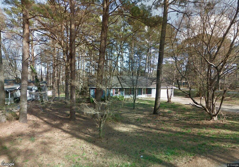
566 Forest Hill Dr Stockbridge, GA 30281
Estimated Value: $216,000 - $238,000
3
Beds
2
Baths
1,448
Sq Ft
$157/Sq Ft
Est. Value
About This Home
This home is located at 566 Forest Hill Dr, Stockbridge, GA 30281 and is currently estimated at $226,818, approximately $156 per square foot. 566 Forest Hill Dr is a home located in Henry County with nearby schools including Woodland Elementary School, Woodland Middle School, and Woodland High School.
Ownership History
Date
Name
Owned For
Owner Type
Purchase Details
Closed on
Jan 28, 2022
Sold by
Boulton Properties Llc
Bought by
New Residential Borrower 2022 Sfr1
Current Estimated Value
Purchase Details
Closed on
Mar 5, 2021
Sold by
Djs Property Management Llc
Bought by
Boulton Properties Llc
Purchase Details
Closed on
Dec 28, 2015
Sold by
Anderson Charlene
Bought by
Djs Property Management Llc
Purchase Details
Closed on
Feb 14, 2015
Sold by
Langston Lamar R
Bought by
Anderson Charlene and Allen Susan Ann
Create a Home Valuation Report for This Property
The Home Valuation Report is an in-depth analysis detailing your home's value as well as a comparison with similar homes in the area
Home Values in the Area
Average Home Value in this Area
Purchase History
| Date | Buyer | Sale Price | Title Company |
|---|---|---|---|
| New Residential Borrower 2022 Sfr1 | -- | -- | |
| Boulton Properties Llc | $167,500 | -- | |
| Djs Property Management Llc | $34,000 | -- | |
| Anderson Charlene | -- | -- |
Source: Public Records
Tax History Compared to Growth
Tax History
| Year | Tax Paid | Tax Assessment Tax Assessment Total Assessment is a certain percentage of the fair market value that is determined by local assessors to be the total taxable value of land and additions on the property. | Land | Improvement |
|---|---|---|---|---|
| 2025 | $3,709 | $92,808 | $12,000 | $80,808 |
| 2024 | $3,709 | $90,440 | $12,000 | $78,440 |
| 2023 | $3,314 | $85,360 | $10,000 | $75,360 |
| 2022 | $2,610 | $67,000 | $7,236 | $59,764 |
| 2021 | $2,286 | $58,560 | $8,000 | $50,560 |
| 2020 | $2,071 | $52,960 | $8,000 | $44,960 |
| 2019 | $1,850 | $47,200 | $8,000 | $39,200 |
| 2018 | $1,676 | $42,640 | $8,000 | $34,640 |
| 2016 | $562 | $13,600 | $2,829 | $10,771 |
| 2015 | $264 | $29,120 | $5,280 | $23,840 |
| 2014 | $188 | $24,080 | $5,280 | $18,800 |
Source: Public Records
Map
Nearby Homes
- 90 Chimney Rise Ct
- 0 Oakview Dr Unit 10472931
- 0 Oakview Dr Unit 7533331
- 0 Chimney Smoke Dr Unit 10640945
- 0 Chimney Smoke Dr Unit 182111
- 0 Flakes Rd Unit 24
- 0 Freeman #128 Dr
- 0 Freeman Dr Unit 128 10480940
- 128 Belair Ln Unit 1
- 30 Hickory Dr
- 297 Edison Dr
- 277 Edison Dr
- 193 Edison Dr
- 109 Greenwood Dr
- 342 Lakeshore Dr
- 115 Lakeview Dr
- 110 Wildwood Dr
- 1527 Old Conyers Rd Unit 4
- 176 Swan Lake Dr
- 107 Woodridge Dr
- 560 Forest Hill Dr
- 563 Forest Hill Dr
- 25 Windsong Ct
- 1515 Flat Rock Rd
- 35 Windsong Ct
- 1483 Flat Rock Rd
- 548 Forest Hill Dr Unit 9
- 548 Forest Hill Dr
- 541 Ivy Ln
- 1517 Flat Rock Rd
- 1538 Flat Rock Rd
- 1473 Flat Rock Rd
- 1145 Ivy Ln
- 537 Ivy Ln
- 546 Forest Hill Dr
- 546 Forest Hill Dr Unit 30281
- 1527 Flat Rock Rd
- 45 Windsong Ct
- 0 Flat Rock Rd
- 0 Flat Rock Rd Unit 3143083