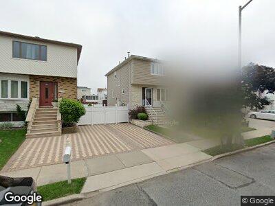
566 Naughton Ave Staten Island, NY 10305
Ocean Breeze NeighborhoodEstimated Value: $715,752 - $767,000
3
Beds
3
Baths
1,386
Sq Ft
$533/Sq Ft
Est. Value
About This Home
This home is located at 566 Naughton Ave, Staten Island, NY 10305 and is currently estimated at $738,188, approximately $532 per square foot. 566 Naughton Ave is a home located in Richmond County with nearby schools including P.S. 052 John C. Thompson, Is 2 George L Egbert, and New Dorp High School.
Ownership History
Date
Name
Owned For
Owner Type
Purchase Details
Closed on
Oct 17, 2001
Sold by
Merlino Carmine R and Merlino Gloria
Bought by
Baran Jan
Current Estimated Value
Home Financials for this Owner
Home Financials are based on the most recent Mortgage that was taken out on this home.
Original Mortgage
$209,000
Interest Rate
7.04%
Create a Home Valuation Report for This Property
The Home Valuation Report is an in-depth analysis detailing your home's value as well as a comparison with similar homes in the area
Home Values in the Area
Average Home Value in this Area
Purchase History
| Date | Buyer | Sale Price | Title Company |
|---|---|---|---|
| Baran Jan | $262,000 | First American Title Ins Co |
Source: Public Records
Mortgage History
| Date | Status | Borrower | Loan Amount |
|---|---|---|---|
| Open | Baran Jan | $4,961 | |
| Open | Baran Jan | $9,139 | |
| Previous Owner | Baran Jan | $209,000 | |
| Previous Owner | Merlino Carmine R | $60,000 |
Source: Public Records
Tax History Compared to Growth
Tax History
| Year | Tax Paid | Tax Assessment Tax Assessment Total Assessment is a certain percentage of the fair market value that is determined by local assessors to be the total taxable value of land and additions on the property. | Land | Improvement |
|---|---|---|---|---|
| 2024 | $5,483 | $40,500 | $5,898 | $34,602 |
| 2023 | $5,146 | $27,019 | $5,751 | $21,268 |
| 2022 | $4,802 | $32,520 | $8,340 | $24,180 |
| 2021 | $4,758 | $34,260 | $8,340 | $25,920 |
| 2020 | $4,794 | $30,660 | $8,340 | $22,320 |
| 2019 | $3,469 | $30,240 | $8,340 | $21,900 |
| 2018 | $4,292 | $22,516 | $6,520 | $15,996 |
| 2017 | $4,031 | $21,242 | $6,931 | $14,311 |
| 2016 | $3,696 | $20,040 | $8,340 | $11,700 |
| 2015 | $3,760 | $21,180 | $6,960 | $14,220 |
| 2014 | $3,760 | $21,180 | $6,960 | $14,220 |
Source: Public Records
Map
Nearby Homes
- 263 Slater Blvd
- 244 Slater Blvd
- 197 Slater Blvd
- 118 Graham Blvd
- 70 Freeborn St
- 885 Olympia Blvd
- 799 Father Capodanno Blvd
- 797 Father Capodanno Blvd
- 795 Father Capodanno Blvd
- 726 Buel Ave
- 9 Iroquois St
- 0 Quincy Ave
- 000 Quincy Ave
- 12 Grimsby St
- 398 Nugent Ave
- 108 Slater Blvd
- 929 Father Capodanno Blvd
- 945 Olympia Blvd
- 952 Olympia Blvd
- 637 Oceanside Ave
- 566 Naughton Ave
- 564 Naughton Ave
- 572 Naughton Ave Unit SI University Hospit
- 572 Naughton Ave Unit 2
- 572 Naughton Ave
- 560 Naughton Ave
- 576 Naughton Ave
- 558 Naughton Ave
- 297 Slater Blvd
- 299 Slater Blvd
- 293 Slater Blvd Unit 1
- 293 Slater Blvd
- 291 Slater Blvd
- 303 Slater Blvd
- 554 Naughton Ave
- 580 Naughton Ave
- 580 Naughton Ave Unit A
- 287 Slater Blvd
- 305 Slater Blvd
- 285 Slater Blvd