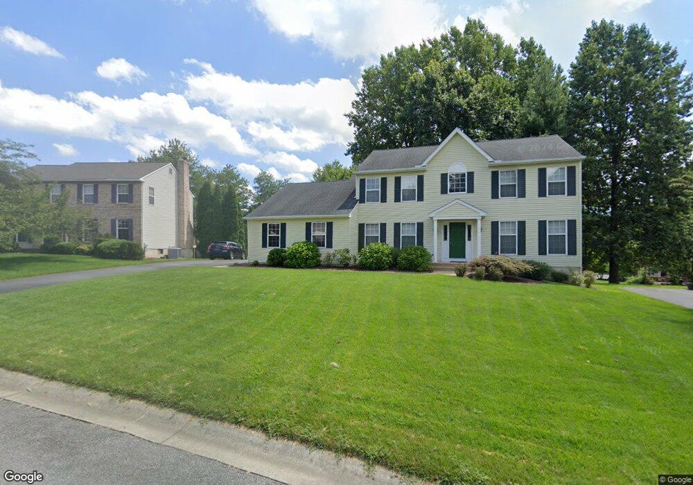
567 Stenning Dr Hockessin, DE 19707
Estimated Value: $606,000 - $678,000
4
Beds
3
Baths
2,587
Sq Ft
$248/Sq Ft
Est. Value
About This Home
This home is located at 567 Stenning Dr, Hockessin, DE 19707 and is currently estimated at $641,672, approximately $248 per square foot. 567 Stenning Dr is a home located in New Castle County with nearby schools including North Star Elementary School, Dupont (H.B.) Middle School, and Alexis I. du Pont High School.
Ownership History
Date
Name
Owned For
Owner Type
Purchase Details
Closed on
Oct 11, 2011
Sold by
Lo Pei Yi and Tseng Li Hwa
Bought by
Lo Pei Yi and Tseng Li Hwa
Current Estimated Value
Purchase Details
Closed on
Jun 15, 2006
Sold by
Zhou Jiacheng and Liu Qi
Bought by
Lo Pei Yi and Tseng Li Hwa
Home Financials for this Owner
Home Financials are based on the most recent Mortgage that was taken out on this home.
Original Mortgage
$260,000
Interest Rate
6.59%
Mortgage Type
Purchase Money Mortgage
Create a Home Valuation Report for This Property
The Home Valuation Report is an in-depth analysis detailing your home's value as well as a comparison with similar homes in the area
Home Values in the Area
Average Home Value in this Area
Purchase History
| Date | Buyer | Sale Price | Title Company |
|---|---|---|---|
| Lo Pei Yi | -- | None Available | |
| Lo Pei Yi | $416,000 | None Available |
Source: Public Records
Mortgage History
| Date | Status | Borrower | Loan Amount |
|---|---|---|---|
| Closed | Lo Pei Yi | $260,000 |
Source: Public Records
Tax History
| Year | Tax Paid | Tax Assessment Tax Assessment Total Assessment is a certain percentage of the fair market value that is determined by local assessors to be the total taxable value of land and additions on the property. | Land | Improvement |
|---|---|---|---|---|
| 2024 | -- | $132,700 | $28,900 | $103,800 |
| 2023 | $4,009 | $132,700 | $28,900 | $103,800 |
| 2022 | $4,033 | $132,700 | $28,900 | $103,800 |
| 2021 | $4,128 | $132,700 | $28,900 | $103,800 |
| 2020 | $4,130 | $132,700 | $28,900 | $103,800 |
| 2019 | $4,832 | $132,700 | $28,900 | $103,800 |
| 2018 | $4,451 | $132,700 | $28,900 | $103,800 |
| 2017 | $4,398 | $132,700 | $28,900 | $103,800 |
| 2016 | $4,184 | $132,700 | $28,900 | $103,800 |
| 2015 | $3,932 | $132,700 | $28,900 | $103,800 |
| 2014 | $3,652 | $132,700 | $28,900 | $103,800 |
Source: Public Records
Map
Nearby Homes
- 87 Chandler Ct
- 24 Eynon Ct
- 7 Piersons Ridge Unit RG
- 257 Grove View Dr
- 253 Grove View Dr
- 255 Grove View Dr
- 271 Grove View Dr
- 567 Southwood Rd
- 301 Hollins Rd Unit 97
- 554 Holly Knoll Rd
- 832 Evanson Rd
- 634 Grant Ave
- 515 Massaferi Way
- 308 Detjen Dr
- Lot 5B Little Baltimore Rd
- Lot 5A Little Baltimore Rd
- 253 Peoples Way
- 513 Pershing Rd
- 12 W Shore Ct
- 408 Willowbend Ct
Your Personal Tour Guide
Ask me questions while you tour the home.