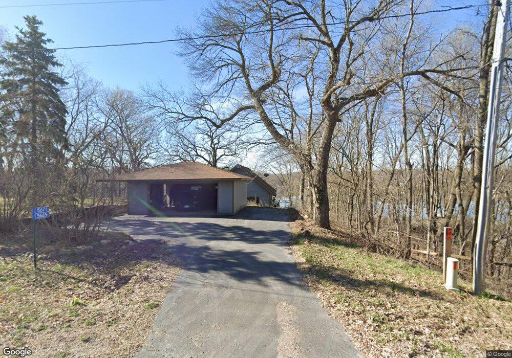
5671 Bradley Rd South Haven, MN 55382
Estimated Value: $383,000 - $494,000
3
Beds
2
Baths
1,080
Sq Ft
$419/Sq Ft
Est. Value
About This Home
This home is located at 5671 Bradley Rd, South Haven, MN 55382 and is currently estimated at $452,975, approximately $419 per square foot. 5671 Bradley Rd is a home located in Stearns County with nearby schools including Kimball Elementary School and Kimball High School.
Ownership History
Date
Name
Owned For
Owner Type
Purchase Details
Closed on
May 8, 2008
Sold by
Mcclure Carolyn K and Hutson George E
Bought by
Robinson David and Cogdill Sharon
Current Estimated Value
Purchase Details
Closed on
Sep 24, 2007
Sold by
Forsyth Scott B and Forsyth Wendy K
Bought by
Hutson George E and Mcclure Carolyn K
Purchase Details
Closed on
Jan 12, 2005
Sold by
Graffunder Thomas
Bought by
Forsyth Scott
Purchase Details
Closed on
Sep 7, 2001
Sold by
Fashant Ronald
Bought by
Graffunder Thomas
Create a Home Valuation Report for This Property
The Home Valuation Report is an in-depth analysis detailing your home's value as well as a comparison with similar homes in the area
Home Values in the Area
Average Home Value in this Area
Purchase History
| Date | Buyer | Sale Price | Title Company |
|---|---|---|---|
| Robinson David | $299,900 | -- | |
| Hutson George E | $275,000 | -- | |
| Forsyth Scott | $294,000 | -- | |
| Graffunder Thomas | $239,900 | -- |
Source: Public Records
Tax History Compared to Growth
Tax History
| Year | Tax Paid | Tax Assessment Tax Assessment Total Assessment is a certain percentage of the fair market value that is determined by local assessors to be the total taxable value of land and additions on the property. | Land | Improvement |
|---|---|---|---|---|
| 2025 | $4,088 | $459,700 | $158,400 | $301,300 |
| 2024 | $2,554 | $430,400 | $150,400 | $280,000 |
| 2023 | $4,392 | $410,700 | $150,400 | $260,300 |
| 2022 | $3,598 | $320,200 | $137,900 | $182,300 |
| 2021 | $2,490 | $320,200 | $137,900 | $182,300 |
| 2020 | $3,638 | $298,400 | $137,900 | $160,500 |
| 2019 | $3,544 | $301,600 | $143,600 | $158,000 |
| 2018 | $3,392 | $265,800 | $132,100 | $133,700 |
| 2017 | $3,372 | $266,300 | $130,100 | $136,200 |
| 2016 | $3,210 | $0 | $0 | $0 |
| 2015 | $2,986 | $0 | $0 | $0 |
| 2014 | -- | $0 | $0 | $0 |
Source: Public Records
Map
Nearby Homes
- 16698 109th St NW
- 10848 Porter Ave NW
- 10399 Reardon Ave NW
- 14XXX County Road 44
- 10368 Oliver Ave NW
- 13943 102nd St NW
- 13934 101st St NW
- 8537 Pittman Ave NW
- 125 Cedar St SE
- 148 Cedar St SE
- 118 Cedar St SE
- 847 Walnut Ave SE
- 531 Hazel Ave E
- 226 Quill St NE
- 451 Linden Ave E
- 230 Newspaper Run NE
- 231 Newspaper Run NE
- 351 Publishers Dr NE
- 210 Linden Ave E
- 121 Spruce Ave E
- 5683 Bradley Rd
- 5665 Bradley Rd
- 5657 Bradley Rd
- 5701 Bradley Rd
- 5625 Bradley Rd
- 5645 Bradley Rd
- 5745 Bradley Rd
- 5765 Bradley Rd
- 5605 Bradley Rd
- 5785 Bradley Rd
- 5543 Brooks Cir
- 5795 Bradley Rd
- 5813 Bradley Rd
- 5835 Bradley Rd
- 5533 Brooks Cir
- 5825 Bradley Rd
- 13154 Brookside Rd
- 5845 Bradley Rd
- 13122 Brookside Rd
- 13212 Brookside Rd