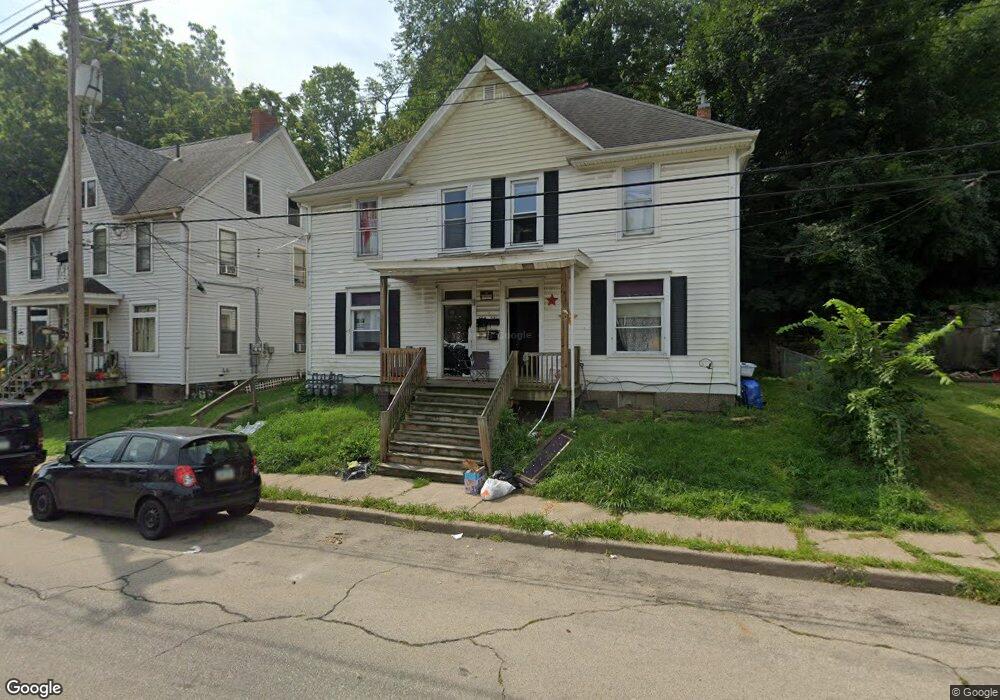
568 W Locust St Dubuque, IA 52001
Estimated Value: $205,000 - $346,000
6
Beds
4
Baths
3,560
Sq Ft
$76/Sq Ft
Est. Value
About This Home
This home is located at 568 W Locust St, Dubuque, IA 52001 and is currently estimated at $271,333, approximately $76 per square foot. 568 W Locust St is a home with nearby schools including Prescott Elementary School, George Washington Middle School, and Dubuque Senior High School.
Ownership History
Date
Name
Owned For
Owner Type
Purchase Details
Closed on
Dec 2, 2009
Sold by
Rjk Investments Llc
Bought by
Liberty Bank Fsb
Current Estimated Value
Purchase Details
Closed on
Dec 7, 2006
Sold by
Wells Fargo Bank National Assn
Bought by
Rjk Investements Llc
Purchase Details
Closed on
Jun 29, 2006
Sold by
Titus Brad
Bought by
Countrywide Home Loans Inc
Purchase Details
Closed on
Jan 26, 2005
Sold by
Poller Gary H
Bought by
Titus Brand and Spark Sara
Purchase Details
Closed on
Nov 22, 2004
Sold by
Mortgage Electronic Registration System
Bought by
Wells Frago Bank Na
Create a Home Valuation Report for This Property
The Home Valuation Report is an in-depth analysis detailing your home's value as well as a comparison with similar homes in the area
Home Values in the Area
Average Home Value in this Area
Purchase History
| Date | Buyer | Sale Price | Title Company |
|---|---|---|---|
| Liberty Bank Fsb | -- | None Available | |
| Rjk Investements Llc | $45,500 | None Available | |
| Countrywide Home Loans Inc | $82,903 | None Available | |
| Titus Brand | $62,000 | Security First Title Co | |
| Wells Frago Bank Na | -- | None Available |
Source: Public Records
Tax History Compared to Growth
Tax History
| Year | Tax Paid | Tax Assessment Tax Assessment Total Assessment is a certain percentage of the fair market value that is determined by local assessors to be the total taxable value of land and additions on the property. | Land | Improvement |
|---|---|---|---|---|
| 2025 | $2,377 | $183,000 | $43,200 | $139,800 |
| 2024 | $2,377 | $150,100 | $25,900 | $124,200 |
| 2023 | $2,096 | $150,100 | $25,900 | $124,200 |
| 2022 | $2,475 | $122,140 | $25,920 | $96,220 |
| 2021 | $2,378 | $122,140 | $25,920 | $96,220 |
| 2020 | $2,810 | $122,140 | $25,920 | $96,220 |
| 2019 | $2,494 | $122,140 | $25,920 | $96,220 |
| 2018 | $2,638 | $101,780 | $21,600 | $80,180 |
| 2017 | $2,828 | $101,780 | $21,600 | $80,180 |
| 2016 | $2,828 | $101,050 | $21,600 | $79,450 |
| 2015 | $2,964 | $101,050 | $21,600 | $79,450 |
| 2014 | $3,002 | $101,050 | $21,600 | $79,450 |
Source: Public Records
Map
Nearby Homes
- 645 Angella St
- 667 W Locust St
- 455 Almond St
- 1906 Ellis St
- 1951 Madison St
- 1805 Madison St
- 364 W Locust St Unit 366 W Locust Street
- 698 Lowell St
- 340 Kaufmann Ave
- 1477 Locust St
- 568 Loras Blvd
- 337 Kaufmann Ave
- 460 Loras Blvd
- 1735 Central Ave
- 604 Chestnut St
- 1337 Main St
- 721 Rose St Unit 721-723 Rose Street
- 1374 Main St
- 1255 - 1257 Locust St
- 1500 Central Ave
- 560 W Locust St
- 576 W Locust St
- 578 W Locust St
- 554 W Locust St
- 579 Quigley Ln
- 569 Quigley Ln
- 1940 Catherine St
- 575 W Locust St
- 546 W Locust St
- 581 W Locust St
- 575 W Locust St
- 587 W Locust St
- 559 Quigley Ln
- 569 W Locust St
- 561 W Locust St
- 540 W Locust St
- 591 W Locust St
- 1906 Catherine St
- 553 W Locust St
- 595 W Locust St