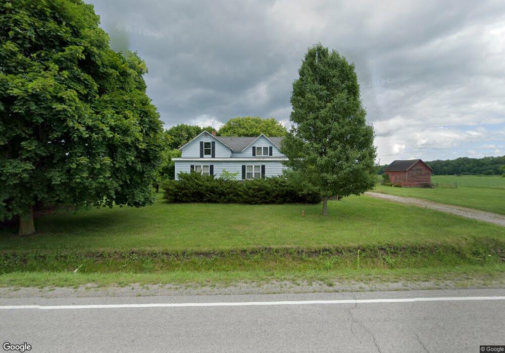
5699 Carter Rd Auburn, MI 48611
Estimated Value: $271,000 - $503,000
4
Beds
2
Baths
1,759
Sq Ft
$190/Sq Ft
Est. Value
About This Home
This home is located at 5699 Carter Rd, Auburn, MI 48611 and is currently estimated at $335,006, approximately $190 per square foot. 5699 Carter Rd is a home located in Bay County with nearby schools including Thrasher Attendance Center, Auburn Elementary School, and Western Middle School.
Ownership History
Date
Name
Owned For
Owner Type
Purchase Details
Closed on
Sep 17, 2010
Sold by
Federal Home Loan Mortgage Corporation
Bought by
Keen Adam Edward
Current Estimated Value
Purchase Details
Closed on
Apr 17, 2009
Sold by
Lecronier Greg and Lecronier Luann
Bought by
Federal Home Loan Mortgage Corp
Purchase Details
Closed on
Dec 22, 1993
Sold by
Kaczynski Joan
Bought by
Lecronier Greg and Lecronier Luann
Create a Home Valuation Report for This Property
The Home Valuation Report is an in-depth analysis detailing your home's value as well as a comparison with similar homes in the area
Home Values in the Area
Average Home Value in this Area
Purchase History
| Date | Buyer | Sale Price | Title Company |
|---|---|---|---|
| Keen Adam Edward | $50,000 | Attorneys Title Agency Llc | |
| Federal Home Loan Mortgage Corp | $135,000 | None Available | |
| Lecronier Greg | $62,000 | -- |
Source: Public Records
Tax History Compared to Growth
Tax History
| Year | Tax Paid | Tax Assessment Tax Assessment Total Assessment is a certain percentage of the fair market value that is determined by local assessors to be the total taxable value of land and additions on the property. | Land | Improvement |
|---|---|---|---|---|
| 2025 | $1,707 | $108,400 | $0 | $0 |
| 2024 | $764 | $102,650 | $0 | $0 |
| 2023 | $727 | $90,550 | $0 | $0 |
| 2022 | $1,580 | $78,750 | $0 | $0 |
| 2021 | $1,470 | $73,500 | $73,500 | $0 |
| 2020 | $1,372 | $64,600 | $64,600 | $0 |
| 2019 | $1,189 | $55,100 | $0 | $0 |
| 2018 | $1,123 | $51,400 | $0 | $0 |
| 2017 | $1,075 | $48,650 | $0 | $0 |
| 2016 | $1,078 | $51,300 | $0 | $51,300 |
| 2015 | -- | $29,350 | $0 | $29,350 |
| 2014 | -- | $29,350 | $0 | $29,350 |
Source: Public Records
Map
Nearby Homes
- 10832 Carter Rd
- 5749 11 Mile Rd
- 4956 W Bis Rd
- 4806 Northridge
- 0 W Midland Rd Unit 50189337
- 0 W Midland Rd Unit 50152278
- 1954 W Midland Rd
- Parcel 175 Joan Dr
- 2011 Prairie Point Dr
- 10399 Webster Rd
- 1598 Fisherville Ct
- 1587 Fisherville Ct
- 0 Court St
- 4760 Putt Ln
- 2730 W Midland Rd
- 4648 Meadow Ct
- 1365 W North Union Rd
- 4745 Bailey Bridge Rd
- 2752 W North Union Rd Unit 88
- 0 Rockwell Dr
- 5699 Carter Rd
- 5698 Carter Rd
- 5784 Carter Rd
- 5808 Carter Rd
- 5822 Carter Rd
- 5822 Carter Rd
- 5833 Carter Rd
- 2376 Hotchkiss Rd
- 5845 Carter Rd
- 2356 Hotchkiss Rd
- 1738 Roberts Rd
- 5860 Carter Rd
- 1741 Roberts Rd
- 5890 Carter Rd
- 5902 Carter Rd
- 5951 Carter Rd
- 1790 Hotchkiss Rd
- 1850 Hotchkiss Rd
- 1964 Hotchkiss Rd
- 1638 Roberts Rd