57 N Barnstead Rd Center Barnstead, NH 03225
Barnstead NeighborhoodEstimated Value: $424,000 - $793,000
3
Beds
2
Baths
3,562
Sq Ft
$169/Sq Ft
Est. Value
About This Home
This home is located at 57 N Barnstead Rd, Center Barnstead, NH 03225 and is currently estimated at $601,554, approximately $168 per square foot. 57 N Barnstead Rd is a home with nearby schools including Barnstead Elementary School and Prospect Mountain High School.
Ownership History
Date
Name
Owned For
Owner Type
Purchase Details
Closed on
Jan 11, 2019
Sold by
Ltl Investments Group Llc
Bought by
New Hampshire State Of
Current Estimated Value
Purchase Details
Closed on
Dec 21, 2010
Sold by
Locke Nathan J
Bought by
Ltl Investment Group L
Purchase Details
Closed on
--
Sold by
Locke Nathan J
Bought by
Ltl Investment Group L
Create a Home Valuation Report for This Property
The Home Valuation Report is an in-depth analysis detailing your home's value as well as a comparison with similar homes in the area
Home Values in the Area
Average Home Value in this Area
Purchase History
| Date | Buyer | Sale Price | Title Company |
|---|---|---|---|
| New Hampshire State Of | -- | -- | |
| New Hampshire State Of | -- | -- | |
| Ltl Investment Group L | $222,800 | -- | |
| Ltl Investment Group L | $222,800 | -- |
Source: Public Records
Tax History Compared to Growth
Tax History
| Year | Tax Paid | Tax Assessment Tax Assessment Total Assessment is a certain percentage of the fair market value that is determined by local assessors to be the total taxable value of land and additions on the property. | Land | Improvement |
|---|---|---|---|---|
| 2024 | $5,788 | $354,886 | $122,486 | $232,400 |
| 2023 | $5,095 | $355,040 | $122,640 | $232,400 |
| 2022 | $5,127 | $237,354 | $65,854 | $171,500 |
| 2021 | $5,233 | $238,311 | $66,811 | $171,500 |
| 2020 | $6,011 | $260,221 | $88,721 | $171,500 |
| 2019 | $11,439 | $258,003 | $89,303 | $168,700 |
| 2018 | $12,520 | $256,987 | $88,287 | $168,700 |
| 2017 | $11,295 | $153,287 | $48,287 | $105,000 |
| 2016 | $4,197 | $154,031 | $49,031 | $105,000 |
| 2015 | $4,185 | $154,131 | $49,131 | $105,000 |
| 2014 | $4,965 | $207,206 | $61,006 | $146,200 |
| 2013 | $5,252 | $223,477 | $77,277 | $146,200 |
Source: Public Records
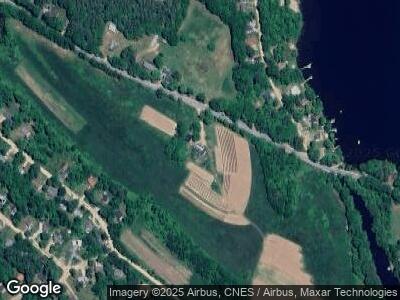
Map
Nearby Homes
- 0 Crescent Dr Unit 5026960
- 114 Varney Rd
- 9 Sands Terrace
- 45 Damsite Rd
- 64 Dalton Dr
- L342 Winchester Dr Unit Map 37, Lot 342
- 42 Oneill Rd
- 22 Shelburne Ln
- 0 N Shore Dr Unit Map 37 Lot 513
- 85 White Oak Rd
- 74 Millsfield Ln
- 418 Narrows Rd
- 10 Foss Dr
- 4 Rustic Shores Rd
- 15 Nutter Cir
- 20 Gillis Ln
- 9-22 Narrows Rd
- Map 46 Lot 4 N Barnstead Rd
- M 3 - L 15-1&2 Prospect Mountain Rd
- M 3 - L 15-2 Prospect Mountain Rd
- 57 N Barnstead Rd
- 1355 Suncook Valley Rd
- 61 Crescent Dr
- 21A Crescent No Barnstead Rd
- 21A Crescent No Barnstead Rd
- 44 N Barnstead Rd
- 0 North Rd
- 53 Crescent Dr
- 58 Danbury Rd
- 52 Danbury Rd
- 64 Crescent Dr
- 66 Crescent Dr
- 51 Crescent Dr
- 48 Danbury Rd
- 58 Crescent Dr
- 76 Crescent Dr
- 0 Damsite Rd
- 0 Damsite Rd Unit 4113118
- 54 Crescent Dr
- 86 N Barnstead Rd