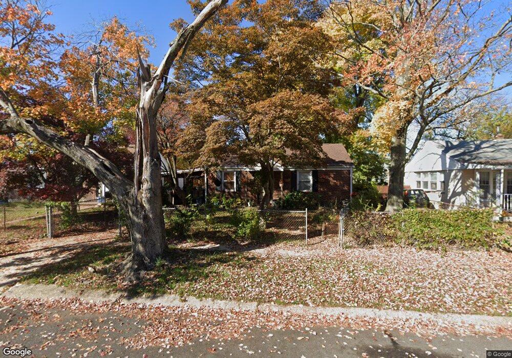
5709 Mustang St Levittown, PA 19057
Estimated Value: $261,000 - $316,266
3
Beds
2
Baths
1,320
Sq Ft
$219/Sq Ft
Est. Value
About This Home
This home is located at 5709 Mustang St, Levittown, PA 19057 and is currently estimated at $288,567, approximately $218 per square foot. 5709 Mustang St is a home located in Bucks County with nearby schools including Truman Senior High School, First Presbyterian Church School, and Hope Lutheran School.
Ownership History
Date
Name
Owned For
Owner Type
Purchase Details
Closed on
Dec 11, 2007
Sold by
Griffith Deborah D
Bought by
Smith Deborah D
Current Estimated Value
Home Financials for this Owner
Home Financials are based on the most recent Mortgage that was taken out on this home.
Original Mortgage
$60,500
Outstanding Balance
$37,293
Interest Rate
5.8%
Mortgage Type
New Conventional
Estimated Equity
$251,274
Purchase Details
Closed on
Jan 7, 1988
Bought by
Griffith Deborah D
Create a Home Valuation Report for This Property
The Home Valuation Report is an in-depth analysis detailing your home's value as well as a comparison with similar homes in the area
Home Values in the Area
Average Home Value in this Area
Purchase History
| Date | Buyer | Sale Price | Title Company |
|---|---|---|---|
| Smith Deborah D | -- | None Available | |
| Griffith Deborah D | -- | -- |
Source: Public Records
Mortgage History
| Date | Status | Borrower | Loan Amount |
|---|---|---|---|
| Open | Smith Deborah D | $60,500 |
Source: Public Records
Tax History Compared to Growth
Tax History
| Year | Tax Paid | Tax Assessment Tax Assessment Total Assessment is a certain percentage of the fair market value that is determined by local assessors to be the total taxable value of land and additions on the property. | Land | Improvement |
|---|---|---|---|---|
| 2025 | $3,042 | $11,200 | $3,040 | $8,160 |
| 2024 | $3,042 | $11,200 | $3,040 | $8,160 |
| 2023 | $3,019 | $11,200 | $3,040 | $8,160 |
| 2022 | $3,019 | $11,200 | $3,040 | $8,160 |
| 2021 | $3,019 | $11,200 | $3,040 | $8,160 |
| 2020 | $3,019 | $11,200 | $3,040 | $8,160 |
| 2019 | $3,438 | $11,200 | $3,040 | $8,160 |
| 2018 | $2,960 | $11,200 | $3,040 | $8,160 |
| 2017 | $2,915 | $11,200 | $3,040 | $8,160 |
| 2016 | $2,915 | $11,200 | $3,040 | $8,160 |
| 2015 | $1,987 | $11,200 | $3,040 | $8,160 |
| 2014 | $1,987 | $11,200 | $3,040 | $8,160 |
Source: Public Records
Map
Nearby Homes
- 2205 Liberator St
- 5604 Fleetwing Dr
- 5617 Beaver Dam Rd
- 1019 Green Ln
- 1201 Pacific Ave
- 5 Green Ln
- 150 Naomi Ct Unit 811
- 5605 Toga St
- 86 Wildflower Rd
- 5517 Schumacher Dr
- 246 Colette Ct
- 55 Cedar Ln
- 35 Cedar Ln
- 86 Cedar Ln
- 84 Whitewood Dr
- 2519 Woodlawn Dr
- 38 Violet Rd
- 28 Old Pond Rd
- 23 Misty Pine Rd
- 101 Idlewild Rd
- 5707 Mustang St
- 5724 Mitchell Rd
- 5705 Mustang St
- 5720 Mitchell Rd
- 5718 Mitchell Rd
- 5722 Mitchell Rd
- 5713 Mustang St
- 5716 Mitchell Rd
- 5714 Mitchell Rd
- 5712 Mitchell Rd
- 5726 Mitchell Rd
- 5708 Mustang St
- 5730 Mitchell Rd
- 5728 Mitchell Rd
- 5703 Mustang St
- 5710 Mitchell Rd
- 5704 Mustang St
- 5710 Mustang St
- 2300 Airacobra St
- 5734 Mitchell Rd