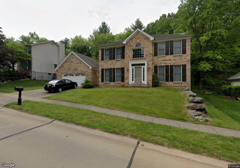
571 McBride Pointe Dr Ballwin, MO 63011
Estimated Value: $526,142 - $598,000
4
Beds
3
Baths
2,850
Sq Ft
$200/Sq Ft
Est. Value
About This Home
This home is located at 571 McBride Pointe Dr, Ballwin, MO 63011 and is currently estimated at $568,786, approximately $199 per square foot. 571 McBride Pointe Dr is a home located in St. Louis County with nearby schools including Babler Elementary School, Rockwood Valley Middle School, and Lafayette High School.
Ownership History
Date
Name
Owned For
Owner Type
Purchase Details
Closed on
Mar 14, 2022
Sold by
Bierman Jeffrey M
Bought by
Jeffrey M Bierman Revocable Trust
Current Estimated Value
Purchase Details
Closed on
May 29, 1998
Sold by
Bierman Mark B
Bought by
Bierman Jeffrey M and Bierman Jeanne L
Home Financials for this Owner
Home Financials are based on the most recent Mortgage that was taken out on this home.
Original Mortgage
$138,000
Interest Rate
7.27%
Purchase Details
Closed on
Sep 3, 1997
Sold by
Bierman Laura S
Bought by
Bierman Mark Benjamin
Create a Home Valuation Report for This Property
The Home Valuation Report is an in-depth analysis detailing your home's value as well as a comparison with similar homes in the area
Home Values in the Area
Average Home Value in this Area
Purchase History
| Date | Buyer | Sale Price | Title Company |
|---|---|---|---|
| Jeffrey M Bierman Revocable Trust | -- | None Listed On Document | |
| Bierman Jeffrey M | -- | -- | |
| Bierman Mark Benjamin | -- | -- |
Source: Public Records
Mortgage History
| Date | Status | Borrower | Loan Amount |
|---|---|---|---|
| Previous Owner | Bierman Jeffrey M | $138,000 |
Source: Public Records
Tax History
| Year | Tax Paid | Tax Assessment Tax Assessment Total Assessment is a certain percentage of the fair market value that is determined by local assessors to be the total taxable value of land and additions on the property. | Land | Improvement |
|---|---|---|---|---|
| 2025 | $5,948 | $86,540 | $24,680 | $61,860 |
| 2024 | $5,948 | $85,540 | $22,820 | $62,720 |
| 2023 | $5,943 | $85,540 | $22,820 | $62,720 |
| 2022 | $5,194 | $69,430 | $15,220 | $54,210 |
| 2021 | $5,155 | $69,430 | $15,220 | $54,210 |
| 2020 | $5,366 | $68,900 | $15,220 | $53,680 |
| 2019 | $5,387 | $68,900 | $15,220 | $53,680 |
| 2018 | $4,793 | $57,800 | $15,220 | $42,580 |
| 2016 | $4,584 | $54,470 | $15,220 | $39,250 |
Source: Public Records
Map
Nearby Homes
- 583 McBride Pointe Dr
- 1839 Sullivan Pointe Dr
- 18024 Cider Mill Dr
- 16403 Prestwick Place Ln
- 16404 Clayton Rd
- 2470 Indian Tree Cir
- 16354 Clayton Rd
- 2112 Wildwood Meadows Ct
- 16342 Clayton Rd
- 1504 Englebrook Dr
- 2140 Dartmouth Gate Ct
- 1909 Shepard Rd
- 1670 Timber Ridge Estates Dr
- 215 Cobblefield Ct
- 17662 Garden Ridge Cir
- 2209 Ridgley Woods Dr
- 1529 Garden Valley Dr
- 1605 Ridge Bend Dr
- 1525 Virginia Dr
- 17824 Valley View Ln
- 567 McBride Pointe Dr
- 1927 Gastorf Pointe Ct
- 563 McBride Pointe Dr
- 570 McBride Pointe Dr
- 574 McBride Pointe Dr
- 1921 Gastorf Pointe Ct
- 579 McBride Pointe Dr
- 566 McBride Pointe Dr
- 1915 Gastorf Pointe Ct
- 559 McBride Pointe Dr
- 562 McBride Pointe Dr
- 1926 Gastorf Pointe Ct
- 1907 Gastorf Pointe Ct
- 555 McBride Pointe Dr
- 558 McBride Pointe Dr
- 1912 Gastorf Pointe Ct
- 1860 Sullivan Pointe Dr
- 1856 Sullivan Pointe Dr
- 1938 Gastorf Pointe Ct
- 1901 Gastorf Pointe Ct
Your Personal Tour Guide
Ask me questions while you tour the home.