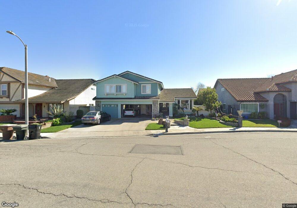
5712 Edward Ware Cir Garden Grove, CA 92845
West Garden Grove NeighborhoodEstimated Value: $1,323,000 - $1,485,000
5
Beds
3
Baths
2,580
Sq Ft
$548/Sq Ft
Est. Value
About This Home
This home is located at 5712 Edward Ware Cir, Garden Grove, CA 92845 and is currently estimated at $1,413,767, approximately $547 per square foot. 5712 Edward Ware Cir is a home located in Orange County with nearby schools including Loyal Barker Elementary School, Hilton D. Bell Intermediate School, and Pacifica High School.
Ownership History
Date
Name
Owned For
Owner Type
Purchase Details
Closed on
Sep 10, 2019
Sold by
Corn Clark D and Corn Donna M
Bought by
Corn Clark D and Corn Donna M
Current Estimated Value
Purchase Details
Closed on
Jan 9, 1997
Sold by
Proto Kenneth G and Proto Anne B
Bought by
Corn Clark D and Corn Donna M
Home Financials for this Owner
Home Financials are based on the most recent Mortgage that was taken out on this home.
Original Mortgage
$192,750
Interest Rate
7.86%
Purchase Details
Closed on
Mar 14, 1996
Sold by
Proto John J and Proto Valerie
Bought by
Proto Kenneth G and Proto Anne B
Home Financials for this Owner
Home Financials are based on the most recent Mortgage that was taken out on this home.
Original Mortgage
$207,000
Interest Rate
6.98%
Create a Home Valuation Report for This Property
The Home Valuation Report is an in-depth analysis detailing your home's value as well as a comparison with similar homes in the area
Home Values in the Area
Average Home Value in this Area
Purchase History
| Date | Buyer | Sale Price | Title Company |
|---|---|---|---|
| Corn Clark D | -- | None Available | |
| Corn Clark D | $257,000 | First American Title Ins Co | |
| Proto Kenneth G | $259,000 | Old Republic Title Company |
Source: Public Records
Mortgage History
| Date | Status | Borrower | Loan Amount |
|---|---|---|---|
| Previous Owner | Corn Clark D | $192,750 | |
| Previous Owner | Proto Kenneth G | $207,000 | |
| Closed | Corn Clark D | $38,500 |
Source: Public Records
Tax History
| Year | Tax Paid | Tax Assessment Tax Assessment Total Assessment is a certain percentage of the fair market value that is determined by local assessors to be the total taxable value of land and additions on the property. | Land | Improvement |
|---|---|---|---|---|
| 2025 | $6,295 | $485,453 | $174,808 | $310,645 |
| 2024 | $6,295 | $475,935 | $171,381 | $304,554 |
| 2023 | $6,168 | $466,603 | $168,020 | $298,583 |
| 2022 | $6,025 | $457,454 | $164,725 | $292,729 |
| 2021 | $5,957 | $448,485 | $161,495 | $286,990 |
| 2020 | $5,879 | $443,887 | $159,839 | $284,048 |
| 2019 | $5,729 | $435,184 | $156,705 | $278,479 |
| 2018 | $5,610 | $426,651 | $153,632 | $273,019 |
| 2017 | $5,527 | $418,286 | $150,620 | $267,666 |
| 2016 | $5,259 | $410,085 | $147,667 | $262,418 |
| 2015 | $5,182 | $403,926 | $145,449 | $258,477 |
| 2014 | $5,060 | $396,014 | $142,600 | $253,414 |
Source: Public Records
Map
Nearby Homes
- 12586 George Reyburn Rd
- 12661 Saint Mark St
- 6122 Anthony Ave
- 5701 Norma Dr
- 6141 Trinette Ave
- 5382 Laverne Cir
- 3661 Wisteria St
- 12272 Chase St
- 13036 Springarden Ln
- 4764 Fir Ave
- 13722 Hammon Place
- 13731 Claremont St
- 6071 Modoc Rd
- 6091 Navajo Rd
- 6282 Cheyenne Dr
- 13822 Marquette St
- 6691 Killarney Ave
- 11961 Bartlett St
- 6252 Santa Rita Ave
- 4549 Birchwood Ave
- 5702 Edward Ware Cir
- 5711 Anthony Ave
- 5721 Anthony Ave
- 5701 Anthony Ave
- 5732 Edward Ware Cir
- 5711 Edward Ware Cir
- 5731 Anthony Ave
- 5721 Edward Ware Cir
- 5701 Edward Ware Cir
- 5731 Edward Ware Cir
- 5712 Converse Howe Cir
- 5712 Anthony Ave
- 5702 Anthony Ave
- 5722 Converse Howe Cir
- 5702 Converse Howe Cir
- 12872 Alonzo Cook St
- 5722 Anthony Ave
- 12862 Alonzo Cook St
- 12882 Alonzo Cook St
- 5732 Converse Howe Cir
Your Personal Tour Guide
Ask me questions while you tour the home.