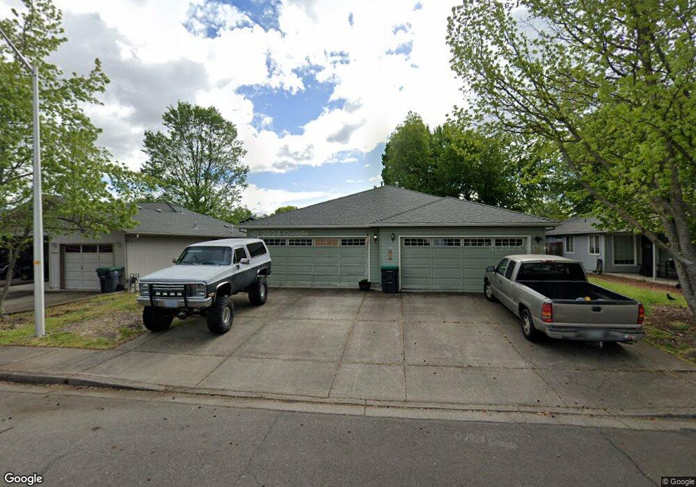
572 Countryside Dr Central Point, OR 97502
Estimated Value: $460,550 - $554,000
4
Beds
4
Baths
2,137
Sq Ft
$233/Sq Ft
Est. Value
About This Home
This home is located at 572 Countryside Dr, Central Point, OR 97502 and is currently estimated at $498,638, approximately $233 per square foot. 572 Countryside Dr is a home located in Jackson County with nearby schools including Central Point Elementary School, Scenic Middle School, and Crater High School.
Ownership History
Date
Name
Owned For
Owner Type
Purchase Details
Closed on
Oct 14, 2011
Sold by
Lukenbill David P and Lukenbill Christy L
Bought by
Lukenbill David P and Lukenbill Christy L
Current Estimated Value
Home Financials for this Owner
Home Financials are based on the most recent Mortgage that was taken out on this home.
Original Mortgage
$135,000
Outstanding Balance
$91,853
Interest Rate
4.05%
Mortgage Type
Purchase Money Mortgage
Estimated Equity
$406,785
Purchase Details
Closed on
Mar 23, 2005
Sold by
Lukenbill David P and Lukenbill Christy L
Bought by
Lukenbill David P and Lukenbill Christy L
Purchase Details
Closed on
May 17, 2004
Sold by
Simmonds Vester V and Simmonds Mary J
Bought by
Lukenbill David P and Lukenbill Christy L
Home Financials for this Owner
Home Financials are based on the most recent Mortgage that was taken out on this home.
Original Mortgage
$115,000
Interest Rate
5.86%
Mortgage Type
Purchase Money Mortgage
Create a Home Valuation Report for This Property
The Home Valuation Report is an in-depth analysis detailing your home's value as well as a comparison with similar homes in the area
Home Values in the Area
Average Home Value in this Area
Purchase History
| Date | Buyer | Sale Price | Title Company |
|---|---|---|---|
| Lukenbill David P | -- | First American Title | |
| Lukenbill David P | -- | -- | |
| Lukenbill David P | $264,900 | Lawyers Title Ins |
Source: Public Records
Mortgage History
| Date | Status | Borrower | Loan Amount |
|---|---|---|---|
| Open | Lukenbill David P | $135,000 | |
| Previous Owner | Lukenbill David P | $115,000 |
Source: Public Records
Tax History Compared to Growth
Tax History
| Year | Tax Paid | Tax Assessment Tax Assessment Total Assessment is a certain percentage of the fair market value that is determined by local assessors to be the total taxable value of land and additions on the property. | Land | Improvement |
|---|---|---|---|---|
| 2025 | $4,542 | $273,170 | $63,980 | $209,190 |
| 2024 | $4,542 | $265,220 | $62,120 | $203,100 |
| 2023 | $4,396 | $257,500 | $60,310 | $197,190 |
| 2022 | $4,293 | $257,500 | $60,310 | $197,190 |
| 2021 | $4,170 | $250,000 | $58,550 | $191,450 |
| 2020 | $4,049 | $242,720 | $56,850 | $185,870 |
| 2019 | $3,949 | $228,800 | $53,590 | $175,210 |
| 2018 | $3,829 | $222,140 | $52,030 | $170,110 |
| 2017 | $3,732 | $222,140 | $52,030 | $170,110 |
| 2016 | $3,623 | $209,390 | $49,040 | $160,350 |
| 2015 | $3,472 | $209,390 | $49,040 | $160,350 |
| 2014 | $3,383 | $197,380 | $46,220 | $151,160 |
Source: Public Records
Map
Nearby Homes
- 851 Juanita Way
- 571 Briarwood Dr
- 928 Brandi Way
- 921 Pittview Ave
- 3496 Edella St
- 555 Freeman Rd Unit 128
- 555 Freeman Rd Unit 146
- 555 Freeman Rd Unit 204
- 555 Freeman Rd Unit 209
- 3364 Bursell Rd
- 1060 Hopkins Rd
- 301 Freeman Rd Unit 100
- 301 Freeman Rd Unit 23
- 301 Freeman Rd Unit 85
- 1017 Fairfield Ave
- 1025 Fairfield Ave
- 3358 Bursell Rd
- 531 Bush St
- 1065 Edwina Ave
- 840 Ash St
- 582 Countryside Dr
- 562 Countryside Dr
- 564 Countryside Dr
- 0 Countryside Dr
- 573 Primrose Dr
- 583 Primrose Dr
- 563 Primrose Dr
- 542 Countryside Dr
- 544 Countryside Dr
- 859 Hopkins Rd
- 565 Countryside Dr
- 543 Primrose Dr
- 865 Hopkins Rd
- 581 Countryside Dr
- 561 Countryside Dr
- 532 Countryside Dr Unit 534
- 531 Countryside Dr
- 533 Primrose Dr
- 566 Briarwood Dr
- 592 Briarwood Dr